

The Catalan Atlas created in 1375 is another example that medievals were not as ignorant of the world as people might think.
It was a very ambitious project showcasing the geographic knowledge at the time!
It was a very ambitious project showcasing the geographic knowledge at the time!
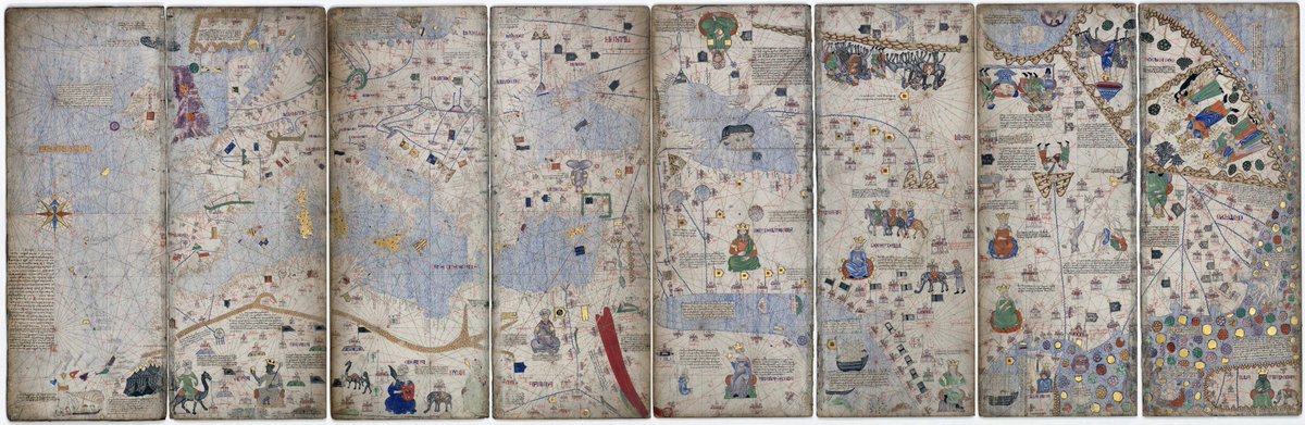
Here it is in 11,811 × 3,850 pixels version. A lot of very curious details!
upload.wikimedia.org
upload.wikimedia.org
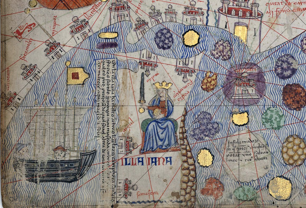
One curious detail I found.
They placed the mythical Amazons on the island of "Illa Jana" where Ceylon is. A warrior queen is depicted as ruling this "island of women".
The medievals loved to depict the Amazon women warriors on maps, always on the margins of the known world.
They placed the mythical Amazons on the island of "Illa Jana" where Ceylon is. A warrior queen is depicted as ruling this "island of women".
The medievals loved to depict the Amazon women warriors on maps, always on the margins of the known world.
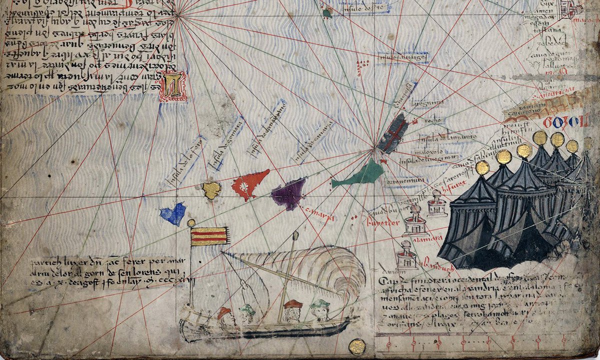
Also notice a galley with an Aragonese banner sailing near West Africa!
This was a tribute to the legendary Majorcan sailor Jaume Ferrer who set sail to Africa in 1346 to look for "River of Gold" and never came back.
This was a tribute to the legendary Majorcan sailor Jaume Ferrer who set sail to Africa in 1346 to look for "River of Gold" and never came back.
Another detail.
Christian cities are depicted with a cross, while Muslim cities are depicted with a dome.
Christian cities are depicted with a cross, while Muslim cities are depicted with a dome.
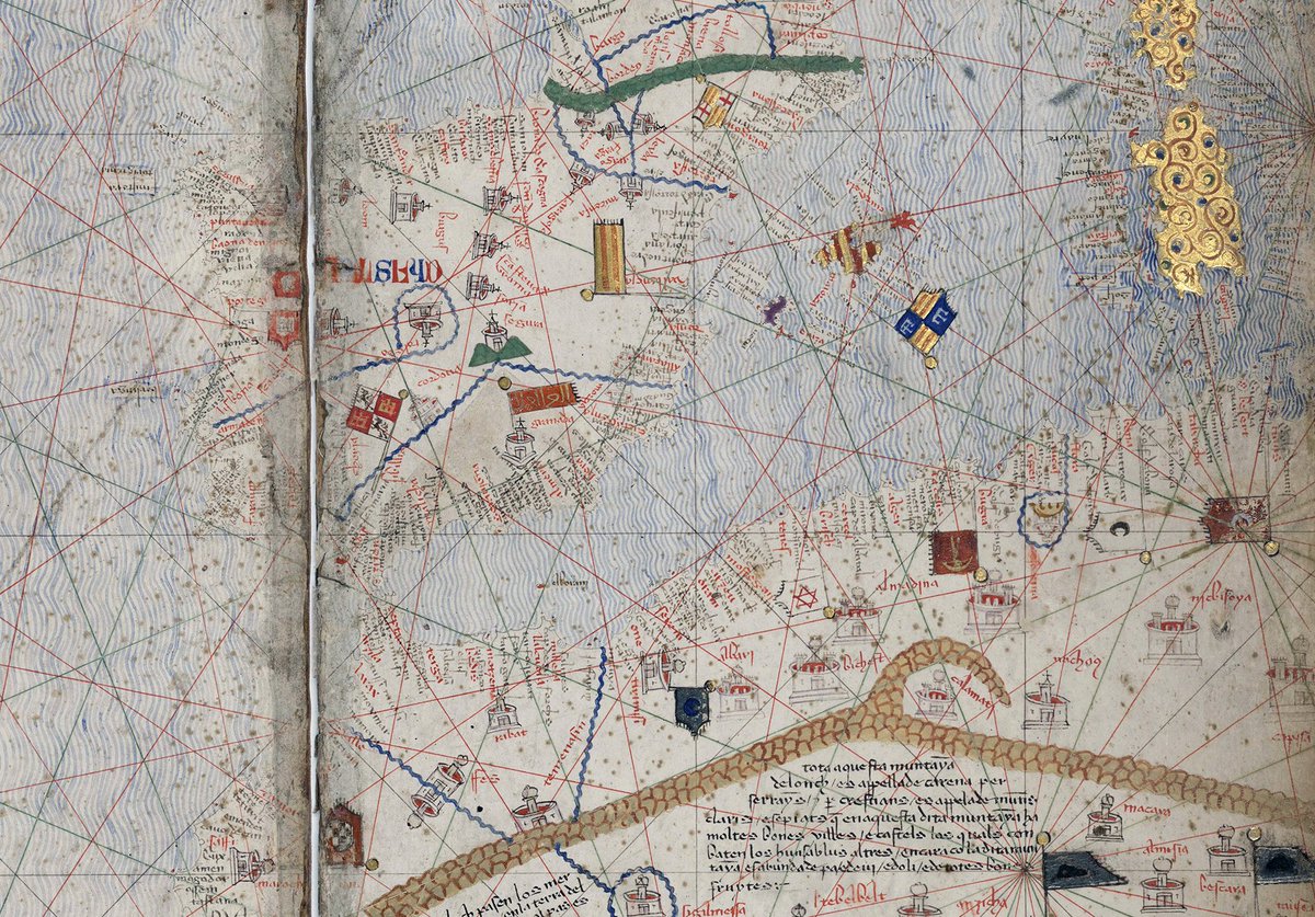
Probably one of the most fascinating details is how accurately the Mediterranean sea is portrayed.
It's by far the more accurate medieval map of Mediterranean I've seen so far.
The Catalans sure knew these waters well!
It's by far the more accurate medieval map of Mediterranean I've seen so far.
The Catalans sure knew these waters well!

Loading suggestions...