

1. After 3 years of my monthly History Threads this anniversary #cartography one is about maps of Burma (Myanmar.) Burma is longer N/S than E/W which doesn’t work well with Twitter’s horizontal images, so please click on maps to see them properly.
2. Decolonizing cartography is important. Recognize that peoples have always represented their own lands, the world in various ways (visual, oral, dreamscape etc.) long before colonizers arrived with visual maps used to claim, conquer, define and impose borders on them.
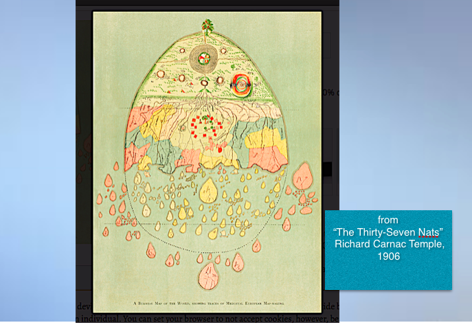
3. Cosmographic maps from Burma include Buddhist diagrams of Mt. Meru. This extraordinary world map with latitude lines is in Temple’s “The 37 Nats” (1906) “The Himalayas form the Fairyland of the Burmans… to the north everything is marvellous…” Date, cartographer unknown.
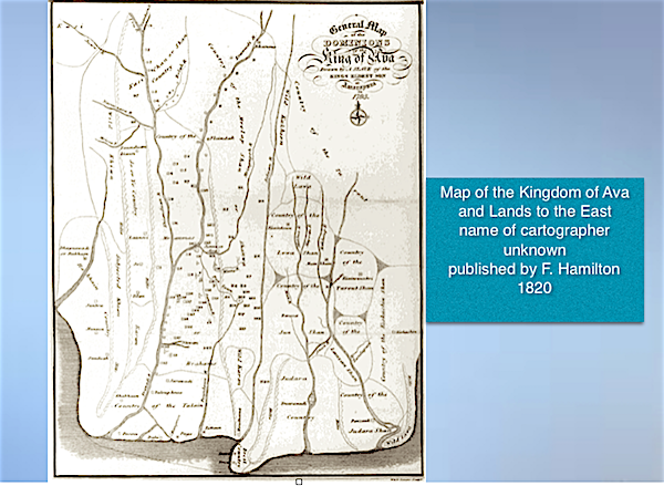
4. Lands that would become Burma had tradition of maps often drawn by Shans, for military & other purposes incl marked forests ready to be cut for wood (Burma Selection System.) “Map of Kingdom of Ava” by an enslaved person detailed ethnic nations, F. Hamiliton published it 1820.
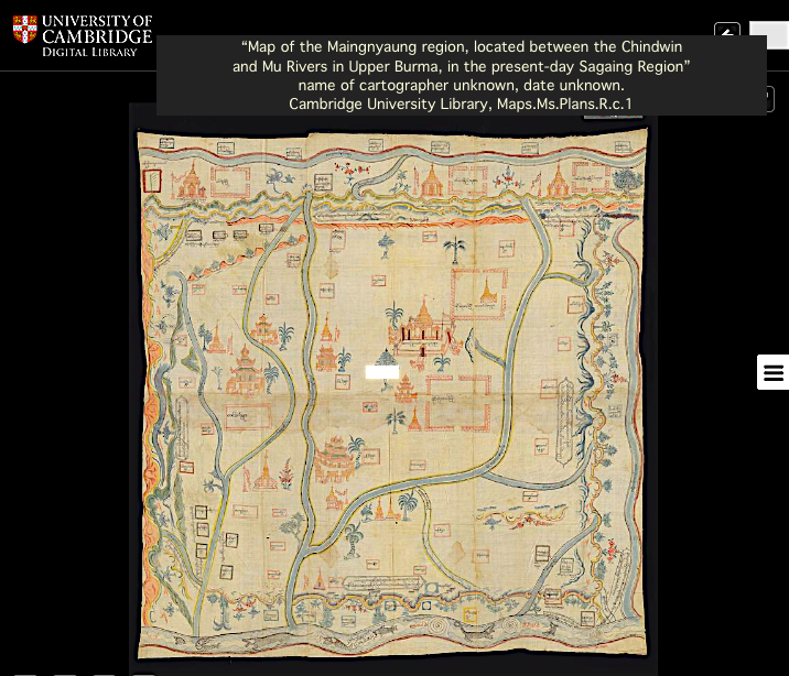
5. 19th Century cartography from Burma included enormous cloth maps (as if in Borges’s “On Exactitude in Science.”) Three in collection of @theUL can be seen here: cudl.lib.cam.ac.uk
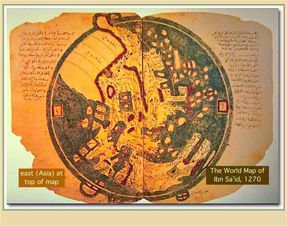
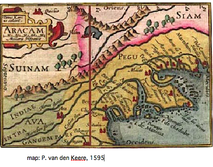
6. Medieval Arab cartographers like Ibn Sa’id mapped the coasts of independent lands that would centuries later become regions of Burma. 15th-17th C. Chinese & European mapmakers showed Arakan and Pegu on maps embellished with walled cities and botanical features.


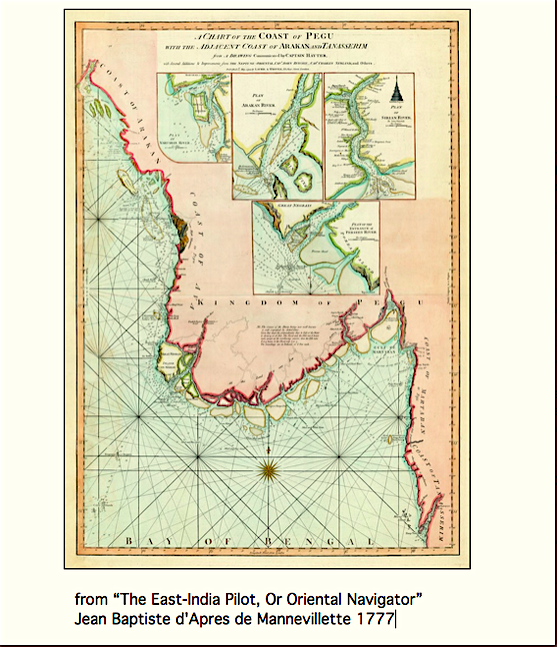
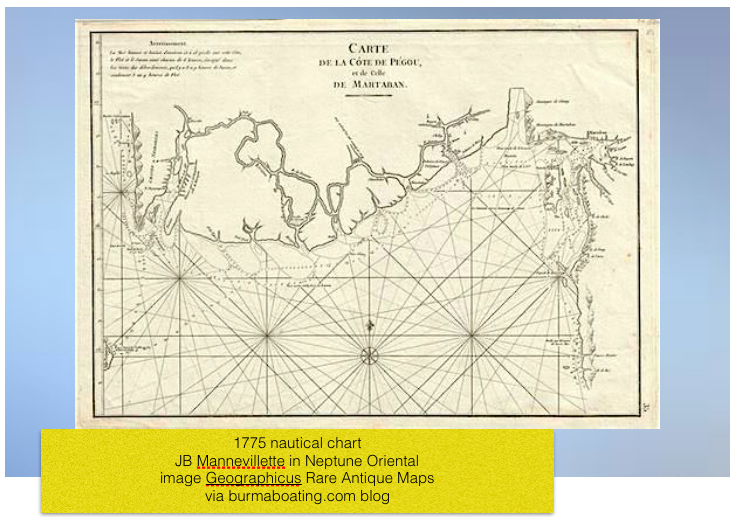
7. Arakan and Pegu had important international sea trade. In 18th-19th C. navigation charts were drawn up by colonial powers, including British taking over Burma, for ports on the Bay of Bengal and Andaman Sea where rice, timber and other commodities were exported.
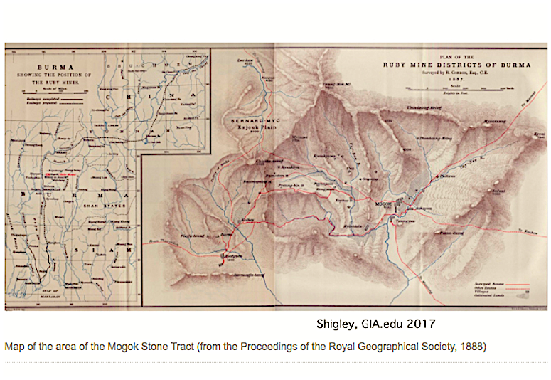
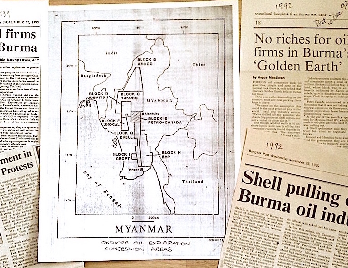
8. During colonial rule and after Independence, maps have been used to enable the resource exploitation of Burma/Myanmar, from ruby & silver mines to cross-border timber and multinational petroleum concessions.

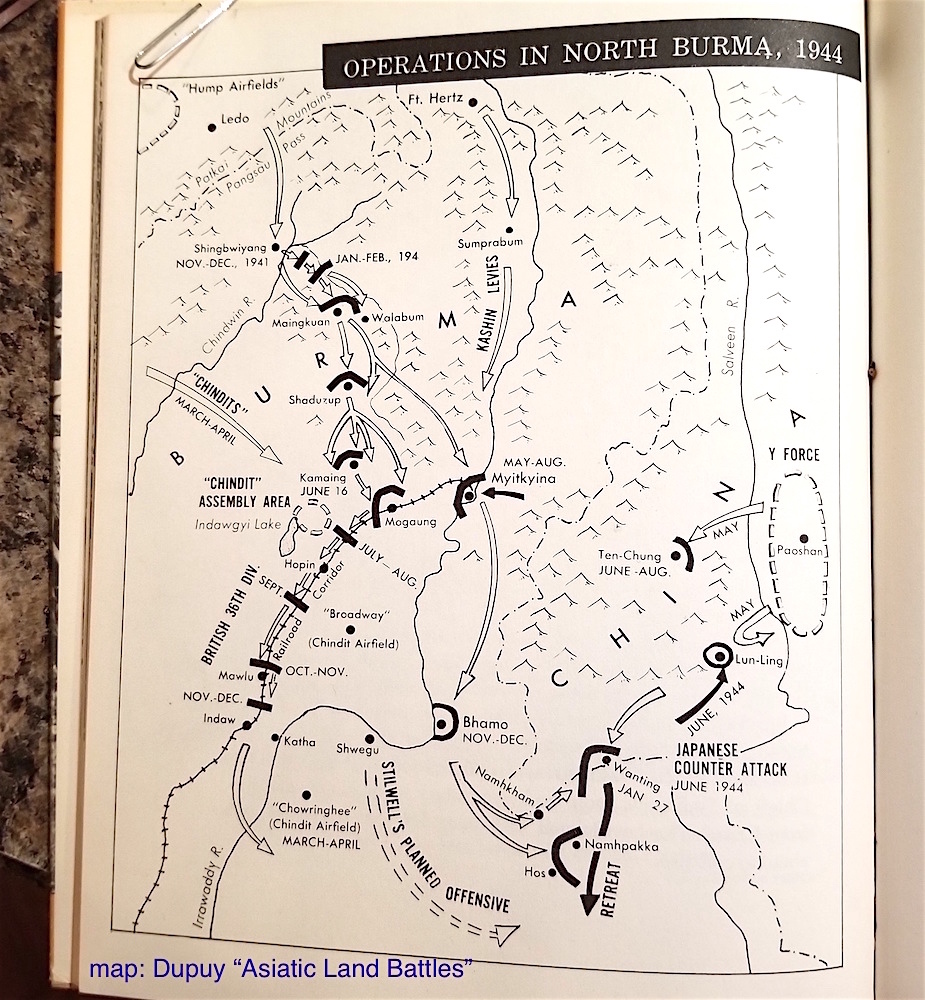
9. World War 2 military forces in Burma generated a vast array of maps. In the press maps explained Ledo & Burma Roads and battle zones. The coolest map I’ve ever used was a WW2 US Army Air Force escape map printed on silk that I borrowed in Tenasserim in 1985.

10. I’m always attracted by books with maps on the endpapers. These are from my Burma World War 2 shelf: JH Williams “Elephant Bill,” Lowell Thomas “Back to Mandalay,” Gordon Seagrave postwar “My Hospital in the Hills.”

11. On my first trip to Burma in 1981 I got a Tourist Burma map to use during the very restricted 1 week. On a couple of subsequent “legit” trips I also used maps of Rangoon, Mandalay, Pagan in a well-worn APA Insight Guide (1982 edition.)

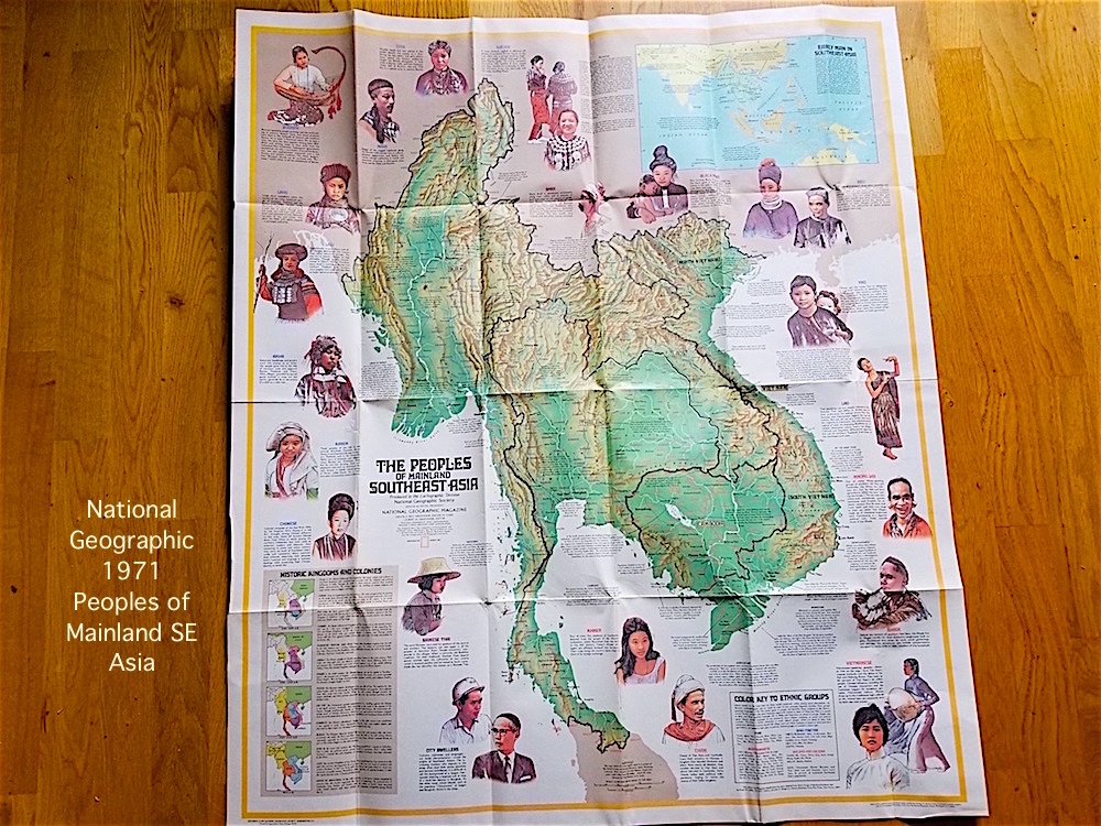
12. Roaming Burma’s frontier conflict zones 1980s I carried National Geographic 1971 Peoples of Mainland SE Asia map. I also had a map of Thailand that left Burma side of the border blank and in office of US Congress SE Asia Subcommittee the wall map didn’t include Burma at all.
13. For ‘80s Thai/Burma frontier forays best choice was large scale (1:250,000) Thai or US military topographic maps but problems if caught with those in Thailand. Like when I was arrested on border in ’87. Absolute favorite whole country Burma map: Nelles 2 sided shaded relief.

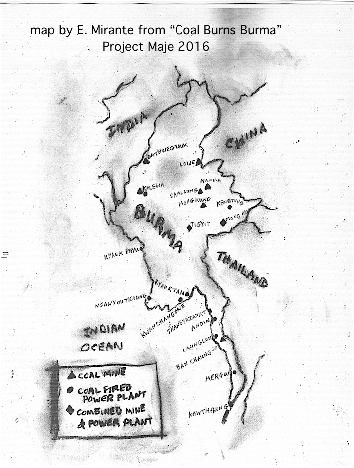
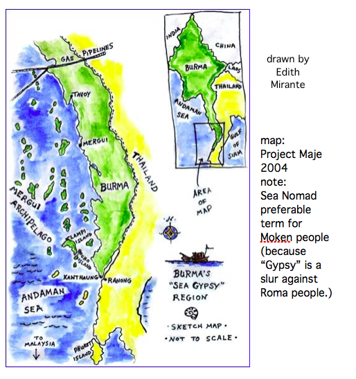
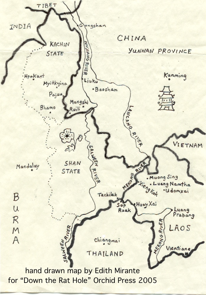
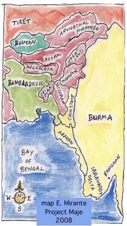
14. As an amateur cartographer I’ve drawn maps for my books, including “Down the Rat Hole” and for many of my projectmaje.org human rights and environmental reports.

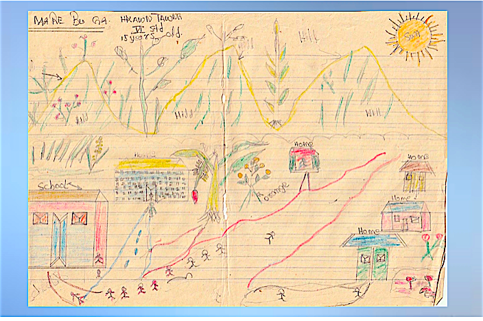
15. In 1991 I interviewed Kachin children displaced by war and collected their drawings for my Project Maje report “Jumping Rope on the Front Line.” Some depicted the villages they’d had to leave, such as this map by a 15 year old of their mountain home and school.
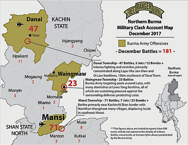
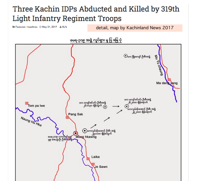
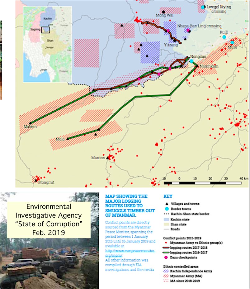
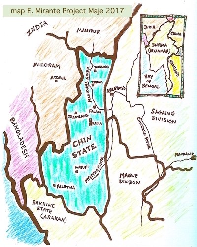
16. Ongoing Myanmar (Burma) war zones such as Kachinland are documented with maps by NGOs & INGOs & press showing military bases, battle positions, displaced persons camps and locations of human rights violations including village destruction.

17. 21 C. satellite data sharing & analysis has transformed Myanmar (Burma) mapping and access to geospatial information. Dec. 2017 Reuters used interactive map datasets to reveal destruction of Rohingya villages in Myanmar govt/military genocidal attacks. fingfx.thomsonreuters.com
18. Sept. 10, 2020 Reuters article shows how Rohingya villages have been literally wiped off maps (including UN maps.) Satellite images show Myanmar infrastructure & settlement building on Rohingya villages destroyed in 2017.
reuters.com
reuters.com
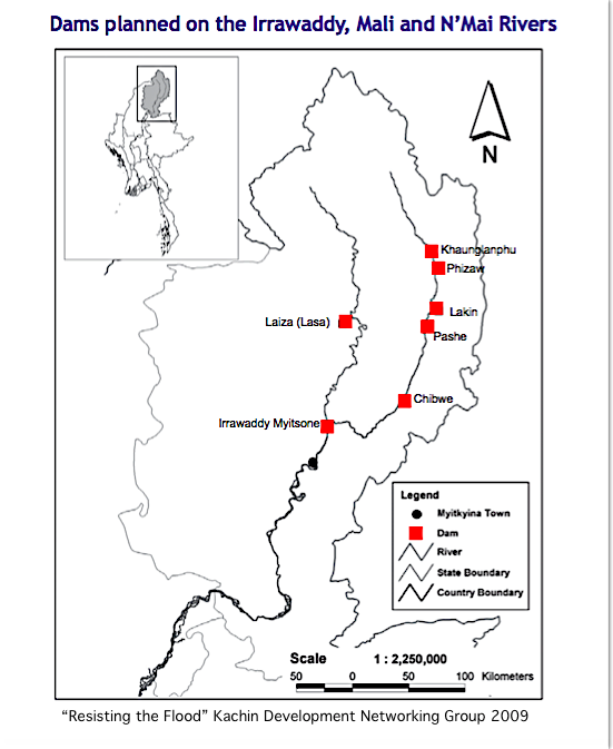
19. NGOs & INGOs often use maps to document/present Myanmar environment issues, illustrating resource distribution & geological background + advocacy for land rights, wildlife protection or climate crisis action. Organizations should seek local input/consent for mapping projects.
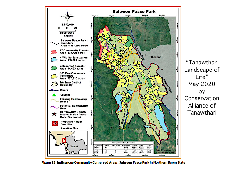
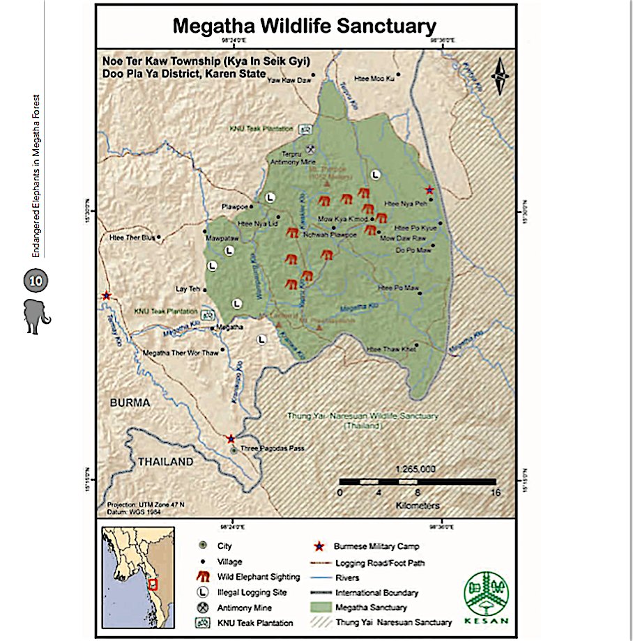
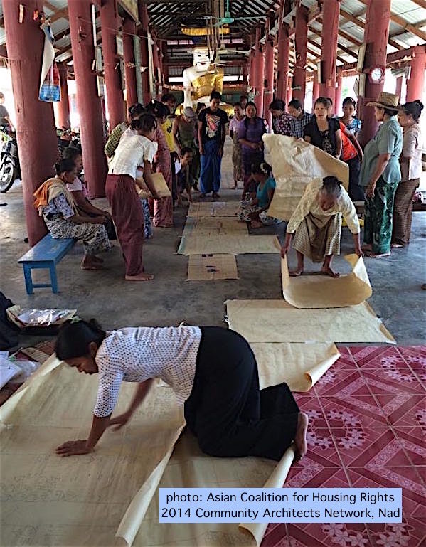
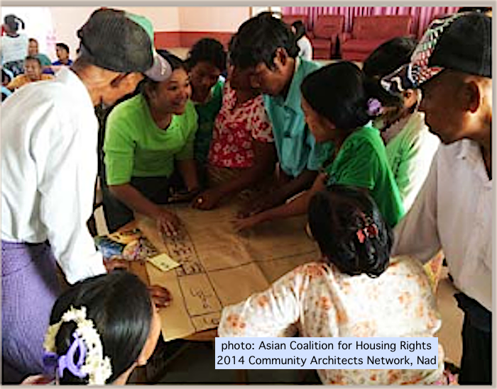
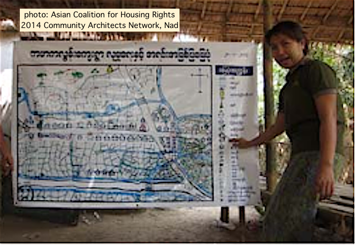
20. Participatory mapping can be useful for indigenous, rural, urban poor, displaced & other communities. Basic mapmaking training & technical support can produce land documentation. There have been fewer community mapping projects in Myanmar than in other Asian countries.
21. History/cartography sources incl. Joseph Schwartzberg in Harley ed. 1994 & Imago Mundi ’94. @FrankJacobs 2015 "Spirit Map" Big Think. Natasha Pairaudeau 2017 re cloth maps Cambridge. My previous Burma History Threads & reports (many w. maps) linked at projectmaje.org
22/22. Bonus: watch this 10 minute video on #Indigenous Zuni Map Art Project by Jim Enote, Zuni farmer & director of A:shiwi A:wan Museum and Heritage Center in New Mexico USA. aeon.co
Loading suggestions...