

[THREAD: UJJAIN — HYPE VS. FACTS]
1/82
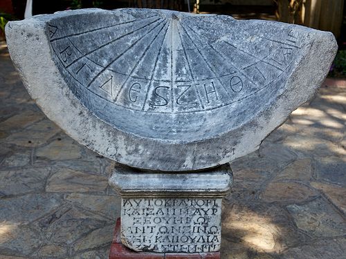
Timekeeping is a 3,500-year-old tradition that goes back to Ancient Egypt and Babylon where they used giant stone obelisks for the purpose. We call them shadow clocks, or sundials. This is how they mostly looked.
1/82
Timekeeping is a 3,500-year-old tradition that goes back to Ancient Egypt and Babylon where they used giant stone obelisks for the purpose. We call them shadow clocks, or sundials. This is how they mostly looked.
![[THREAD: UJJAIN — HYPE VS. FACTS]
1/82
Timekeeping is a 3,500-year-old tradition that goes back to A...](https://pbs.twimg.com/media/EnVN81QWEAAPuTv.jpg)
2/82
With time, these ideas were adopted and further refined by other civilizations, most notably the Ancient Greeks. Sundials started getting smaller and more accurate after the Greeks introduced trigonometry to its calculations. Here's a quick primer on how the thing works.
With time, these ideas were adopted and further refined by other civilizations, most notably the Ancient Greeks. Sundials started getting smaller and more accurate after the Greeks introduced trigonometry to its calculations. Here's a quick primer on how the thing works.
3/82
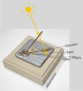
The whole idea is that things cast shadows. And depending on the angle of light, the shadow can be longer or shorter. Also, the shadow always points directly away from light. That's pretty intuitive, nothing complex to process here. That's all the physics you need.
The whole idea is that things cast shadows. And depending on the angle of light, the shadow can be longer or shorter. Also, the shadow always points directly away from light. That's pretty intuitive, nothing complex to process here. That's all the physics you need.
4/82
A sundial is nothing but a circular plate with a stick at the center. This stick runs along the plate's axis and is called the gnomon (the one who knows). The plate itself is the dial. Kept out in the sun, the gnomon would cast a shadow on the dial.
A sundial is nothing but a circular plate with a stick at the center. This stick runs along the plate's axis and is called the gnomon (the one who knows). The plate itself is the dial. Kept out in the sun, the gnomon would cast a shadow on the dial.
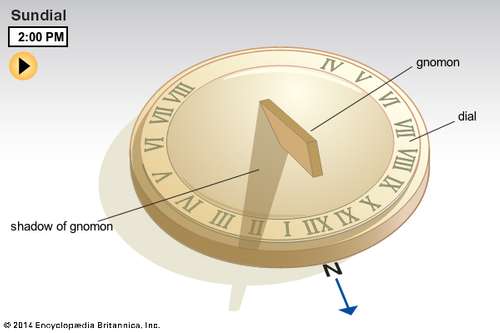
5/82
The shadow's angle is always aligned with that of the Sun and since the latter moves throughout the day (actually it's the Earth that does), so does the shadow. The dial is etched with hour markers at regular intervals so the shadow falling on them tells the time.
The shadow's angle is always aligned with that of the Sun and since the latter moves throughout the day (actually it's the Earth that does), so does the shadow. The dial is etched with hour markers at regular intervals so the shadow falling on them tells the time.
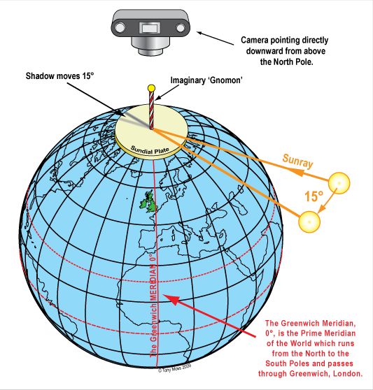
6/82
That was a short explanation. Here's a detailed version. Imagine the Earth as a giant sundial and its axis as the gnomon. Jaipur on the North Pole, you can see how the gnomon's shadow would move tracing a circular path with the Earth's rotation.
That was a short explanation. Here's a detailed version. Imagine the Earth as a giant sundial and its axis as the gnomon. Jaipur on the North Pole, you can see how the gnomon's shadow would move tracing a circular path with the Earth's rotation.
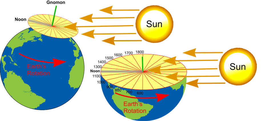
7/82
If a circle is taken as 360°, and the day has 24 hours, each hour would correspond to a 15° slice on the Earth dial. Remember, the entire dial is in light here because the Earth's axis isn't exactly perpendicular to its orbital plane, there's a 23° tilt.
If a circle is taken as 360°, and the day has 24 hours, each hour would correspond to a 15° slice on the Earth dial. Remember, the entire dial is in light here because the Earth's axis isn't exactly perpendicular to its orbital plane, there's a 23° tilt.
8/82
This hypothetical sundial works because the gnomon is parallel to the Earth's axis, and since the axis is perpendicular to the equator, the dial itself aligns with the latter. That's why a sundial built to this specification is called an equatorial sundial.
This hypothetical sundial works because the gnomon is parallel to the Earth's axis, and since the axis is perpendicular to the equator, the dial itself aligns with the latter. That's why a sundial built to this specification is called an equatorial sundial.
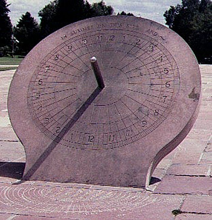
9/82
The further away you move this sundial from the pole, the more of it will fall in the shadow. At the equator, only half of it would see the Sun which means, it'd only be capable of telling the time over roughly 12 hours instead of 24. See the second image here.
The further away you move this sundial from the pole, the more of it will fall in the shadow. At the equator, only half of it would see the Sun which means, it'd only be capable of telling the time over roughly 12 hours instead of 24. See the second image here.

10/82
But there's one problem with equatorial sundials. The gnomon must always run parallel to the Earth's axis. At the pole, this is easy, just let the dial sit flat, parallel to the equator. But on other latitudes, this becomes problematic.
But there's one problem with equatorial sundials. The gnomon must always run parallel to the Earth's axis. At the pole, this is easy, just let the dial sit flat, parallel to the equator. But on other latitudes, this becomes problematic.
11/82
At non-polar latitudes, the gnomon can either be parallel to the Earth's axis, or perpendicular to the ground, never both. To keep the gnomon parallel to the Earth's axis, it must be kept on an angle with the ground. At what angle? Brace for some light geometry here.
At non-polar latitudes, the gnomon can either be parallel to the Earth's axis, or perpendicular to the ground, never both. To keep the gnomon parallel to the Earth's axis, it must be kept on an angle with the ground. At what angle? Brace for some light geometry here.
12/82
Here's how we do it. First, some labels:
BC: Equator
IM: Earth's axis
DG: A non-equatorial latitude
JL: Alignment of the gnomon (parallel to IM)
KH: Alignment of the dial (parallel to the ground)
α: Angle of the latitude DG with the equator
P.S. diagram courtesy, moi.
Here's how we do it. First, some labels:
BC: Equator
IM: Earth's axis
DG: A non-equatorial latitude
JL: Alignment of the gnomon (parallel to IM)
KH: Alignment of the dial (parallel to the ground)
α: Angle of the latitude DG with the equator
P.S. diagram courtesy, moi.
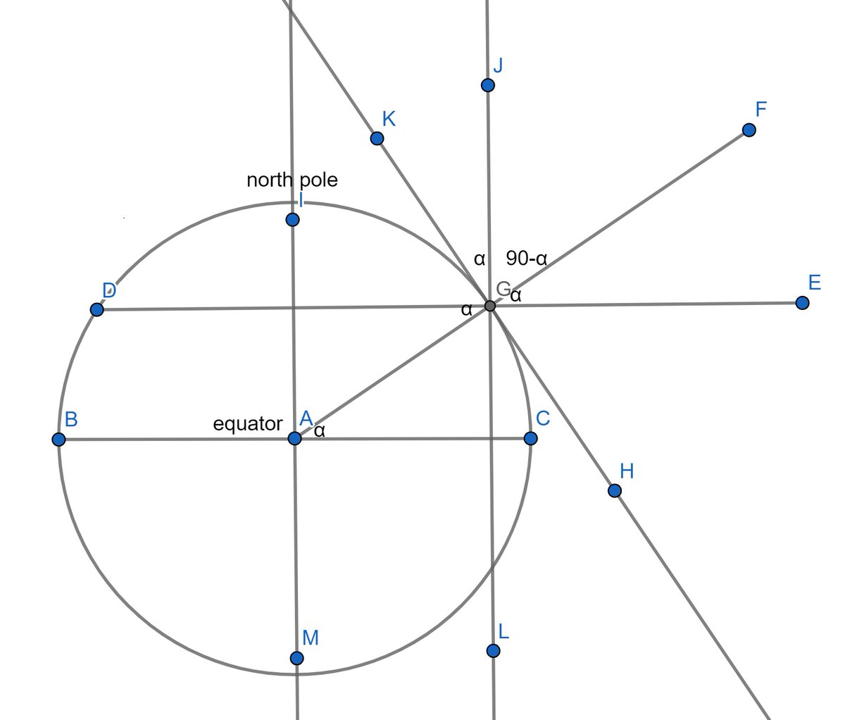
13/82
Since a latitude is defined by the angle by which it's separated from the equator, the latitude (DG) in our example is α° N.
Since DG and BC are parallel and AG forms the transversal between them, angles GAC and DGA are equal, per the theorem of alternate interior angles.
Since a latitude is defined by the angle by which it's separated from the equator, the latitude (DG) in our example is α° N.
Since DG and BC are parallel and AG forms the transversal between them, angles GAC and DGA are equal, per the theorem of alternate interior angles.
14/82
When two straight lines cross each other, opposite angle are congruent. Thus, FGE is equal to DGA which is already equal to GAC, i.e. α. Since JL and DE are mutually perpendicular, JGE must be a right angle, i.e. 90°. Which leaves JGF as 90-α.
When two straight lines cross each other, opposite angle are congruent. Thus, FGE is equal to DGA which is already equal to GAC, i.e. α. Since JL and DE are mutually perpendicular, JGE must be a right angle, i.e. 90°. Which leaves JGF as 90-α.
15/82
Since KH is tangential to the Earth's surface and AF is perpendicular to it, KGF must also be a right angle. Part of this angle is JGF which is 90-α. Thus, the remaining part, i.e. KGJ must be 90-(90-α). That reduces to α.
Since KH is tangential to the Earth's surface and AF is perpendicular to it, KGF must also be a right angle. Part of this angle is JGF which is 90-α. Thus, the remaining part, i.e. KGJ must be 90-(90-α). That reduces to α.
16/82
Since KH is the dial and JG is the gnomon, KGJ is basically the gnomon's tilt against the dial. That is α. Which also happens to be the latitude!
In short, an equatorial sundial's gnomon must be at an angle with the dial the value of which is the same as its latitude.
Since KH is the dial and JG is the gnomon, KGJ is basically the gnomon's tilt against the dial. That is α. Which also happens to be the latitude!
In short, an equatorial sundial's gnomon must be at an angle with the dial the value of which is the same as its latitude.
17/82
The Greeks has all of this figured out at least by the time of Euclid (300 BC) if not earlier. But they had already borrowed the more primitive obelisk clocks from the Babylonians as early as the 6th century BC, long before the equatorial or equinoctial sundial.
The Greeks has all of this figured out at least by the time of Euclid (300 BC) if not earlier. But they had already borrowed the more primitive obelisk clocks from the Babylonians as early as the 6th century BC, long before the equatorial or equinoctial sundial.
18/82
Do note at this point that a sundial has to be aware of its latitude since that's the value governing the gnomon's orientation. But it doesn't have to know the longitude. This is a very crucial bit that'll come in handy later down the thread.
Now let's go to Afghanistan.
Do note at this point that a sundial has to be aware of its latitude since that's the value governing the gnomon's orientation. But it doesn't have to know the longitude. This is a very crucial bit that'll come in handy later down the thread.
Now let's go to Afghanistan.
19/82
Some 285 miles north of Kabul, where Kokcha pours into Amu Darya and Afghanistan meets Turkmenistan, is an archaeological dig. Politically, the region is part of the frontier province of Takhar. At one time in the past, this is where kings would come on hunting expeditions.
Some 285 miles north of Kabul, where Kokcha pours into Amu Darya and Afghanistan meets Turkmenistan, is an archaeological dig. Politically, the region is part of the frontier province of Takhar. At one time in the past, this is where kings would come on hunting expeditions.
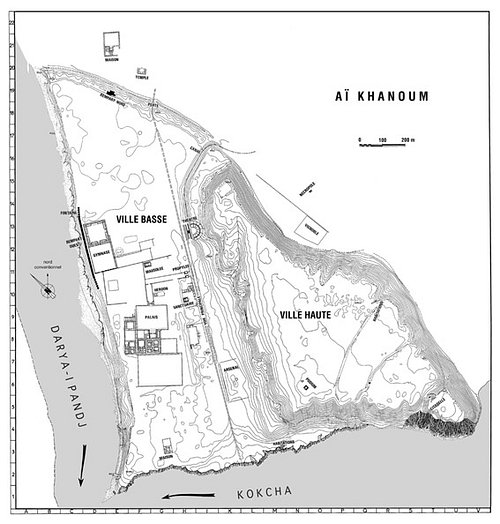
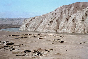
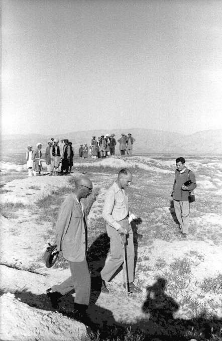
20/82
On one such expedition, Khan Gholam Serwar Nasher stumbled upon some artefacts that seemed ancient. Intrigued, he called upon Daniel Schlumberger the famous Princeton archeologist to investigate. By 1970, French archeologists had dug the whole place up.
On one such expedition, Khan Gholam Serwar Nasher stumbled upon some artefacts that seemed ancient. Intrigued, he called upon Daniel Schlumberger the famous Princeton archeologist to investigate. By 1970, French archeologists had dug the whole place up.
21/82
Turns out, this desolate stretch was once a bustling Graeco-Bactrian metropolis named Aï Khanūm (Uzbek for Lady Moon). The Greeks called it Alexandria after the famous Macedonian conqueror. There were many Alexandrias those days, this one was Alexandria on the Oxus.
Turns out, this desolate stretch was once a bustling Graeco-Bactrian metropolis named Aï Khanūm (Uzbek for Lady Moon). The Greeks called it Alexandria after the famous Macedonian conqueror. There were many Alexandrias those days, this one was Alexandria on the Oxus.
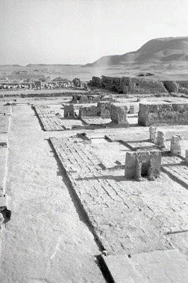
22/82
Aï Khanūm was pretty much the frontier of the Graeco-Bactrian territory, almost bordering the Mauryan Empire of India. To the south, Bactria reached what's today Hyderabad (Pakistan) but was then Pattala. Aï Khanūm unfortunately was completely abandoned by 145-120 BC.
Aï Khanūm was pretty much the frontier of the Graeco-Bactrian territory, almost bordering the Mauryan Empire of India. To the south, Bactria reached what's today Hyderabad (Pakistan) but was then Pattala. Aï Khanūm unfortunately was completely abandoned by 145-120 BC.

23/82
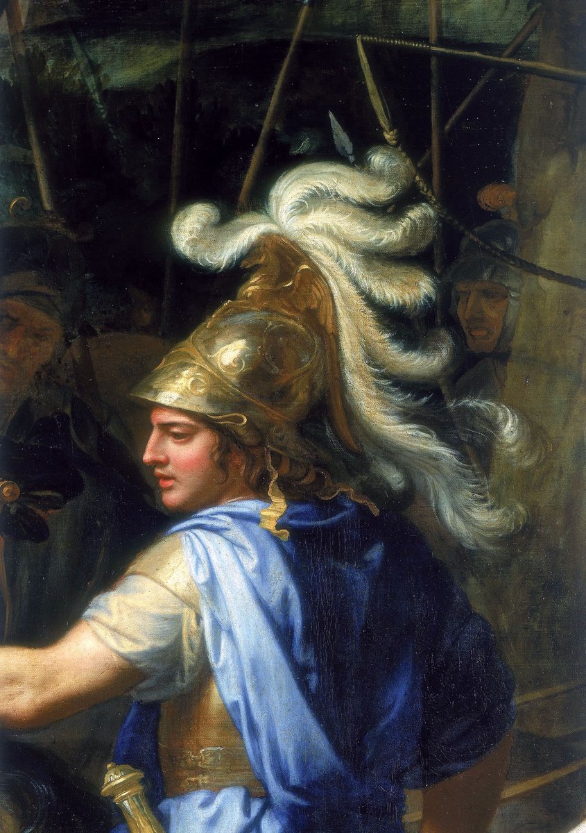
The city was named Alexandria for a reason. In 329 BC, Alexander was in the region on an eastward campaign. Aï Khanūm is where he made a pit stop. His men fatigued, his supplies running out, the emperor decided to stay on until ready to fight again.
The city was named Alexandria for a reason. In 329 BC, Alexander was in the region on an eastward campaign. Aï Khanūm is where he made a pit stop. His men fatigued, his supplies running out, the emperor decided to stay on until ready to fight again.
24/82
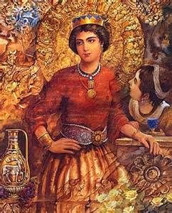
It's during this period of rest that he founded a city, named it Alexandria on the Oxus (ancient name for Amu Darya), and married a local Bactrian princess called Roxana.
This is the magnificent city the French Archaeological Delegation in Afghanistan had unearthed.
It's during this period of rest that he founded a city, named it Alexandria on the Oxus (ancient name for Amu Darya), and married a local Bactrian princess called Roxana.
This is the magnificent city the French Archaeological Delegation in Afghanistan had unearthed.
25/82
To the East, Bactria bordered the Mauryan Empire, not far from where Aï Khanūm stood. And the Mauryan Empire was divvied up into 4 provinces, one of them being the Western province with capital at the newly-annexed Avanti.
To the East, Bactria bordered the Mauryan Empire, not far from where Aï Khanūm stood. And the Mauryan Empire was divvied up into 4 provinces, one of them being the Western province with capital at the newly-annexed Avanti.
26/82
Avanti was so grand for its time, it was made the capital of the whole empire. Today, we know the city as Ujjain.
Ujjain has an interesting location.
Horizontally, it sat right in the middle of the Mauryan Empire. Almost vertically so too.
Avanti was so grand for its time, it was made the capital of the whole empire. Today, we know the city as Ujjain.
Ujjain has an interesting location.
Horizontally, it sat right in the middle of the Mauryan Empire. Almost vertically so too.
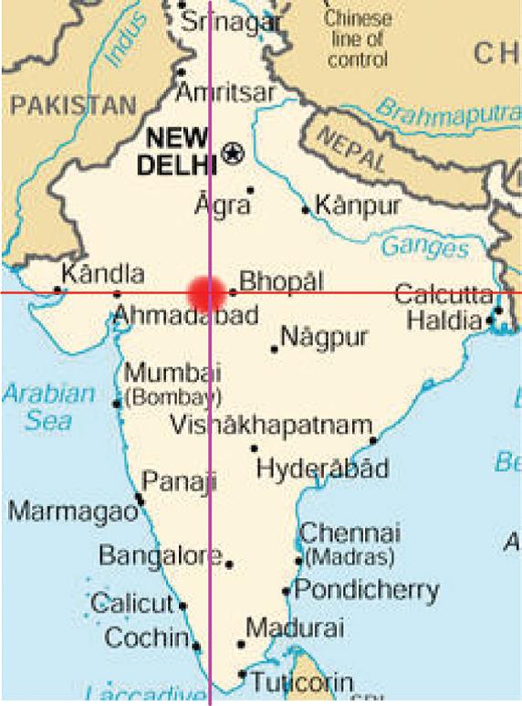
27/82
Even today, the longitude that runs through this city (76°38′E) is considered the "unofficial" prime meridian of India.
India, not world.
The longitude is roughly half an hour behind the one that runs through Allahabad, the "official" prime meridian of India (IST).
Even today, the longitude that runs through this city (76°38′E) is considered the "unofficial" prime meridian of India.
India, not world.
The longitude is roughly half an hour behind the one that runs through Allahabad, the "official" prime meridian of India (IST).
28/82
This astronomical trivia was first recorded in the Sanskrit treatise Sūrya Siddhānta. Even today, traditional Hindu horoscopes treat the Ujjain line as its 0°.
Sūrya Siddhānta itself goes back to between 350 and 500 AD depending on who you ask.
This astronomical trivia was first recorded in the Sanskrit treatise Sūrya Siddhānta. Even today, traditional Hindu horoscopes treat the Ujjain line as its 0°.
Sūrya Siddhānta itself goes back to between 350 and 500 AD depending on who you ask.
29/82
The practice of standard time wasn't confined to India though. Throughout antiquity, empires and kingdoms have designated their own "prime meridians." There was no universal time coordinate because the need was never felt.
The practice of standard time wasn't confined to India though. Throughout antiquity, empires and kingdoms have designated their own "prime meridians." There was no universal time coordinate because the need was never felt.
30/82
While the choice of a nation's standard/prime meridian (a local "0°," if you will) is constrained by geometry (the closer to the horizontal midpoint, the better), that of the universal prime meridian is rather arbitrary. Any given longitude can play the role.
While the choice of a nation's standard/prime meridian (a local "0°," if you will) is constrained by geometry (the closer to the horizontal midpoint, the better), that of the universal prime meridian is rather arbitrary. Any given longitude can play the role.
31/82
But ancient Indians weren't the first to have a standard meridian, or even meridians in general. Greek polymath Eratosthenes had propounded longitudes as early as the 3rd century BC. That doesn't necessarily mean the Indians learned it from him.
But ancient Indians weren't the first to have a standard meridian, or even meridians in general. Greek polymath Eratosthenes had propounded longitudes as early as the 3rd century BC. That doesn't necessarily mean the Indians learned it from him.
32/82
In fact, it's possible that astrologers in Ujjain came up with the concept of longitudes independently since they didn't measure those in degrees like the Greeks did. The first reference to this in India comes from the aforementioned Sūrya Siddhānta.
In fact, it's possible that astrologers in Ujjain came up with the concept of longitudes independently since they didn't measure those in degrees like the Greeks did. The first reference to this in India comes from the aforementioned Sūrya Siddhānta.
33/82
Sūrya Siddhānta itself claims to be from 2 million years ago. Obviously, that's just poetic liberty and the oldest it's been dated to is around 350 AD; it was done by John Bowman of Colombia University. So that makes Eratosthenes at least 550 years older than this text.
Sūrya Siddhānta itself claims to be from 2 million years ago. Obviously, that's just poetic liberty and the oldest it's been dated to is around 350 AD; it was done by John Bowman of Colombia University. So that makes Eratosthenes at least 550 years older than this text.
34/82
Eratosthenes defined a prime meridian for Alexandria in Egypt. That's because he worked there, as the librarian at the Great Library of Alexandria. After him, others Greek city-states started marking their own prime meridians. This included one at Rhodes.
Eratosthenes defined a prime meridian for Alexandria in Egypt. That's because he worked there, as the librarian at the Great Library of Alexandria. After him, others Greek city-states started marking their own prime meridians. This included one at Rhodes.
35/82
By 150 AD, Claudius Ptolemy came out with a treatise of his own in Alexandria. It was titled Γεωγραφικὴ Ὑφήγησις (Latinized as Geographia). Geographia was a rehash of an earlier work by Marinus of Tyre with additional influences from contemporary Persian cartographers.
By 150 AD, Claudius Ptolemy came out with a treatise of his own in Alexandria. It was titled Γεωγραφικὴ Ὑφήγησις (Latinized as Geographia). Geographia was a rehash of an earlier work by Marinus of Tyre with additional influences from contemporary Persian cartographers.
36/82
With this volume, Ptolemy became the first individual to propose a universal time coordinate, a single standard prime meridian for the entire world. This original prime meridian corresponds to 25° 40' 32″ W today. That's way off the line through Greenwich.
With this volume, Ptolemy became the first individual to propose a universal time coordinate, a single standard prime meridian for the entire world. This original prime meridian corresponds to 25° 40' 32″ W today. That's way off the line through Greenwich.
37/82
Ptolemy's meridian remained the global prime well into the Middle Ages. The line in Ujjain became prime for territories within the Indian subcontinent with the Sūrya Siddhānta, 200 years after Geographia. At no point in time was it the universal standard.
Ptolemy's meridian remained the global prime well into the Middle Ages. The line in Ujjain became prime for territories within the Indian subcontinent with the Sūrya Siddhānta, 200 years after Geographia. At no point in time was it the universal standard.
38/82
So thus far, here's what we have.
Sundials originated in Ancient Egypt and Babylon. The simplest kind is the equinoctial or equatorial sundial. It consists of a dial with hour markings and a gnomon. The gnomon casts a shadow which tells the time.
So thus far, here's what we have.
Sundials originated in Ancient Egypt and Babylon. The simplest kind is the equinoctial or equatorial sundial. It consists of a dial with hour markings and a gnomon. The gnomon casts a shadow which tells the time.
39/82
The angle between the gnomon and the dial must be the same as the latitude at the place of installation. Ergo, the sundial's configuration changes with a change in latitude. No dependency on the longitude whatsoever. This holds true for other kinds of sundials too.
The angle between the gnomon and the dial must be the same as the latitude at the place of installation. Ergo, the sundial's configuration changes with a change in latitude. No dependency on the longitude whatsoever. This holds true for other kinds of sundials too.
40/82
That is, two identical sundials on two different longitudes but on the same latitude will function the exact same way. They'll give different time readings but they'll both be equally accurate.
We also learned that Aï Khanūm was the Uzbek name for Alexandria on the Oxus.
That is, two identical sundials on two different longitudes but on the same latitude will function the exact same way. They'll give different time readings but they'll both be equally accurate.
We also learned that Aï Khanūm was the Uzbek name for Alexandria on the Oxus.
41/82
Alexandria on the Oxus was a pit stop developed into a functional city by Alexander the Great while on a campaign trail toward India. The city sat on the eastern frontier of Bactria, not far from the border with the Mauryan Empire of India.
Alexandria on the Oxus was a pit stop developed into a functional city by Alexander the Great while on a campaign trail toward India. The city sat on the eastern frontier of Bactria, not far from the border with the Mauryan Empire of India.
42/82
Concurrent to the founding of Alexandria on the Oxus, was the Mauryan annexation of Avanti, an ancient city corresponding to today's Ujjain. Ujjain was considered the hub of Indian timekeeping because an ancient book on the subject said so.
Concurrent to the founding of Alexandria on the Oxus, was the Mauryan annexation of Avanti, an ancient city corresponding to today's Ujjain. Ujjain was considered the hub of Indian timekeeping because an ancient book on the subject said so.
43/82
This book was Sūrya Siddhānta and it was the first to introduce India to longitudes. It also named the one through Ujjain, the subcontinent's prime meridian. This book's been dated to 350 AD or later.
The idea of longitudes was first given 550 years earlier by the Greeks.
This book was Sūrya Siddhānta and it was the first to introduce India to longitudes. It also named the one through Ujjain, the subcontinent's prime meridian. This book's been dated to 350 AD or later.
The idea of longitudes was first given 550 years earlier by the Greeks.
44/82
Eratosthenes proposed longitudes and local prime meridians in the 3rd century BC. Ptolemy proposed a single universal prime meridian for the whole world (like today's UTC) in 150 AD. This was 200 years before Sūrya Siddhānta.
Eratosthenes proposed longitudes and local prime meridians in the 3rd century BC. Ptolemy proposed a single universal prime meridian for the whole world (like today's UTC) in 150 AD. This was 200 years before Sūrya Siddhānta.
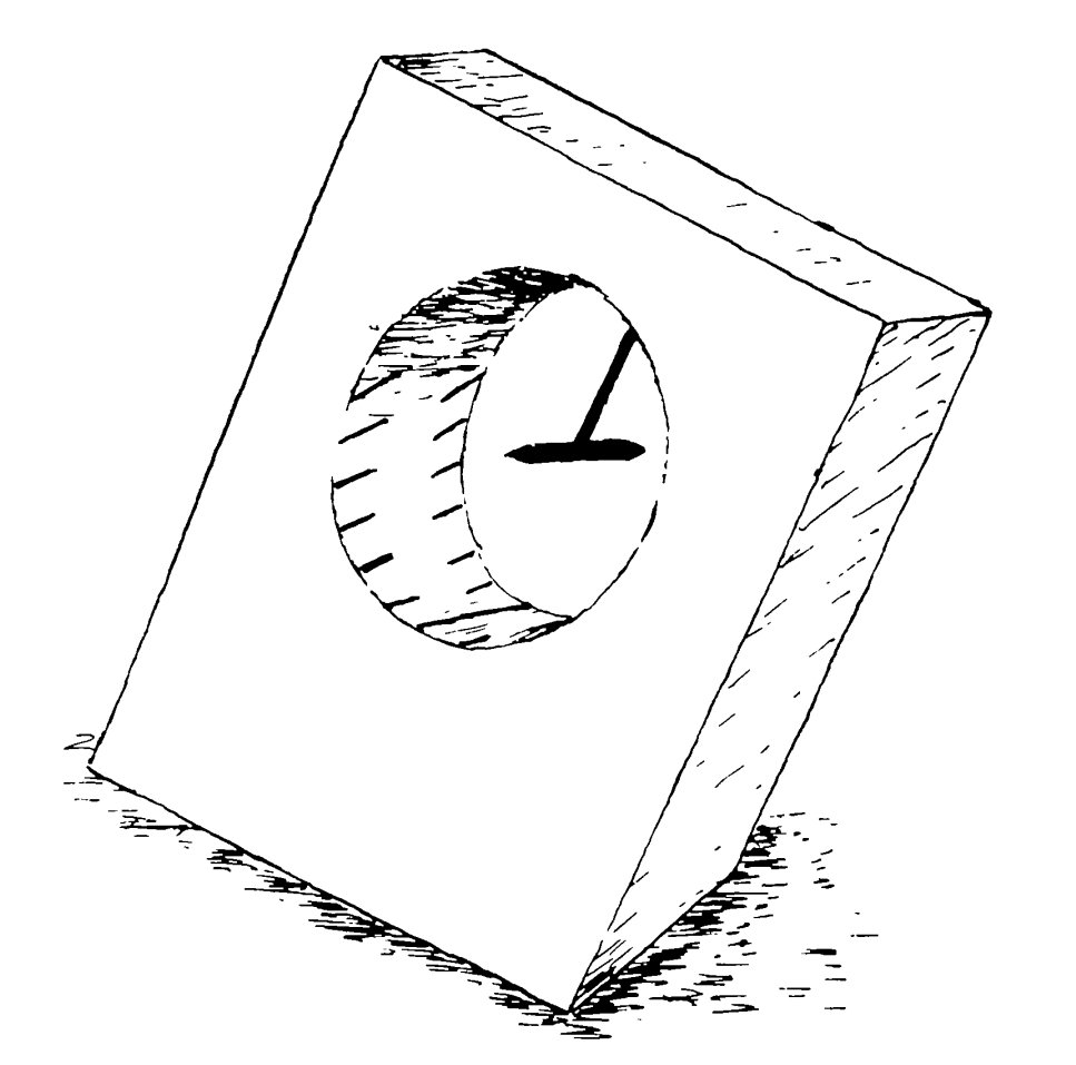
45/82
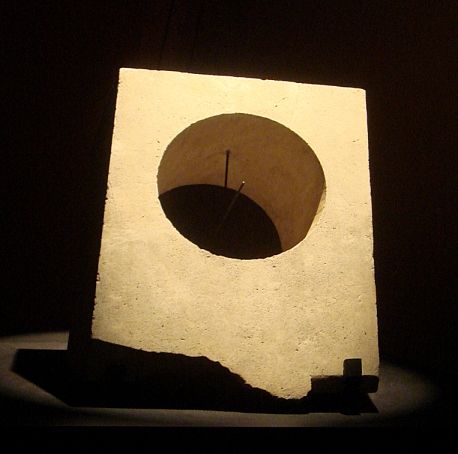
Now coming back to Afghanistan, in 1975, the French team digging up Aï Khanūm unearthed a carved slab of limestone with a large cylindrical hole through it. The slab was 45 cm high, 35 cm wide, and 15 cm thick. The hole was 22 cm across.
Now coming back to Afghanistan, in 1975, the French team digging up Aï Khanūm unearthed a carved slab of limestone with a large cylindrical hole through it. The slab was 45 cm high, 35 cm wide, and 15 cm thick. The hole was 22 cm across.
46/82
After much deliberation, this artefact was concluded to be an exotic type of sundial, one of its kind that didn't feature even in Vitruvius' list of 13 types of sundials from 25 BC.
The inner surface of the cylindrical hole had markings.
After much deliberation, this artefact was concluded to be an exotic type of sundial, one of its kind that didn't feature even in Vitruvius' list of 13 types of sundials from 25 BC.
The inner surface of the cylindrical hole had markings.
47/82
There were two sets of markings (lines), each with 13. These lines were arranged in such a way that if the surface were to be unrolled and spread flat, it'd show the two sets running parallel to each other. Each set had a long center line with 6 smaller ones on either side.
There were two sets of markings (lines), each with 13. These lines were arranged in such a way that if the surface were to be unrolled and spread flat, it'd show the two sets running parallel to each other. Each set had a long center line with 6 smaller ones on either side.

48/82
If the slab were to be laid parallel to the equator, and a rod driven through the hole's axis, this could easily become a modified equinoctial sundial. The rod would then be the gnomon. We will get to the working of this sundial shortly but first some design details.
If the slab were to be laid parallel to the equator, and a rod driven through the hole's axis, this could easily become a modified equinoctial sundial. The rod would then be the gnomon. We will get to the working of this sundial shortly but first some design details.
49/82
Unlike a regular equinoctial sundial, this time the gnomon wouldn't have to tilt. It'd always be perpendicular to the dial, i.e. the slab. Instead, it's the slab itself that'd tilt with respect to the ground in order to remain parallel to the equator.
Unlike a regular equinoctial sundial, this time the gnomon wouldn't have to tilt. It'd always be perpendicular to the dial, i.e. the slab. Instead, it's the slab itself that'd tilt with respect to the ground in order to remain parallel to the equator.
50/82
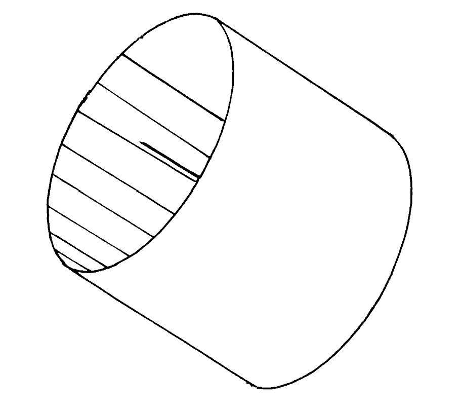
In order to make the slab tilt, a triangular portion of it would've needed to be chipped off. In the following diagram (side profile), you can see this bit as the hatched section ABC. Sure enough the slab was found to have this chipping done.
In order to make the slab tilt, a triangular portion of it would've needed to be chipped off. In the following diagram (side profile), you can see this bit as the hatched section ABC. Sure enough the slab was found to have this chipping done.

51/82
The angle of tilt ought to be the same as the latitude of the slab's installation, shown here as φ. Now, if you examine the hour markings closely, you'll notice 12 sections on each side, 6 on either side of the long center line.
The angle of tilt ought to be the same as the latitude of the slab's installation, shown here as φ. Now, if you examine the hour markings closely, you'll notice 12 sections on each side, 6 on either side of the long center line.

52/82
These 12 lines corresponded to the 12 temporal hours of the day. The long center line was the noon marker. This gives us the perfect equinoctial sundial with each hour marker separated from the adjacent ones by 15° (180° ÷ 12 hours). But there's 2 sets of lines. Why?
These 12 lines corresponded to the 12 temporal hours of the day. The long center line was the noon marker. This gives us the perfect equinoctial sundial with each hour marker separated from the adjacent ones by 15° (180° ÷ 12 hours). But there's 2 sets of lines. Why?
53/82
Those days, hours weren't uniform. The span between dawn and dusk was divided into 12 hours. Thus, winter hours were shorter than summer hours. We call this temporal hour. Thus, a dial with equidistant markers would be useless. There was something to remedy just that.
Those days, hours weren't uniform. The span between dawn and dusk was divided into 12 hours. Thus, winter hours were shorter than summer hours. We call this temporal hour. Thus, a dial with equidistant markers would be useless. There was something to remedy just that.
54/82
The hour markers were equidistant, but not straight lines. They were etched to slightly incline towards the middle marker, the noon line. This way, the gnomon's shadow would always account for the seasonal variation in the length of individual hours.
The hour markers were equidistant, but not straight lines. They were etched to slightly incline towards the middle marker, the noon line. This way, the gnomon's shadow would always account for the seasonal variation in the length of individual hours.
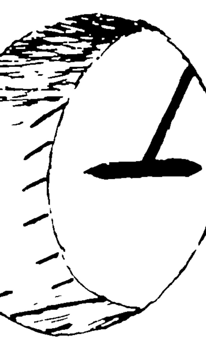
55/82
There was another issue. The Sun wouldn't always shine on the same side of the slab. One side would face the Sun in winter while the other would in summer. This was remedied by having two sets of hour markers, one on either edge of the inner surface.
There was another issue. The Sun wouldn't always shine on the same side of the slab. One side would face the Sun in winter while the other would in summer. This was remedied by having two sets of hour markers, one on either edge of the inner surface.
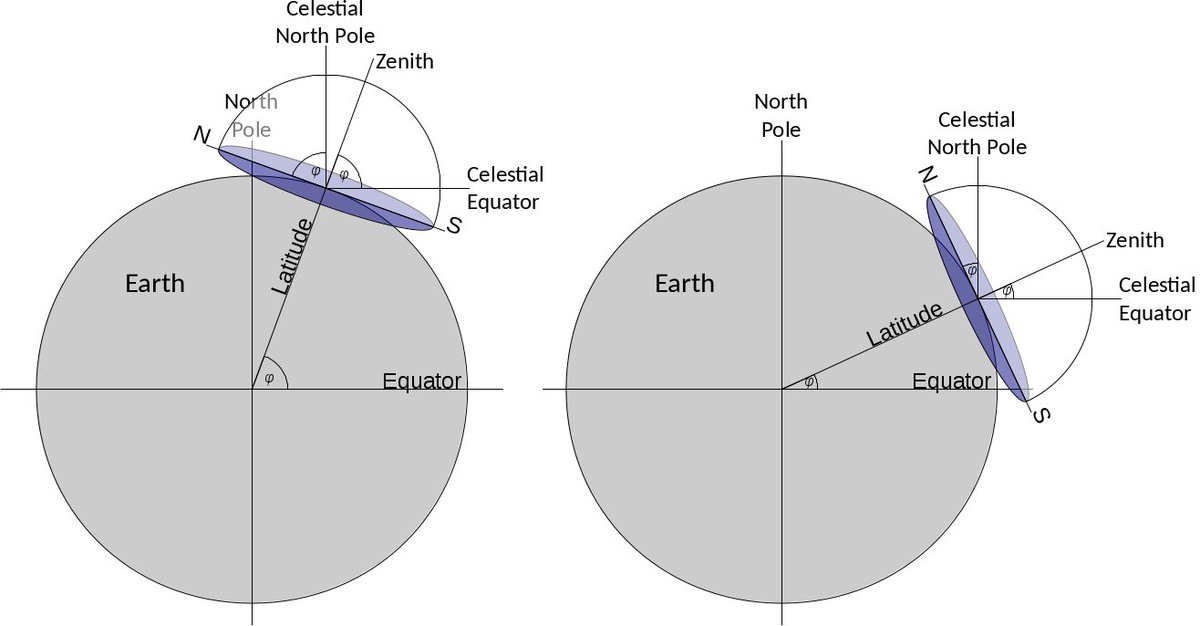
56/82
Before we proceed from here, lemme introduce you to something called declination. In simplest terms, it's the orientation of a celestial body expressed as an angle with the Earth's equatorial plane. Let this diagram illustrate:
Before we proceed from here, lemme introduce you to something called declination. In simplest terms, it's the orientation of a celestial body expressed as an angle with the Earth's equatorial plane. Let this diagram illustrate:
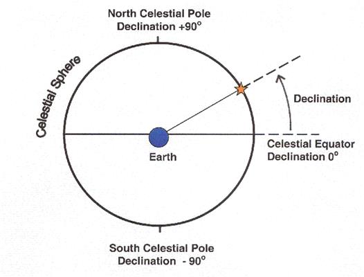
57/82
This declination can be calculated for any celestial body and that includes the Sun. This angle changes from one day to the next and for the Sun, ranges between -23.44° and +23.44°.
Now, do recall that the marker lines are inclined toward the middle or noon line.
This declination can be calculated for any celestial body and that includes the Sun. This angle changes from one day to the next and for the Sun, ranges between -23.44° and +23.44°.
Now, do recall that the marker lines are inclined toward the middle or noon line.
58/82
So, the ends are farther apart on the outer edge than they are on the inside. Naturally, then, the outer edge corresponds to the longest hours (on equinoxes), the inner to the shortest (on solstices). Here's a diagram I drew to illustrate this (not to scale).
So, the ends are farther apart on the outer edge than they are on the inside. Naturally, then, the outer edge corresponds to the longest hours (on equinoxes), the inner to the shortest (on solstices). Here's a diagram I drew to illustrate this (not to scale).

59/82
DC is the noon line with hour markers on either side of it (I've shown only one side on one edge here). So, DB can be seen as half of an equinoctial day whereas JQ, half of a solstitial day. 6×(JQ ÷ DB), then, gives us a value that's called the hour angle of the Sun.
DC is the noon line with hour markers on either side of it (I've shown only one side on one edge here). So, DB can be seen as half of an equinoctial day whereas JQ, half of a solstitial day. 6×(JQ ÷ DB), then, gives us a value that's called the hour angle of the Sun.
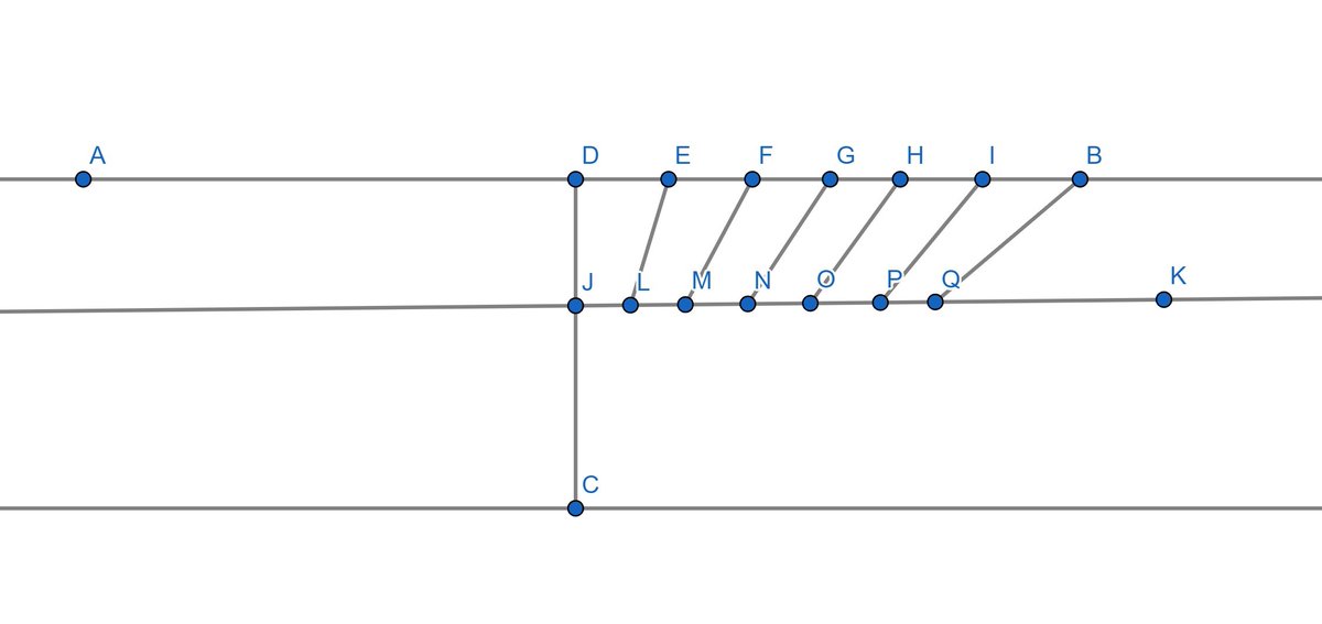
60/82
Solar hour angle is, in simplest terms, the angle the Sun makes with the local meridian at any given time. Due to the Earth's rotation, this changes by the hour. The value returned by 6×(JQ ÷ DB) is the hour angle of the Sun when it just crosses the horizon (t).
Solar hour angle is, in simplest terms, the angle the Sun makes with the local meridian at any given time. Due to the Earth's rotation, this changes by the hour. The value returned by 6×(JQ ÷ DB) is the hour angle of the Sun when it just crosses the horizon (t).
61/82
With this information, it's possible to calculate the latitude of the slab's installation using this formula:
tan θ = (cos t ÷ tan d)
where θ is the latitude, t is the hour angle we just calculated, and d is the Sun's declination during the solstices.
With this information, it's possible to calculate the latitude of the slab's installation using this formula:
tan θ = (cos t ÷ tan d)
where θ is the latitude, t is the hour angle we just calculated, and d is the Sun's declination during the solstices.
62/82
When the slab was built, d was 23.9°. So the formula now reduces to:
tan θ = (cos t ÷ tan 23.9°)
When resolved, θ comes to 23.5°. In the northern hemisphere we call this latitude the Tropic of Cancer. But the dial was found at Aï Khanūm which lies on 37°.
When the slab was built, d was 23.9°. So the formula now reduces to:
tan θ = (cos t ÷ tan 23.9°)
When resolved, θ comes to 23.5°. In the northern hemisphere we call this latitude the Tropic of Cancer. But the dial was found at Aï Khanūm which lies on 37°.
63/82
That's a difference of over 13 degrees. This proves the sundial wasn't meant to be installed where it was found, rather it was transported there. But from where?
To find out, archeologists surveyed the all the routes Alexander followed on his campaigns.
That's a difference of over 13 degrees. This proves the sundial wasn't meant to be installed where it was found, rather it was transported there. But from where?
To find out, archeologists surveyed the all the routes Alexander followed on his campaigns.
64/82
The southernmost point reached by Alexander turned out to be Pattala, an ancient city near today's Hyderabad in Sindh. Pattala sat on 25° N. The port city of Karachi being a mere 100 miles from there, it was reasonable to assume Alexander planned on annexing it.
The southernmost point reached by Alexander turned out to be Pattala, an ancient city near today's Hyderabad in Sindh. Pattala sat on 25° N. The port city of Karachi being a mere 100 miles from there, it was reasonable to assume Alexander planned on annexing it.
65/82
Port cities were key to trade and having as many of those in one's control was a commercial imperative. Whether Alexander managed to annexe Karachi is unclear, but his navy certainly visited the port. Alexander himself never did though.
bl.uk
Port cities were key to trade and having as many of those in one's control was a commercial imperative. Whether Alexander managed to annexe Karachi is unclear, but his navy certainly visited the port. Alexander himself never did though.
bl.uk

66/82
This is sufficient grounds to assume that the Macedonian imperialist either conquered, or planned to conquer Karachi and develop it as a new maritime Alexandria of sorts. There were already Greek traders settled in the city and around those days.
This is sufficient grounds to assume that the Macedonian imperialist either conquered, or planned to conquer Karachi and develop it as a new maritime Alexandria of sorts. There were already Greek traders settled in the city and around those days.
67/82
If that were the case, Pattala could easily have been his planned local capital from where he'd mount his southward invasions. This theory means the sundial was initially meant to be installed in Pattala, hence the corresponding latitude.
If that were the case, Pattala could easily have been his planned local capital from where he'd mount his southward invasions. This theory means the sundial was initially meant to be installed in Pattala, hence the corresponding latitude.
68/82
But everything so far, other than the derivation of 23.9°, is still mere conjecture. Calculations are needed to improve its plausibility. So further calculations were, indeed, done.
If you recall tweets 49 and 50, the slab was meant to be on a tilt with the ground.
But everything so far, other than the derivation of 23.9°, is still mere conjecture. Calculations are needed to improve its plausibility. So further calculations were, indeed, done.
If you recall tweets 49 and 50, the slab was meant to be on a tilt with the ground.
69/82
This tilt was to keep the gnomon parallel to the Earth's axis and the dial to the equatorial plane, thus making it in essence, an equatorial/equinoctial device. We also saw how that tilt (φ in the last illustration) ought to be the same as the latitude of installation.
This tilt was to keep the gnomon parallel to the Earth's axis and the dial to the equatorial plane, thus making it in essence, an equatorial/equinoctial device. We also saw how that tilt (φ in the last illustration) ought to be the same as the latitude of installation.
70/82
Now here's the puzzling part: φ was measured and it came to 37°, the latitude of Aï Khanūm! So the slab's tilt says it was for Aï Khanūm, but the calculation using solar hour angle says it was for Pattala. And both are equally compelling mathematical facts!
Now here's the puzzling part: φ was measured and it came to 37°, the latitude of Aï Khanūm! So the slab's tilt says it was for Aï Khanūm, but the calculation using solar hour angle says it was for Pattala. And both are equally compelling mathematical facts!
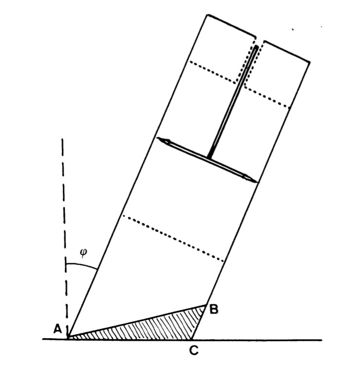
71/82
This can easily be explained with a closer look at the slab's base plate. Here, AC represents the original base, tiled for Pattala's latitude. Then, it was later moved to Aï Khanūm and re-tilted for the new latitude. This "recarved" base plate is represented by AB.
This can easily be explained with a closer look at the slab's base plate. Here, AC represents the original base, tiled for Pattala's latitude. Then, it was later moved to Aï Khanūm and re-tilted for the new latitude. This "recarved" base plate is represented by AB.

72/82
So, it can now be established with reasonable confidence that the dial was originally constructed and meant to be installed at Pattala. This city sat where Hyderabad (Sindh) sits today, on the Tropic of Cancer. This latitude runs through another ancient city too.
Ujjain.
So, it can now be established with reasonable confidence that the dial was originally constructed and meant to be installed at Pattala. This city sat where Hyderabad (Sindh) sits today, on the Tropic of Cancer. This latitude runs through another ancient city too.
Ujjain.
73/82
But since there's no textual evidence of Ujjain, then Avanti, having any timekeeping industry those days nor did Alexander get anywhere close to the city, it's absurd to assume this sundial has anything to do with it. Ujjain doesn't even have a sundial from that time.
But since there's no textual evidence of Ujjain, then Avanti, having any timekeeping industry those days nor did Alexander get anywhere close to the city, it's absurd to assume this sundial has anything to do with it. Ujjain doesn't even have a sundial from that time.
74/82
In fact, Ujjain only became the "prime meridian" of the Indian subcontinent, as we've seen earlier, from Sūrya Siddhānta the earliest which has been dated to is 350 AD, at least 495 years after Aï Khanūm was abandoned due to constant invasions from the North.
In fact, Ujjain only became the "prime meridian" of the Indian subcontinent, as we've seen earlier, from Sūrya Siddhānta the earliest which has been dated to is 350 AD, at least 495 years after Aï Khanūm was abandoned due to constant invasions from the North.
75/82
So that's the story of the single most remarkable timekeeping device ever built by man, only one specimen of whose kind has ever been discovered, the sundial of Aï Khanūm. Which only came to light in 1975, more than 2,000 years after it was lost to time.
So that's the story of the single most remarkable timekeeping device ever built by man, only one specimen of whose kind has ever been discovered, the sundial of Aï Khanūm. Which only came to light in 1975, more than 2,000 years after it was lost to time.
76/82
Key takeaways from this story:
- Sundials are built to align with latitudes, not longitudes.
- The first sundials were Egyptian and Babylonian and were in the form of rock obelisks.
- The first equatorial sundials were Greek.
Key takeaways from this story:
- Sundials are built to align with latitudes, not longitudes.
- The first sundials were Egyptian and Babylonian and were in the form of rock obelisks.
- The first equatorial sundials were Greek.
77/82
- The concept of longitudes was given by Eratosthenes of Alexandria (3rd century BC).
- The concept of local "prime meridians" was also given by Greek cartographers after Eratosthenes.
- The concept of a global prime meridian was given by Ptolemy (150 AD).
- The concept of longitudes was given by Eratosthenes of Alexandria (3rd century BC).
- The concept of local "prime meridians" was also given by Greek cartographers after Eratosthenes.
- The concept of a global prime meridian was given by Ptolemy (150 AD).
78/82
- The concept of longitudes and local prime meridian first appeared in India in 350 AD through Sūrya Siddhānta, at least 200 years after Ptolemy.
- Ujjain became the timekeeping center of ancient India due to it being on the middle longitude of the subcontinent.
- The concept of longitudes and local prime meridian first appeared in India in 350 AD through Sūrya Siddhānta, at least 200 years after Ptolemy.
- Ujjain became the timekeeping center of ancient India due to it being on the middle longitude of the subcontinent.
79/82
- For this reason, Ujjain continues to be called the Greenwich of India and its meridian still remains the standard coordinate for Hindu time calculations.
- The sundial of Aï Khanūm was built for the Tropic of Cancer but was later moved to and re-shaped for Aï Khanūm.
- For this reason, Ujjain continues to be called the Greenwich of India and its meridian still remains the standard coordinate for Hindu time calculations.
- The sundial of Aï Khanūm was built for the Tropic of Cancer but was later moved to and re-shaped for Aï Khanūm.
80/82
- The Tropic of Cancer passes through both Pattala (today's Hyderabad in Sindh) and Ujjain.
- Alexander never came to Ujjain, so there's no way he could've transported the sundial from there to Aï Khanūm.
- The Tropic of Cancer passes through both Pattala (today's Hyderabad in Sindh) and Ujjain.
- Alexander never came to Ujjain, so there's no way he could've transported the sundial from there to Aï Khanūm.
81/82
- Alexander did visit Pattala, so it's fair to assume that that's where the sundial was initially installed.
- Another reason the sundial couldn't belong to Ujjain is that the city isn't known to have had any timekeeping industry during BC.
- Alexander did visit Pattala, so it's fair to assume that that's where the sundial was initially installed.
- Another reason the sundial couldn't belong to Ujjain is that the city isn't known to have had any timekeeping industry during BC.
82/82
- No ancient sundial installation has ever been found in Ujjain.
- And once again, sundials are built to align with latitudes, not longitudes.
With these takeaways in mind, have a look at this screenshot. I rest my case.
- No ancient sundial installation has ever been found in Ujjain.
- And once again, sundials are built to align with latitudes, not longitudes.
With these takeaways in mind, have a look at this screenshot. I rest my case.

Loading suggestions...