
Map Archive Kashmir.
1: Father Monserrate’s Map, 1590.
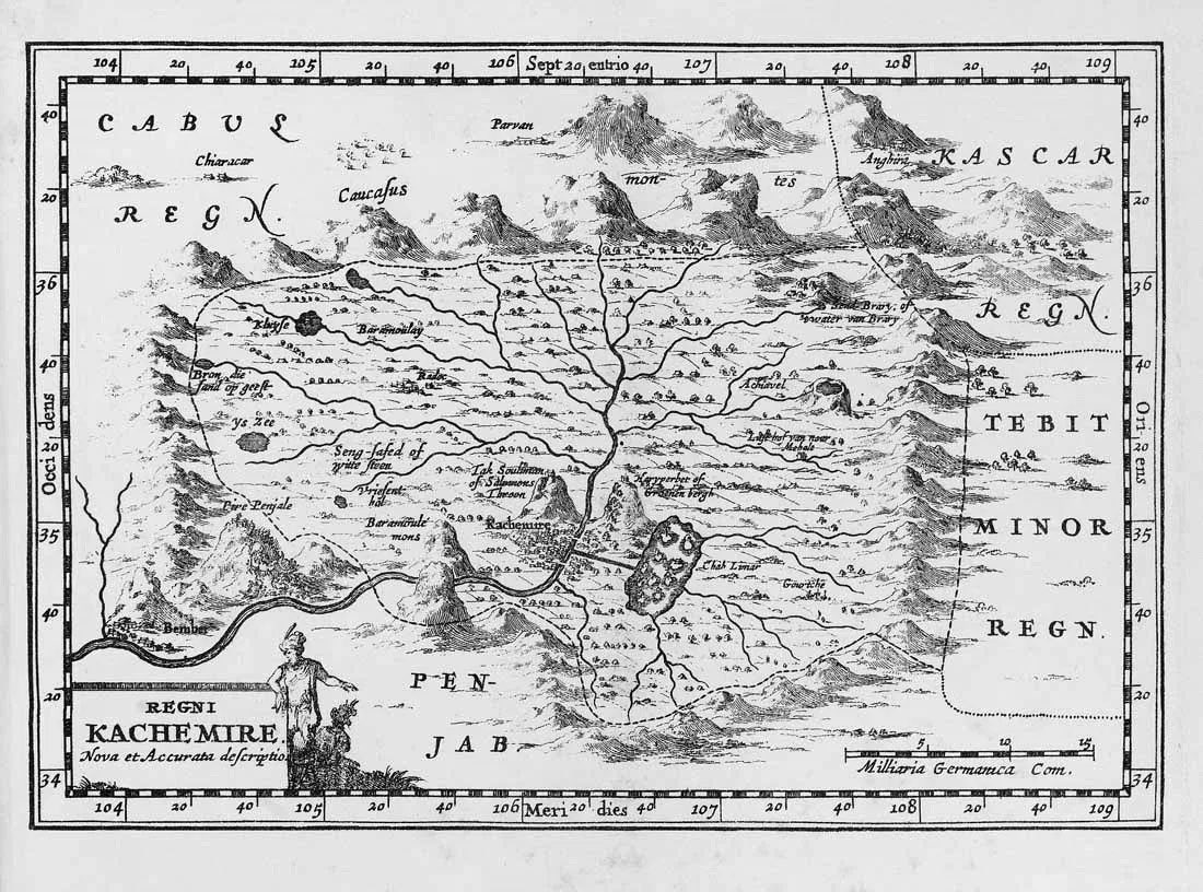
2: Map by Sanson d’Abbeville, 1652.
3: William Baffin’s map from, 1619.
4: David McCormick’s ‘An artist in the Himalayas’ (1895). (1/n)
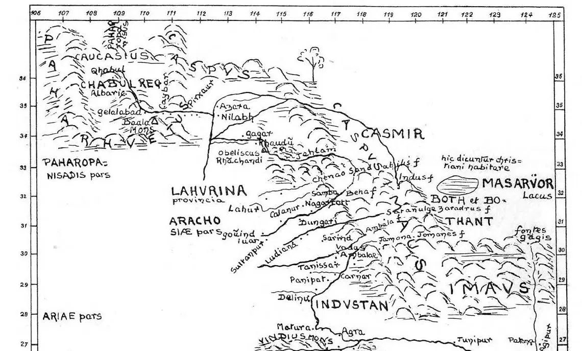
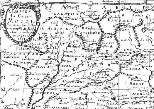
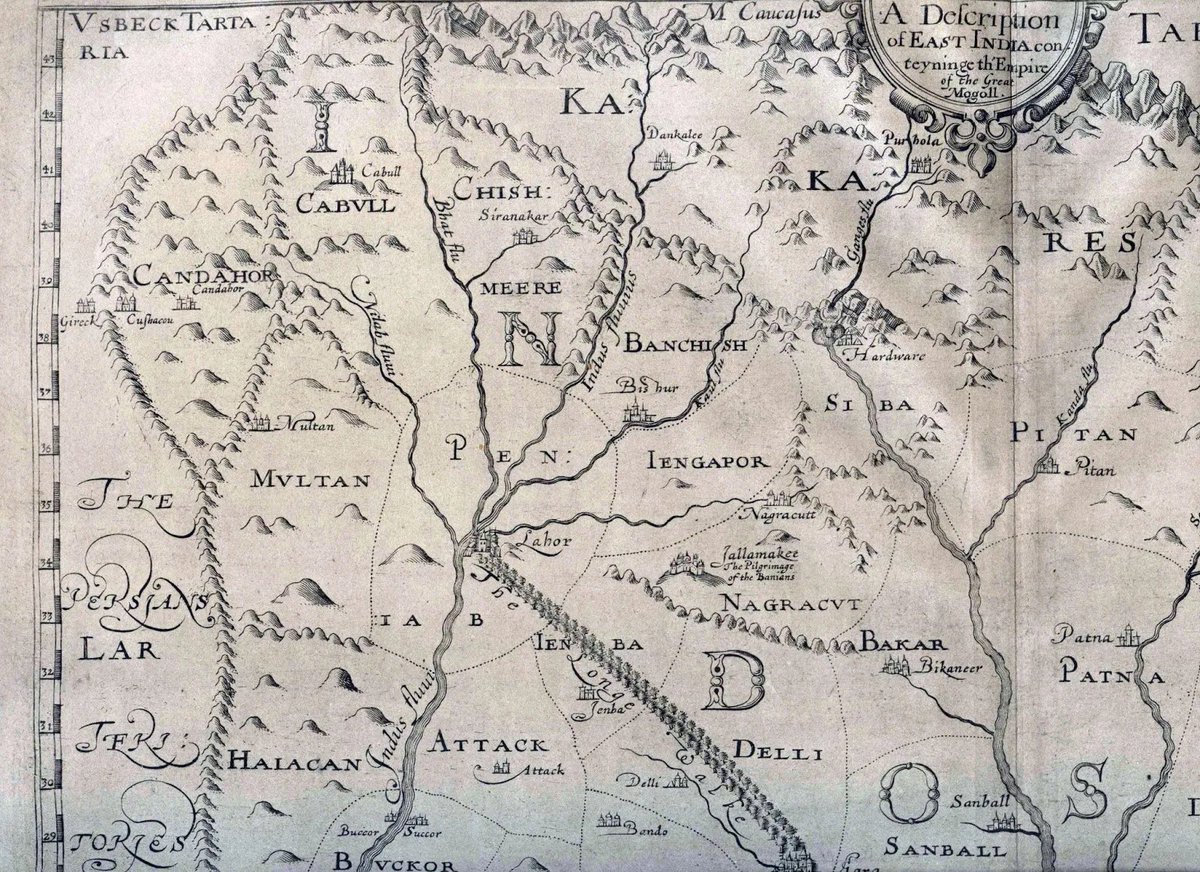
1: Father Monserrate’s Map, 1590.
2: Map by Sanson d’Abbeville, 1652.
3: William Baffin’s map from, 1619.
4: David McCormick’s ‘An artist in the Himalayas’ (1895). (1/n)
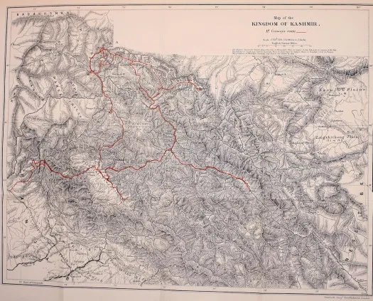
1: From ‘The Vale of Kashmir’ by Ellsworth Huntington, 1906.
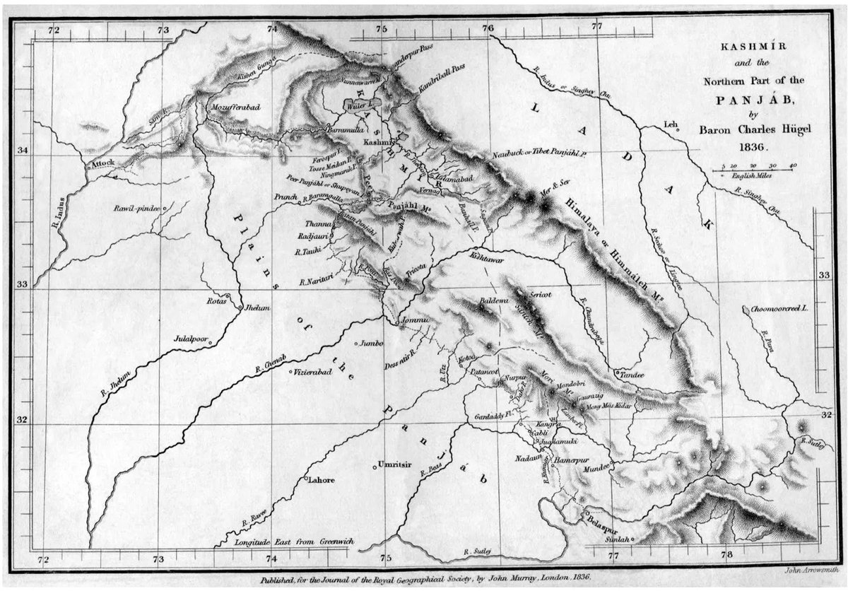
2: Charles von Hügel, January 1, 1836.
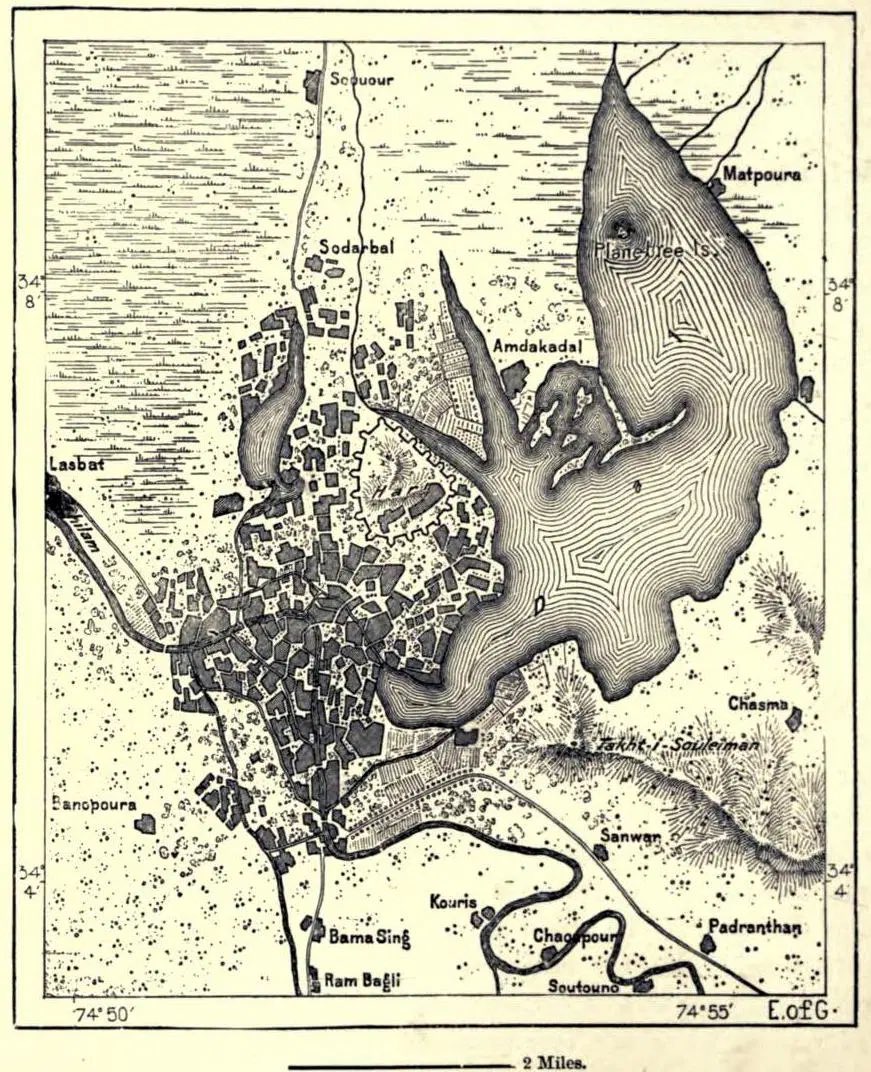
3: Map of Srinagar from ‘The Earth and Its Inhabitants, Asia, Volume 3’ by Elisée Reclus, 1891.
4: Unknown cartographer (2/n)
2: Charles von Hügel, January 1, 1836.
3: Map of Srinagar from ‘The Earth and Its Inhabitants, Asia, Volume 3’ by Elisée Reclus, 1891.
4: Unknown cartographer (2/n)

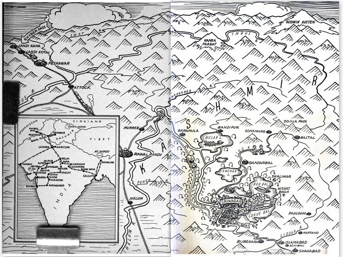
1: ‘Houseboating in Kashmir’ by Alberta Johnston Denis, 1934.
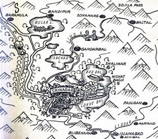
2: Zoomed version of same map showing Srinagar.
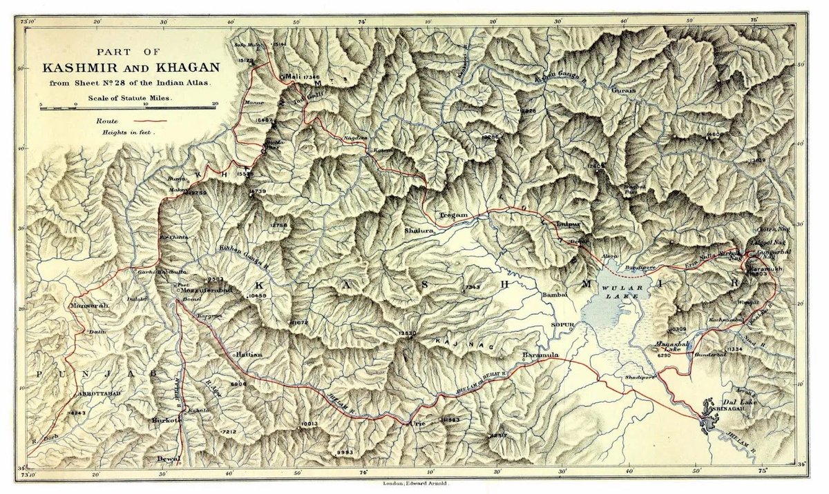
3: From ‘Five months in the Himalaya a record of mountain travel in Garhwal and Kashmir’ (1909) by A.L. Mumm.
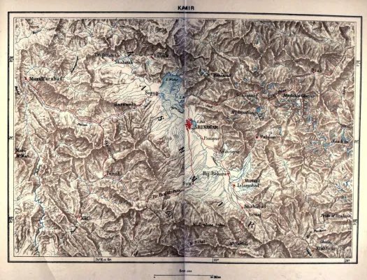
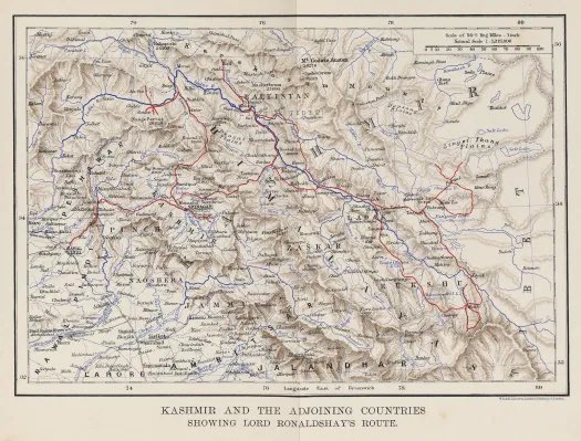
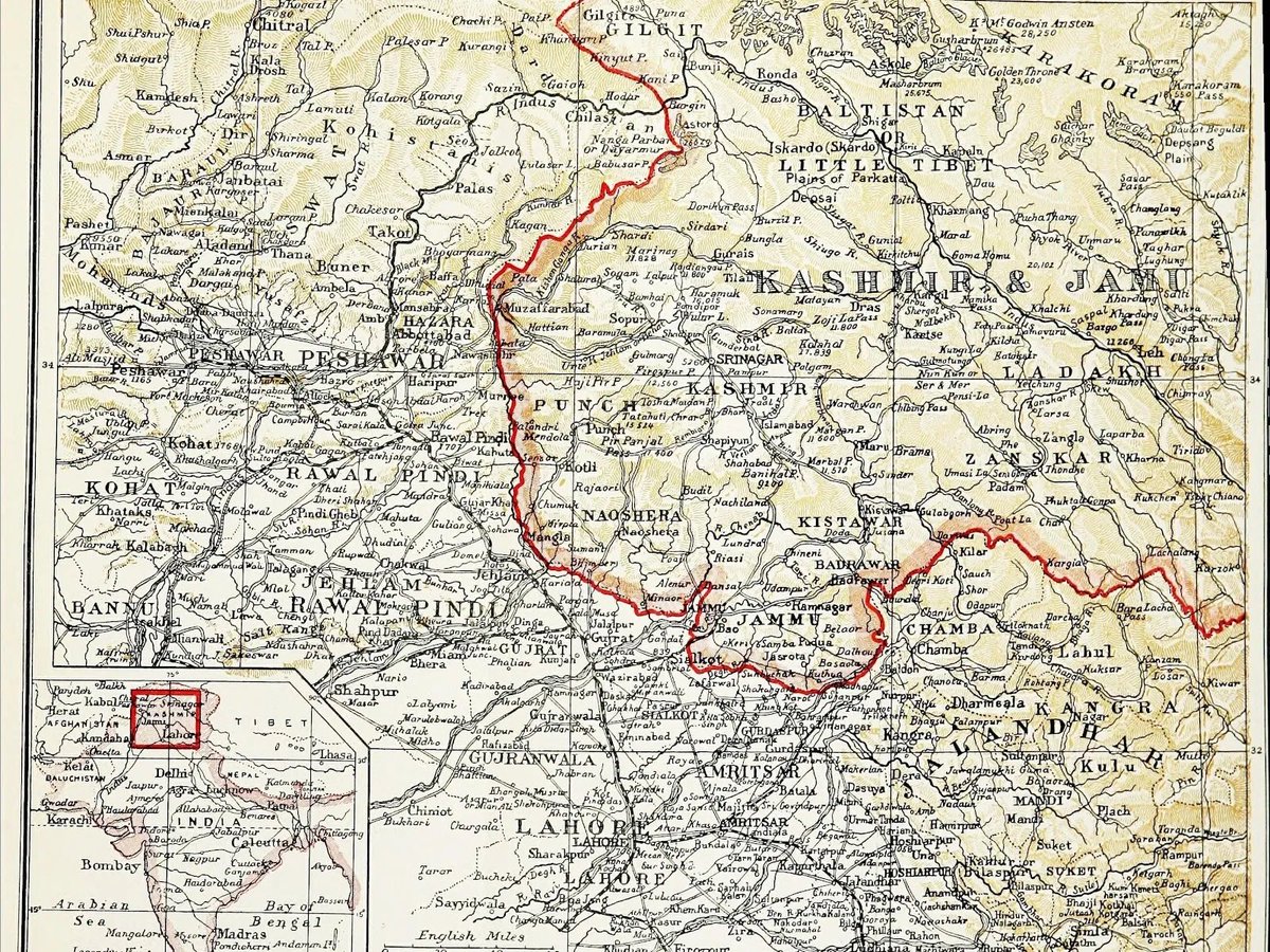
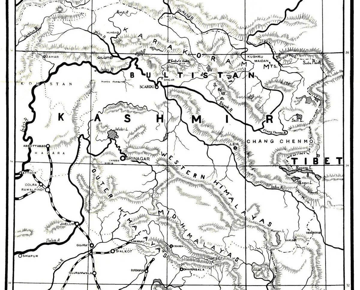
4: Kashmir and the Adjoining Countries ,1902.
(3/n)
2: Zoomed version of same map showing Srinagar.
3: From ‘Five months in the Himalaya a record of mountain travel in Garhwal and Kashmir’ (1909) by A.L. Mumm.
4: Kashmir and the Adjoining Countries ,1902.
(3/n)
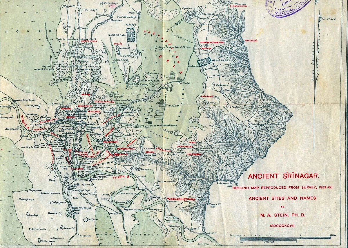
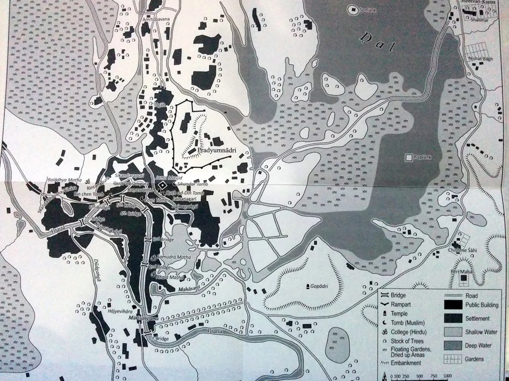
1: Auriel Stein’s map of anicent Srinagar, 1898.
2: Jammu and Kashmir by Ashley Carus-Wilson, 1901.
3: Provincial geographies of India, 1913.
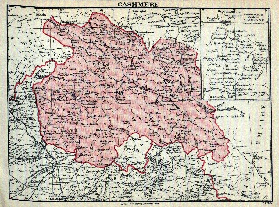
4: From ‘A Handbook for travellers in India, Pakistan, Burma and Ceylon’ by publishing firm, John Murray, 1901.
(4/n)
2: Jammu and Kashmir by Ashley Carus-Wilson, 1901.
3: Provincial geographies of India, 1913.
4: From ‘A Handbook for travellers in India, Pakistan, Burma and Ceylon’ by publishing firm, John Murray, 1901.
(4/n)
1: Sketch map of Jammu & Kashmir by J .& C.Walker Sculpt., 1842.
2: From Travels in the Mogul Empire’ by Francois Bernier, 1891.
3: Tyndale Biscoe, 1922.
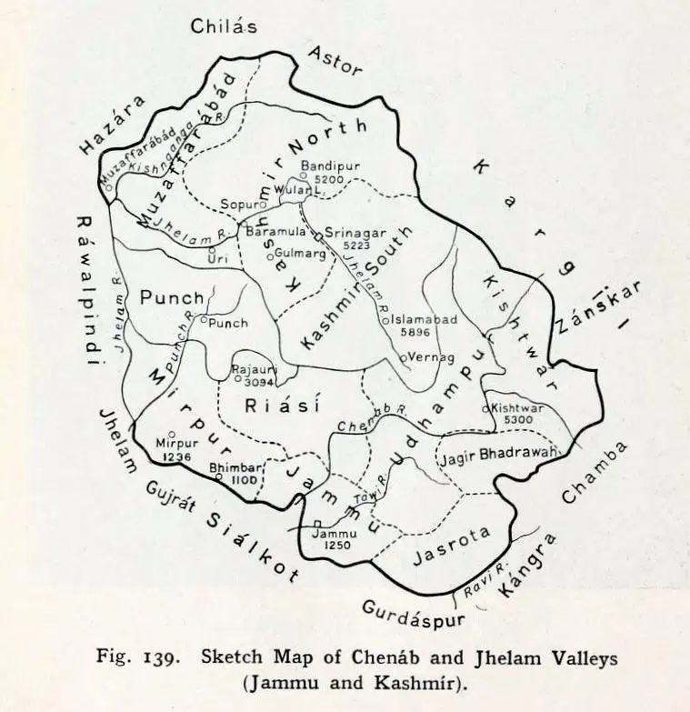
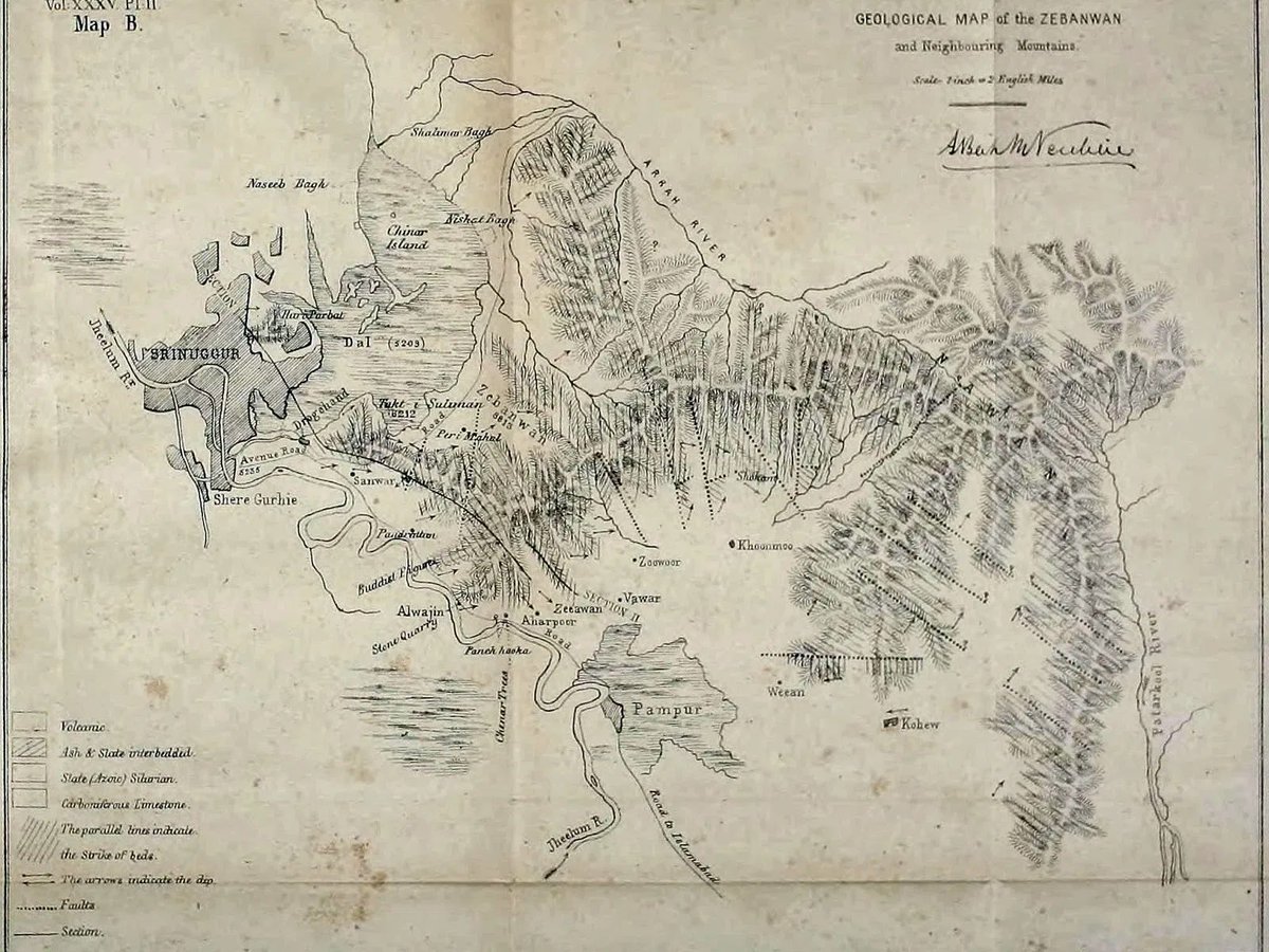
4: Map of Zabarwan, 1866.
(5/n)
2: From Travels in the Mogul Empire’ by Francois Bernier, 1891.
3: Tyndale Biscoe, 1922.
4: Map of Zabarwan, 1866.
(5/n)

1: From: ‘Kingship in Kaśmīr (C.E 1148–1459)’ by Walter Slaje.
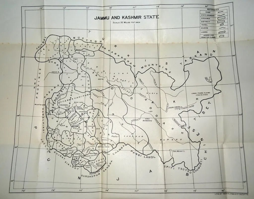
2: ‘Geography of The Jammu and Kashmir State’ by Pandit Anand Koul. 1925.
3: Map of Mughal province of Cachemir (Kashmir), 1770 by Colonel Jean Baptiste Gentil, agent for the French Government to the Court. (6/n)
2: ‘Geography of The Jammu and Kashmir State’ by Pandit Anand Koul. 1925.
3: Map of Mughal province of Cachemir (Kashmir), 1770 by Colonel Jean Baptiste Gentil, agent for the French Government to the Court. (6/n)

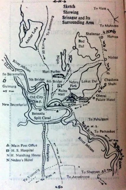
1: Srinagar City.
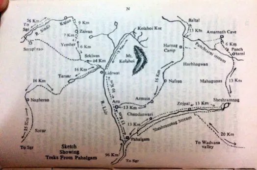
2: Snow treks, Pahalgam.
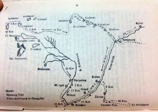
3. Trek From Sonamarg to Gangabal.
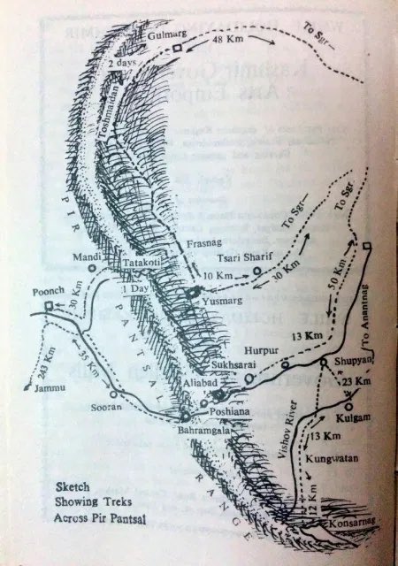
4: Treks across Pir Panchal
(1969)
(7/n)
2: Snow treks, Pahalgam.
3. Trek From Sonamarg to Gangabal.
4: Treks across Pir Panchal
(1969)
(7/n)
Loading suggestions...