

Thread of Robert M. Chapin's maps


Chapin was an American cartographer, illustrator and architect whose maps from the Second World War and early Cold War, mostly published in Time, remain some of the most interesting examples of 'cartographic propaganda'.
The genre of the propaganda map was in no way novel in the 1930s – it had been a prominent part of political publishing culture in Europe and elsewhere since the nineteenth century.
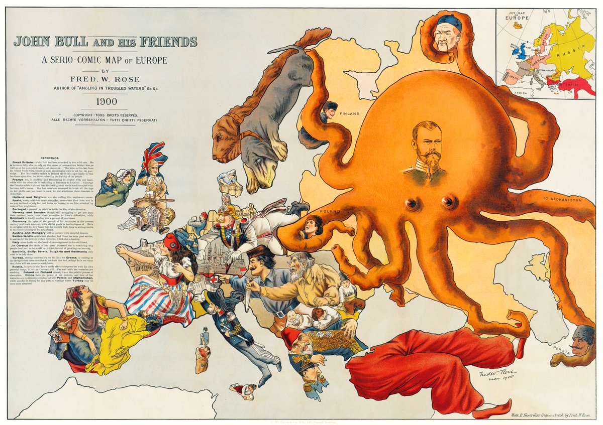
John Bull and his friends (1900)
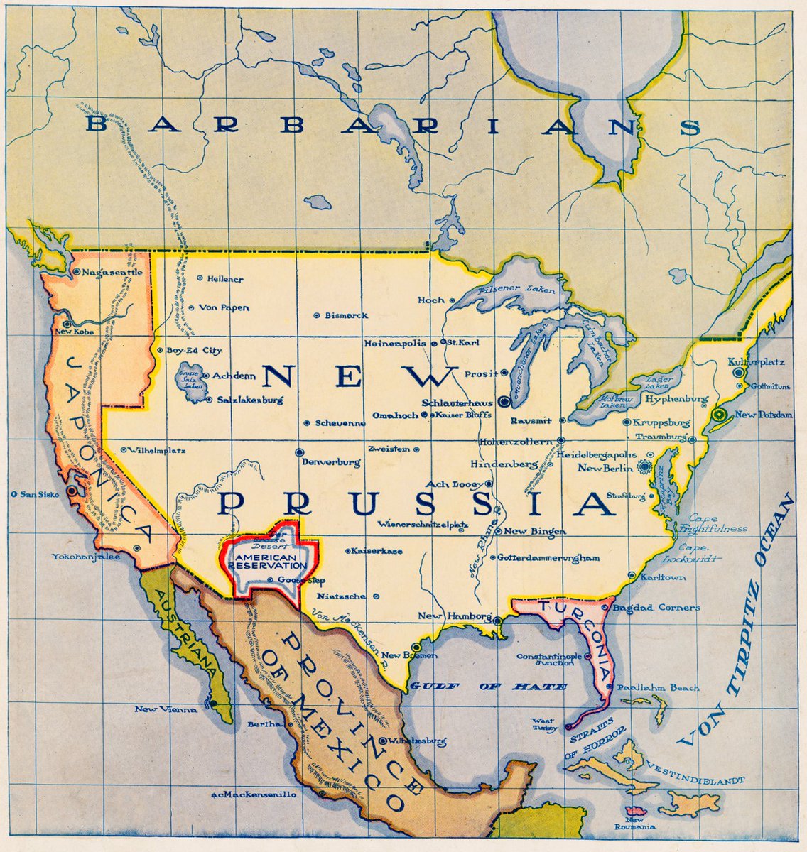
New Prussia (1916)
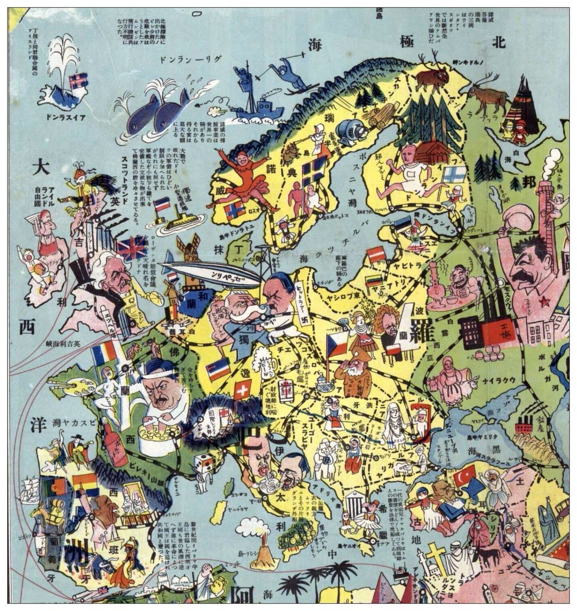
Detail from Japanese political map (1932)
John Bull and his friends (1900)
New Prussia (1916)
Detail from Japanese political map (1932)
Chapin began his career at Newsweek but moved to Time magazine after catching the attention of editor Manfred Gottfried. Chapin headed the cartography department from 1937 until 1970.
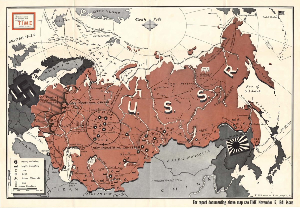
Map of the USSR following the Axis invasion, November 1941.
Map of the USSR following the Axis invasion, November 1941.
Most of Chapin's maps from the Second World War illustrated the evolving military situation in various theatres of war, and weren't strictly "propagandistic" (at least not at the start).
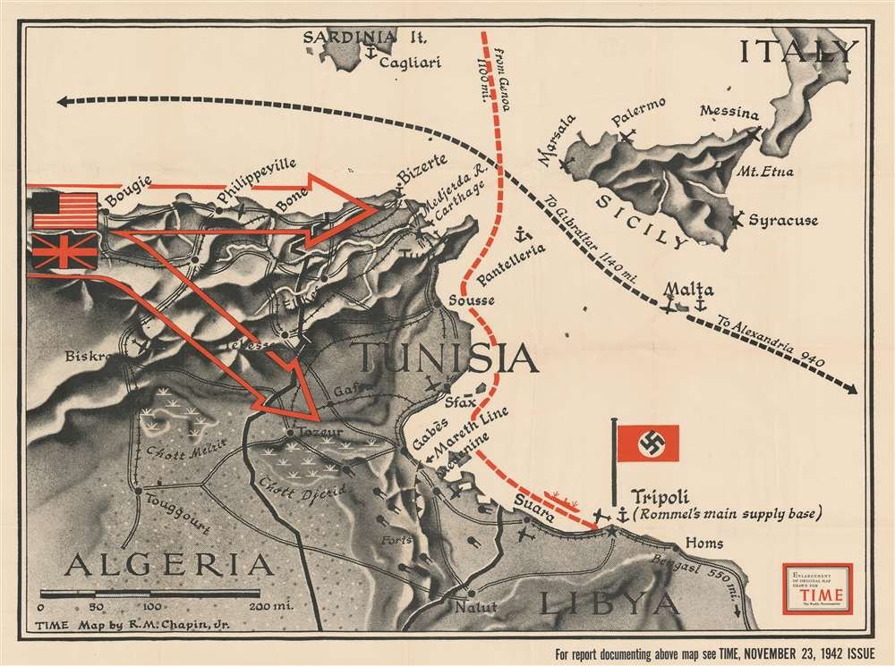
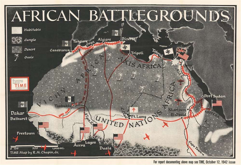
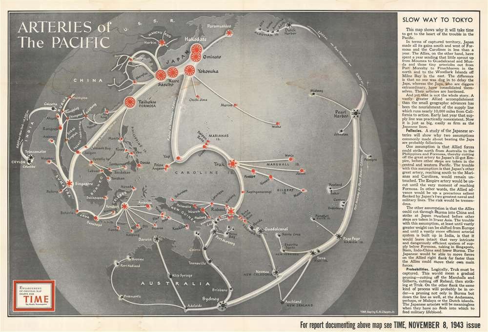
Here are some from 1942 and 1943 showing Europe, Africa and the Pacific.
Here are some from 1942 and 1943 showing Europe, Africa and the Pacific.
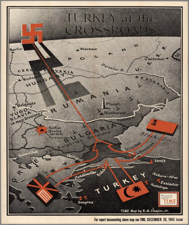
"Turkey at the crossroads" – Map from December 1943 illustrating a proposed British/Soviet invasion of Bulgaria through Turkey, with the swastika looming in the distance.
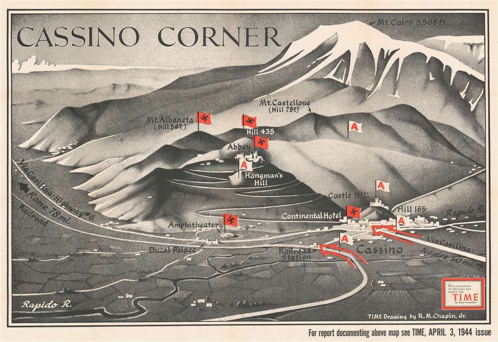
"Cassino corner" – Map from April 1944 illustrating the situation during the protracted Battle of Monte Cassino as Allied forces struggled to take the well-fortified German positions.
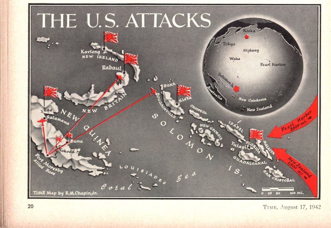
A few maps from 1942–45 showing the changing situation in Asia and the Pacific. 'The Squeeze' is an especially famous one.
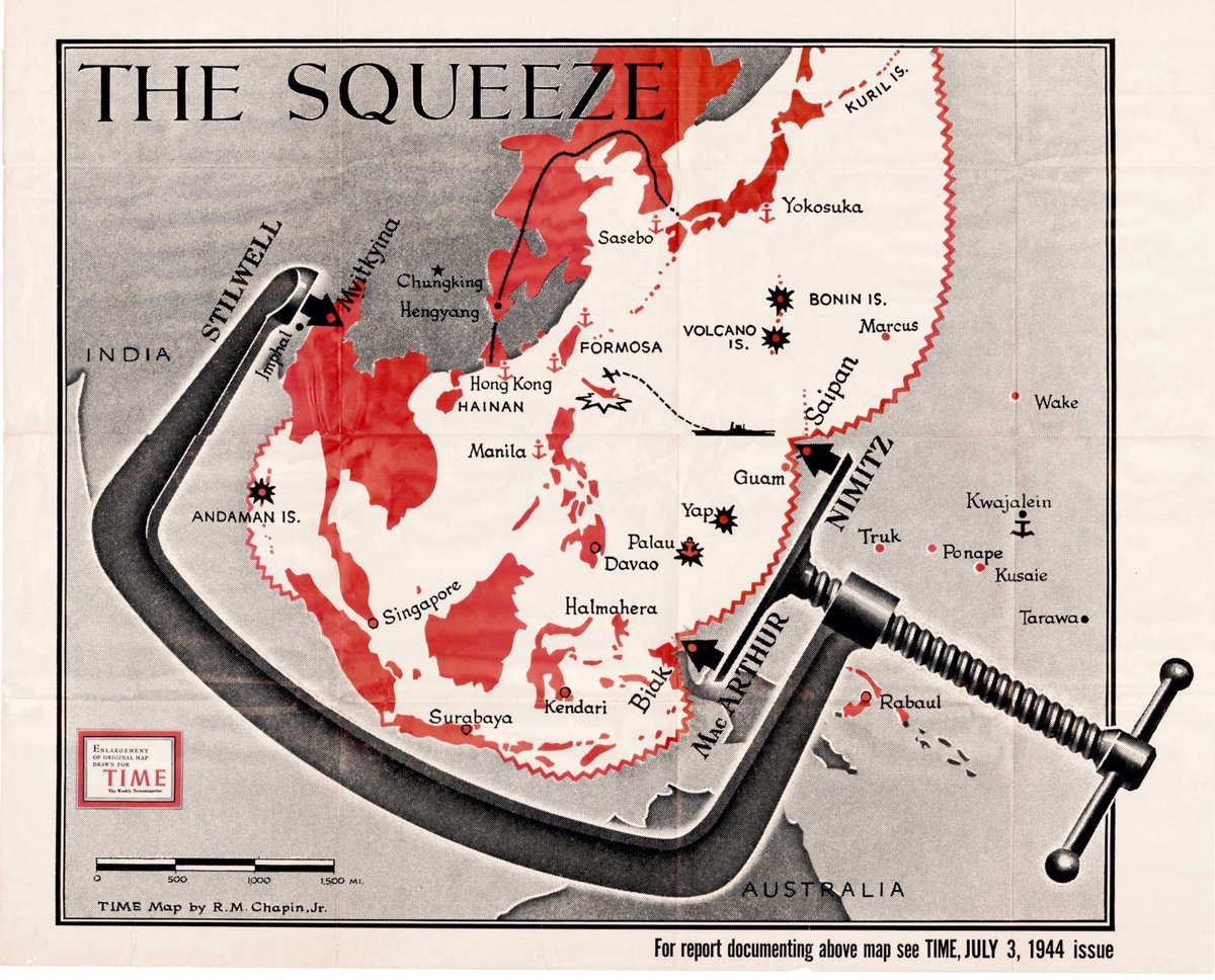

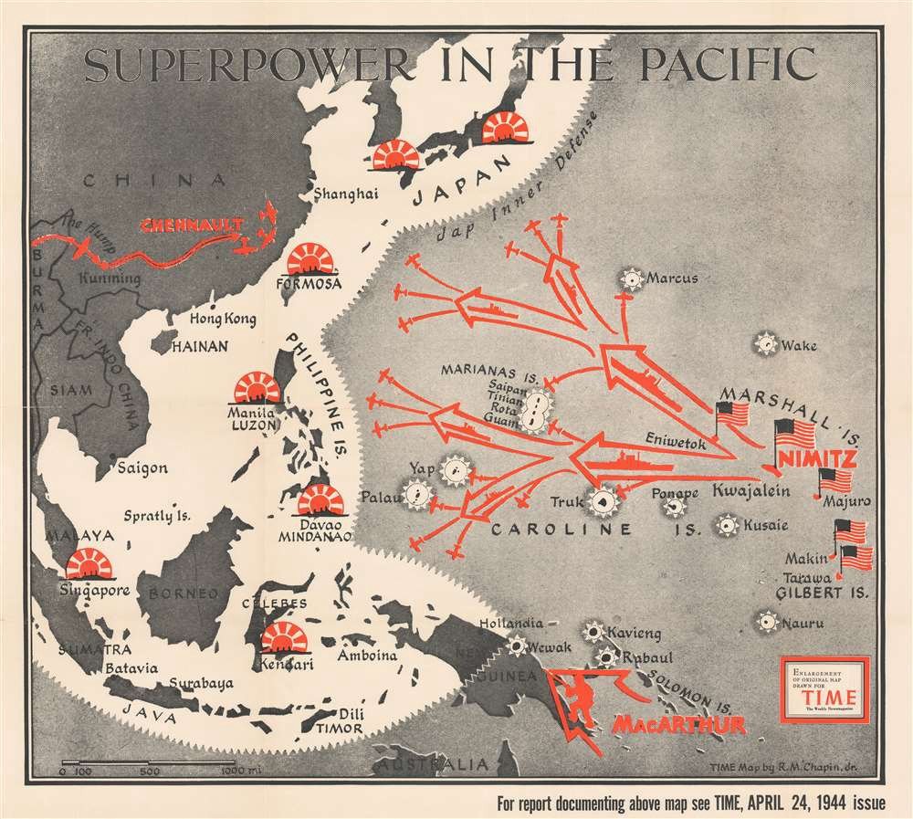
Bit of extra info on The Squeeze one:
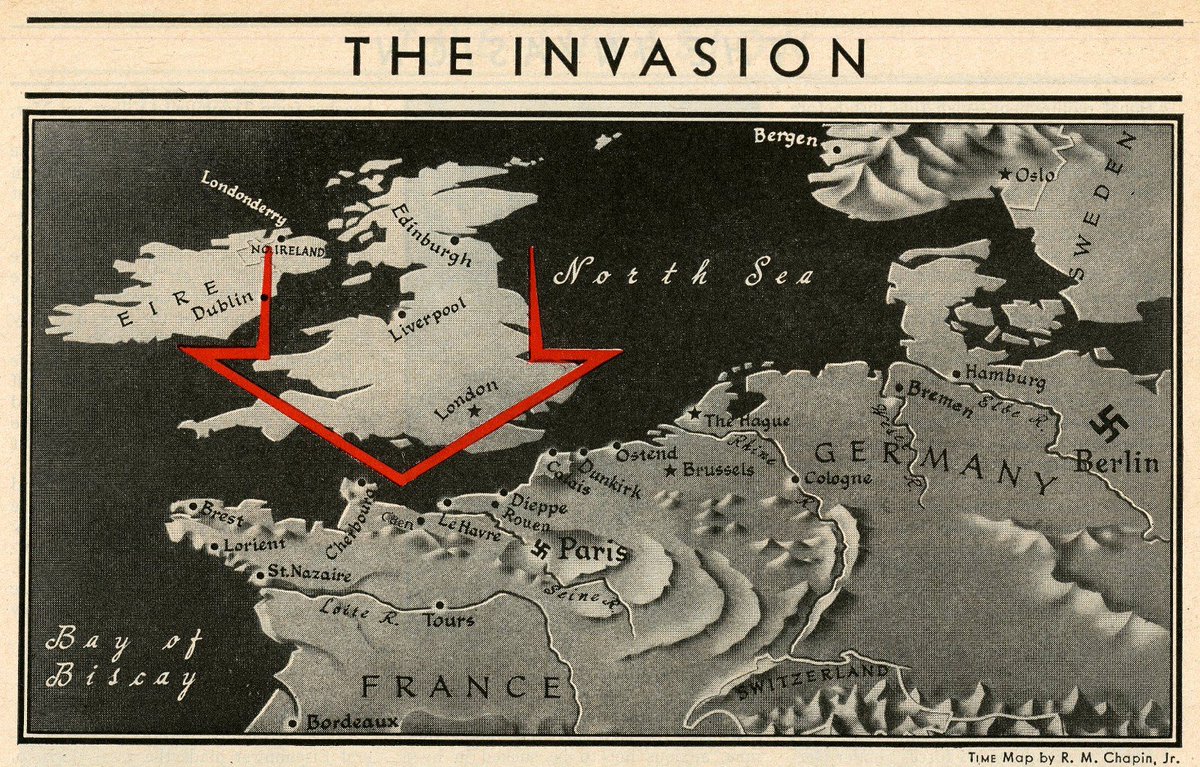
"The invasion" – D-Day map from 1944.
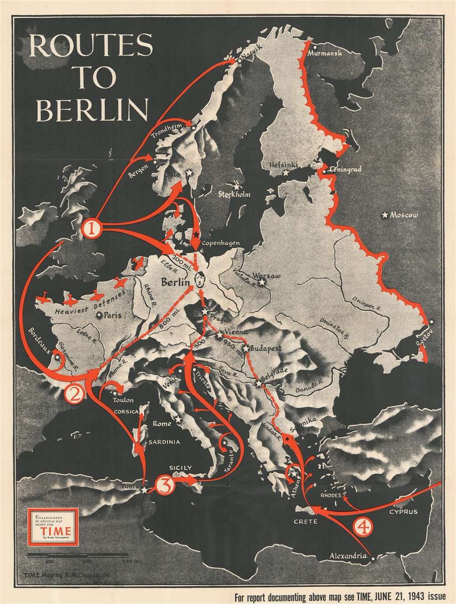
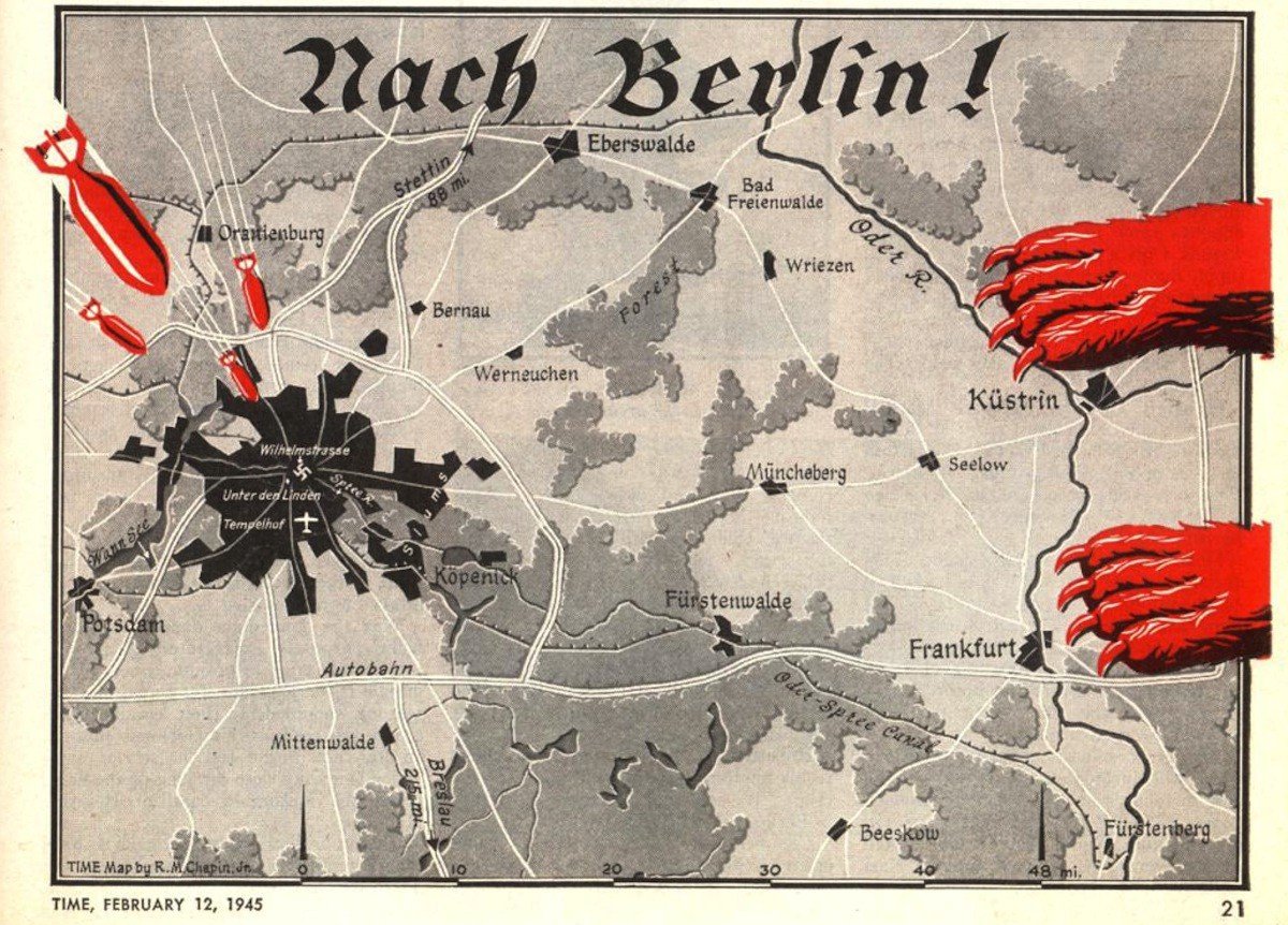
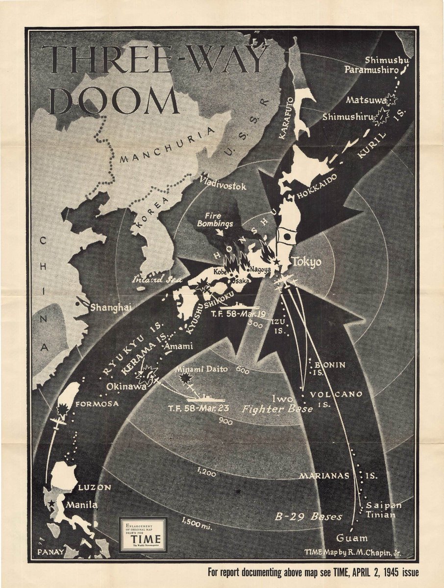
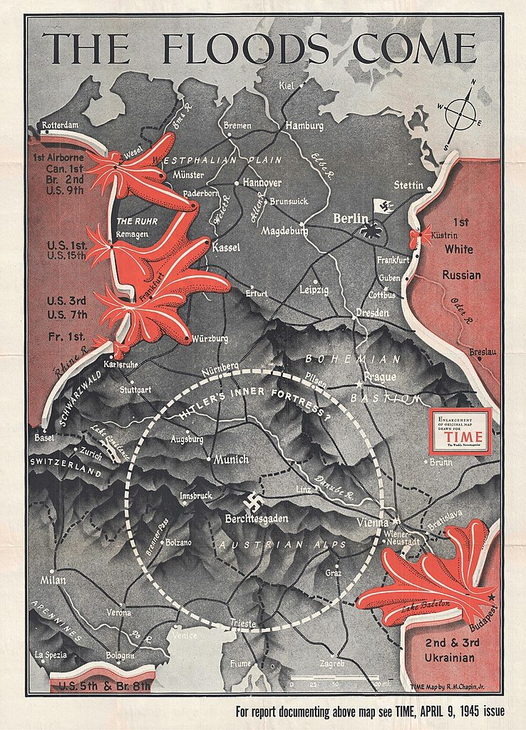
Three of Chapin's maps from 1945 show the Allied armies closing in on Germany and Japan.
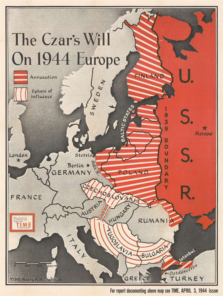
With the end of the Second World War, the anti-communism of some of Chapin's earlier work (such as this one from 1944) grew more explicit.
"The Czar's will on 1944 Europe" – Map detailing Soviet ambitions in Europe.
"The Czar's will on 1944 Europe" – Map detailing Soviet ambitions in Europe.
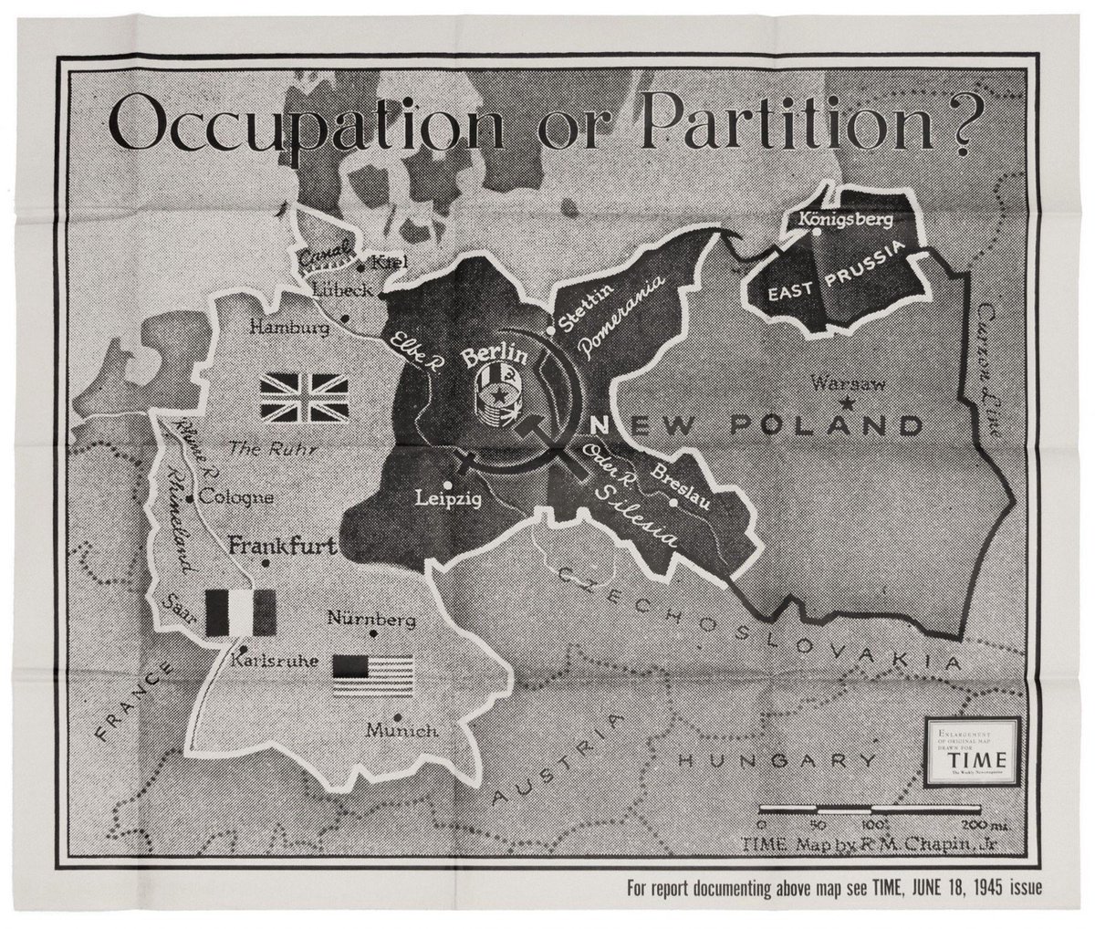
"Occupation or Partition? – Map from June 1945.
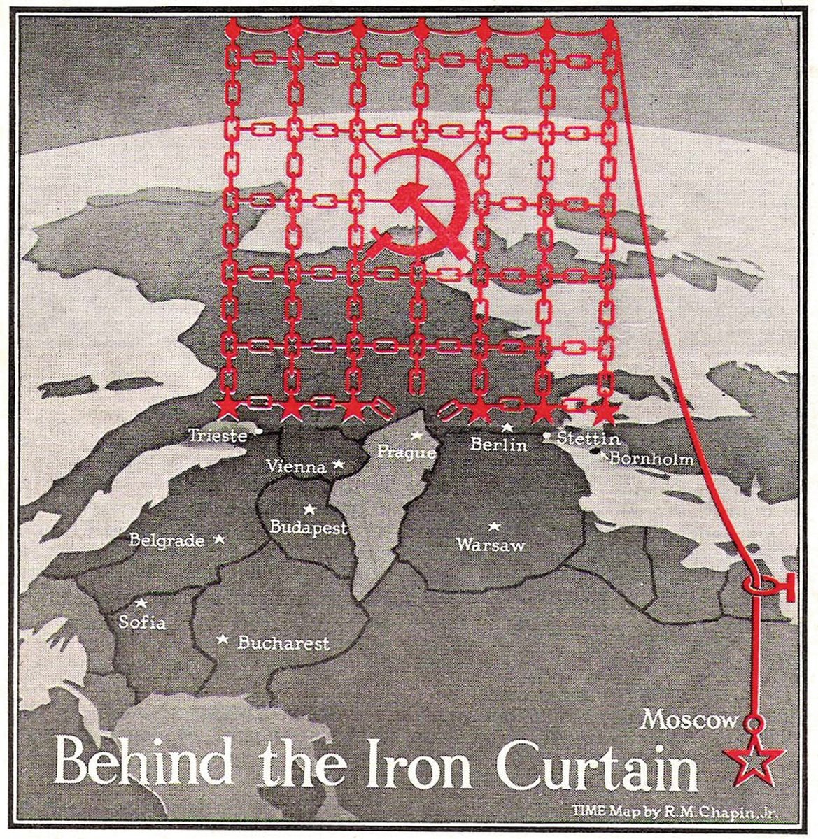
"Behind the Iron Curtain" – Published in 1946, just a few weeks after Churchill's Sinews of Peace speech, this map was one of the earliest visual representations of the Iron Curtain.
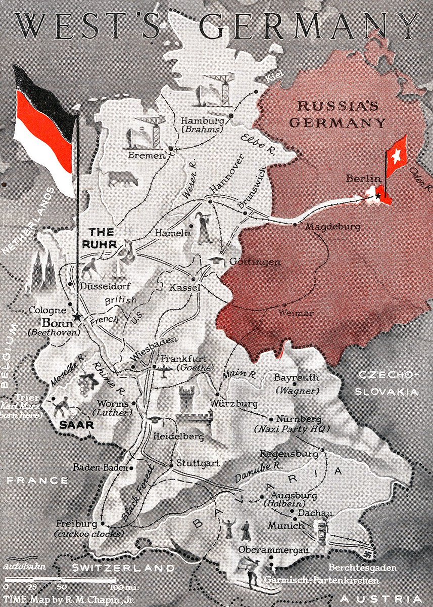
"West's Germany" – Map from 1949 contrasting a lively West Germany with the comparatively drab and barren "Russia's Germany".
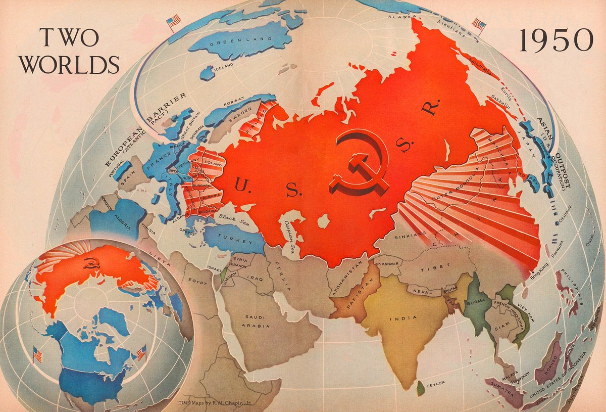
"Two worlds" – Map from 1950 showing the Soviet Union spreading out across the globe, casting rays over Europe and Asia. One of Chapin's more famous.
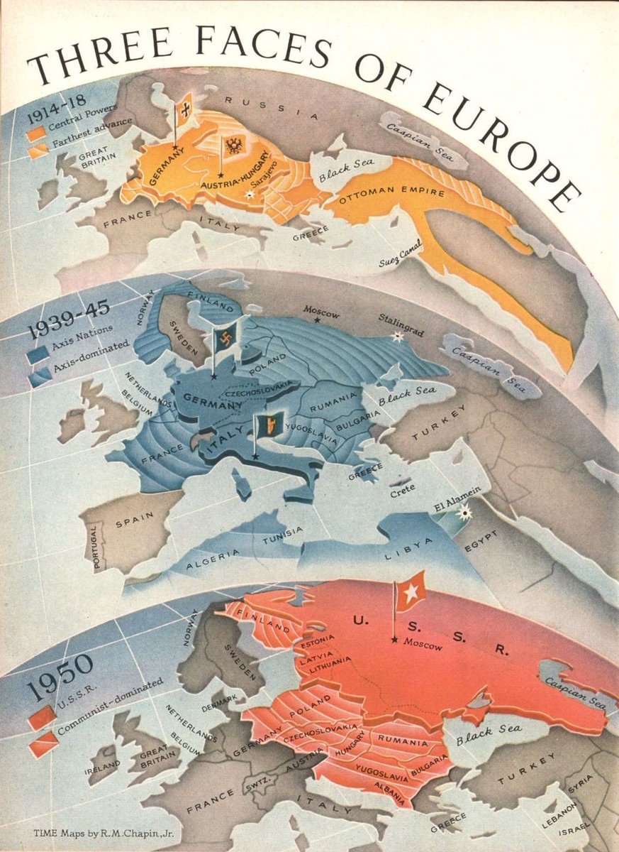
"Three faces of Europe" – Another from 1950, this one showing maps of Europe during the two World Wars and the postwar period, with the Soviet Union depicted as the new imperial power, spreading westwards.
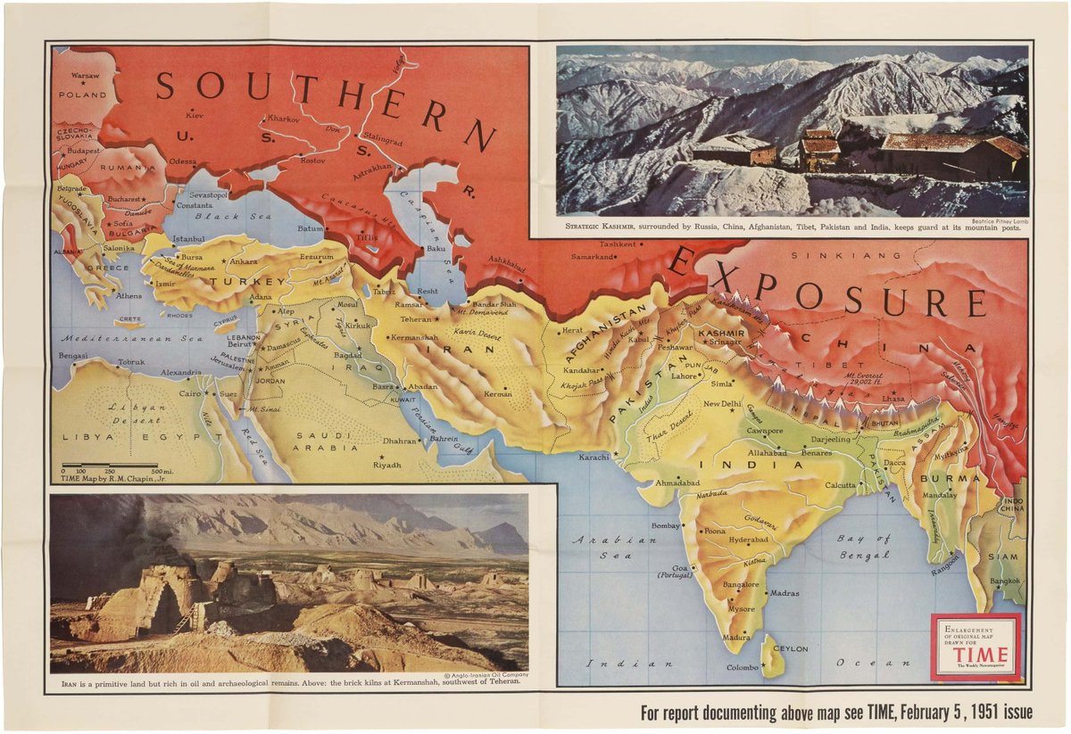
"Southern exposure" – Map from 1951 showing the communist threat looming over Asia.
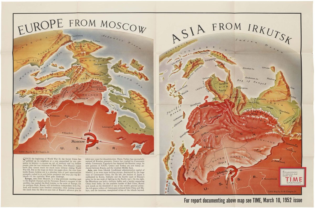
One of the famous pieces here, a map illustrating Soviet ambitions in Europe and Asia from the POV of Moscow and Irkutsk. Published in Time, 1952.
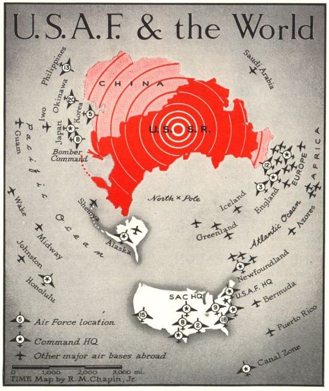
"U.S.A.F & the World" – 1952 map showing the USSR and China surrounded by US airbases.
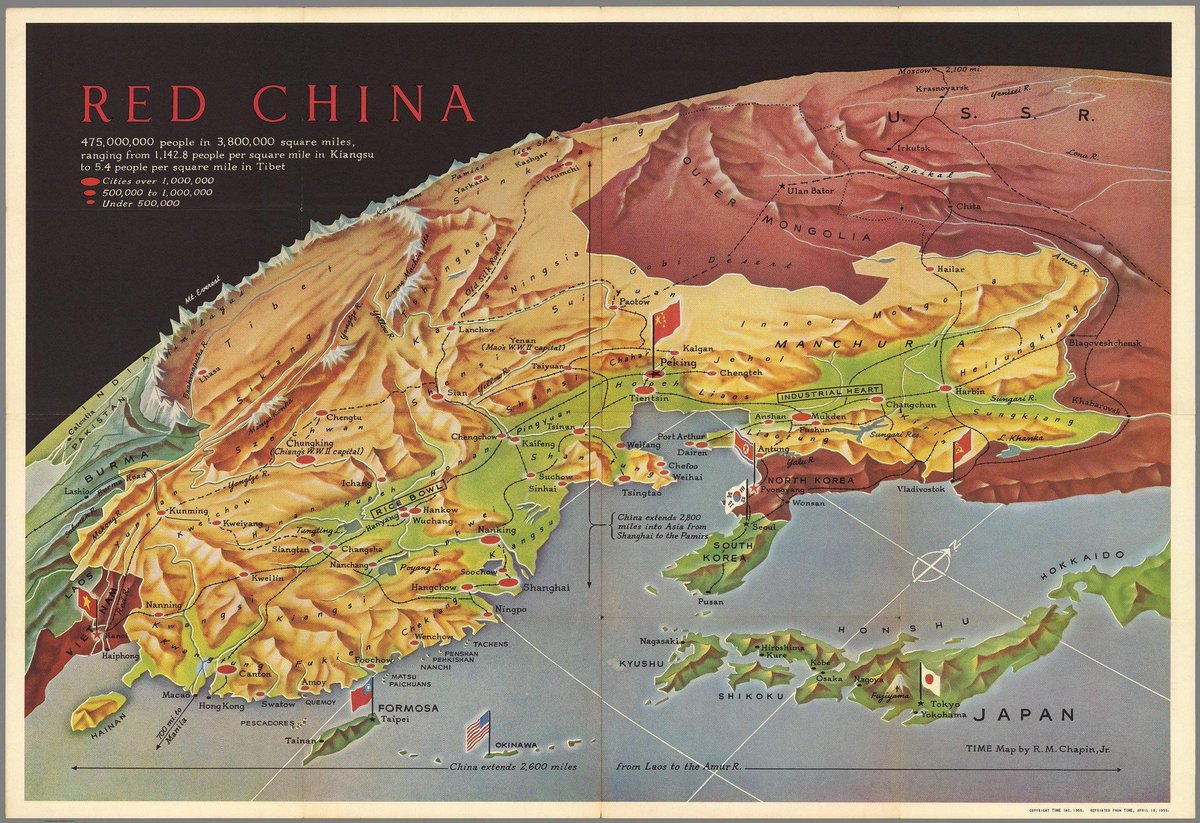
"Red China" – Map from 1955 showing communism spreading across East Asia.
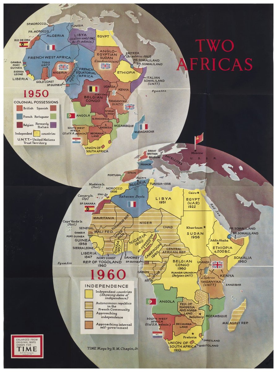
"Two Africas" – Interesting one contrasting maps of Africa in 1950 and 1960, demonstrating the wave of independence across the continent. Published not long after Harold Macmillan's 'Wind of Change' speech.
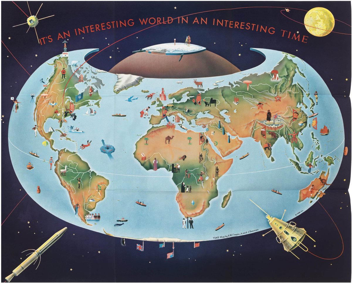
"An interesting world in an interesting time" – Slightly more wholesome one from 1959. It uses the 'Armadillo projection' developed by cartographer Erwin Raisz in the 40s.
Obviously lots more that I haven't included here but gives a general taste of Chapin's work. Would like to turn this into a blog once I actually get around to sorting one.
Loading suggestions...