

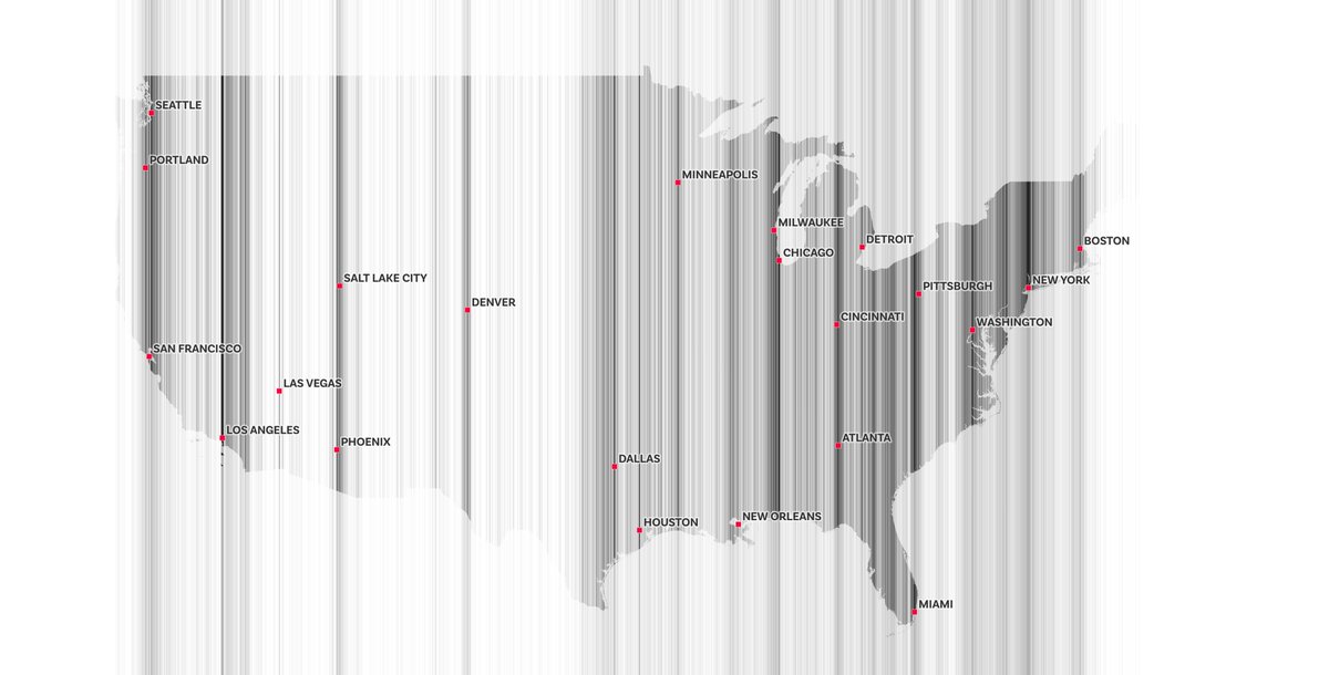
Plotting population distributions in barcode format, east-west or north-south depending upon the country - here's the US lower 48, plus three European countries but with no outlines


some methods for implementing different mapping techniques in QGIS, through the medium of tartan
three more countries for anyone who wants to put aside their actual work and figure these out - one is southern hemisphere, one is South America and one is European (check replies for answers because map people on here are far too clever)


and then three side-by-side for comparison of north-south settlement pattern

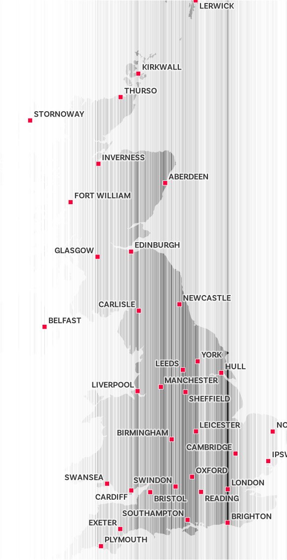
such techniques also come in handy when you urgently need to answer the perennial 'is it west of Bristol?' question (or when you want to amaze your unsuspecting nerd friends with the Aberdeen/Manchester comparison)
Loading suggestions...