

10 days ago Indian and Chinese troops clashed on the LAC, the most violent incident since the 2020 Galwan clashes. With @GrewalBaani and new satellite imagery, we have mapped the area and explained the clashes. Read our report at pageflow.aspi.org.au
& this thread 🧵
& this thread 🧵
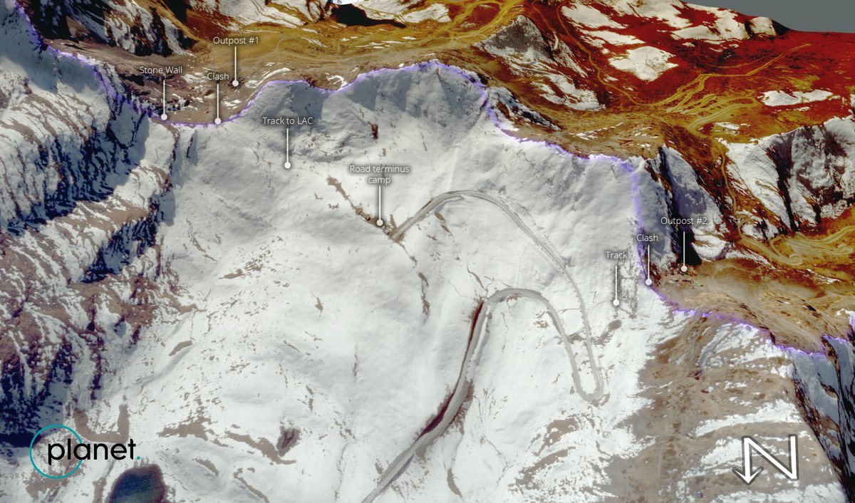
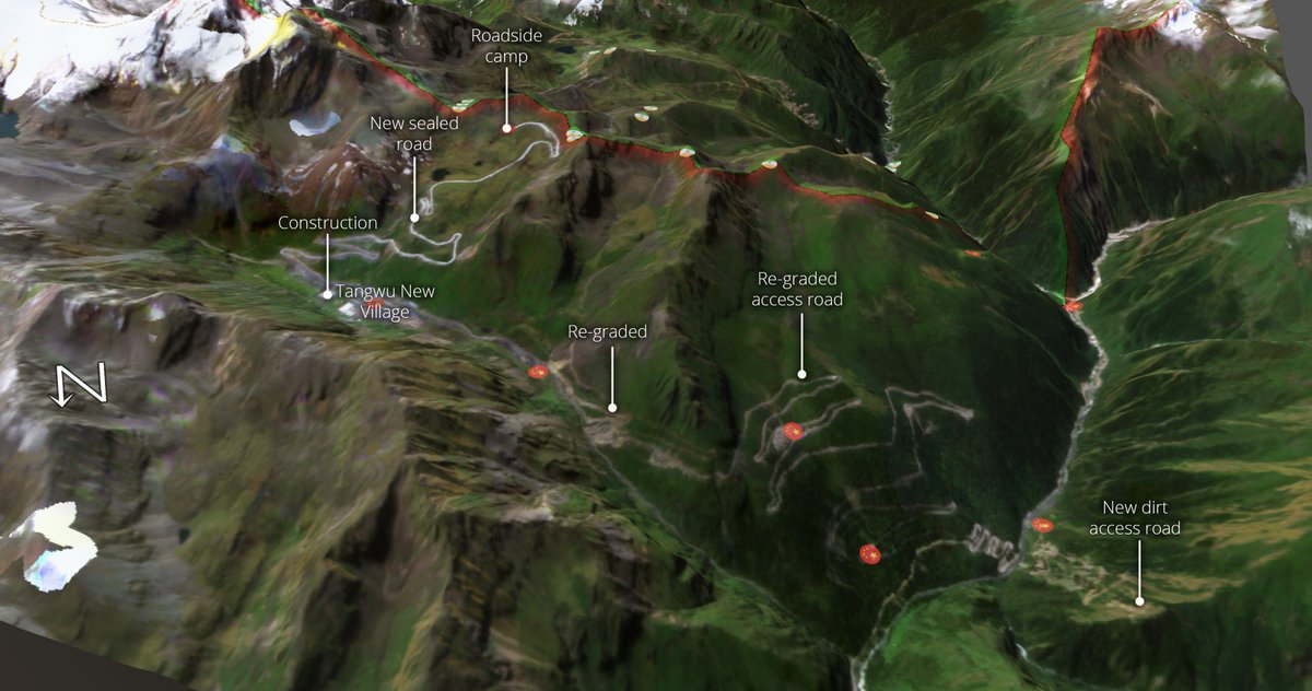
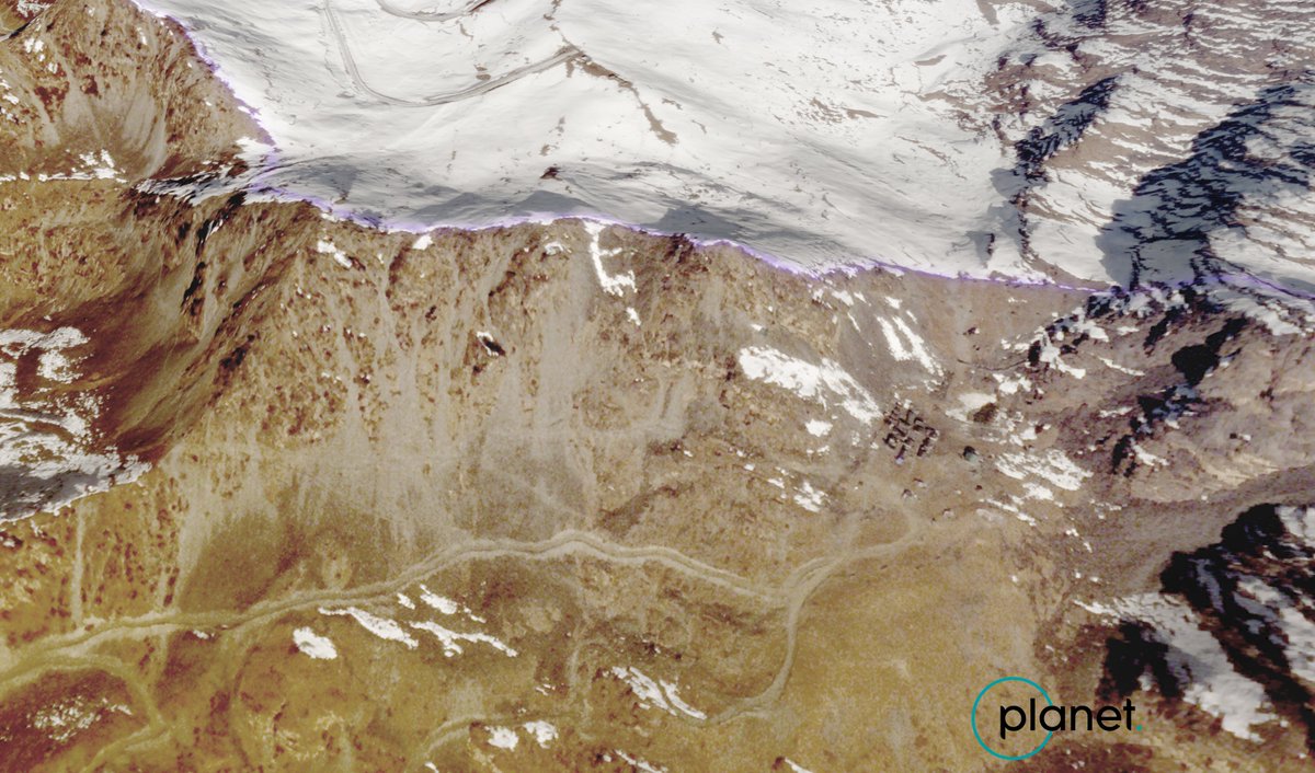
On Dec 9th, 200-600 Chinese troops surged up a newly constructed road from Tangwu New Village to the LAC, where they clashed with Indian border outposts at two places. @Planet satellite imagery from Dec 14th shows the foot-tracks leading to the LAC (orange highlight).

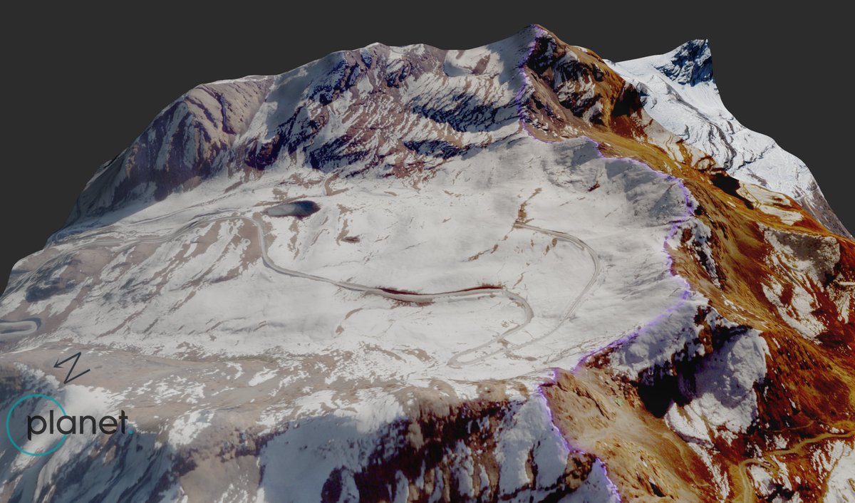
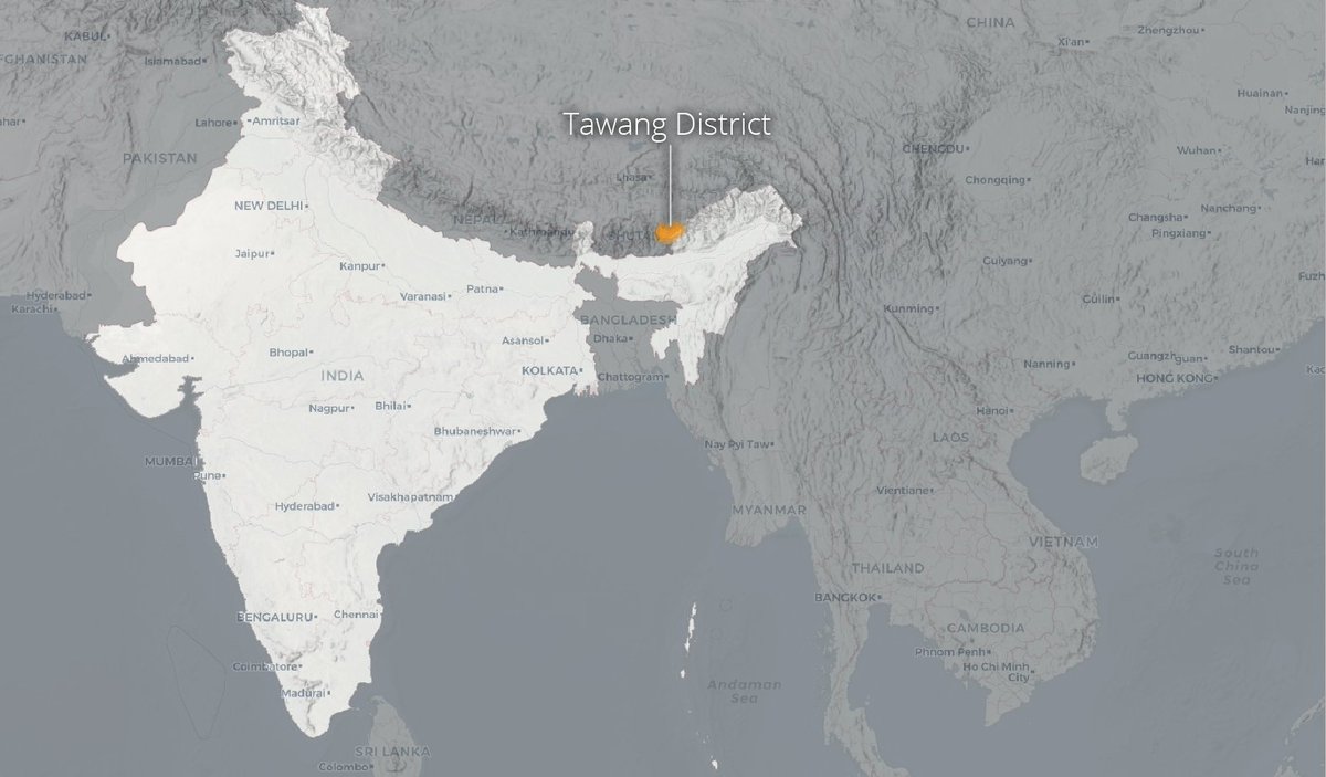
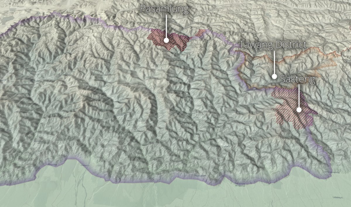
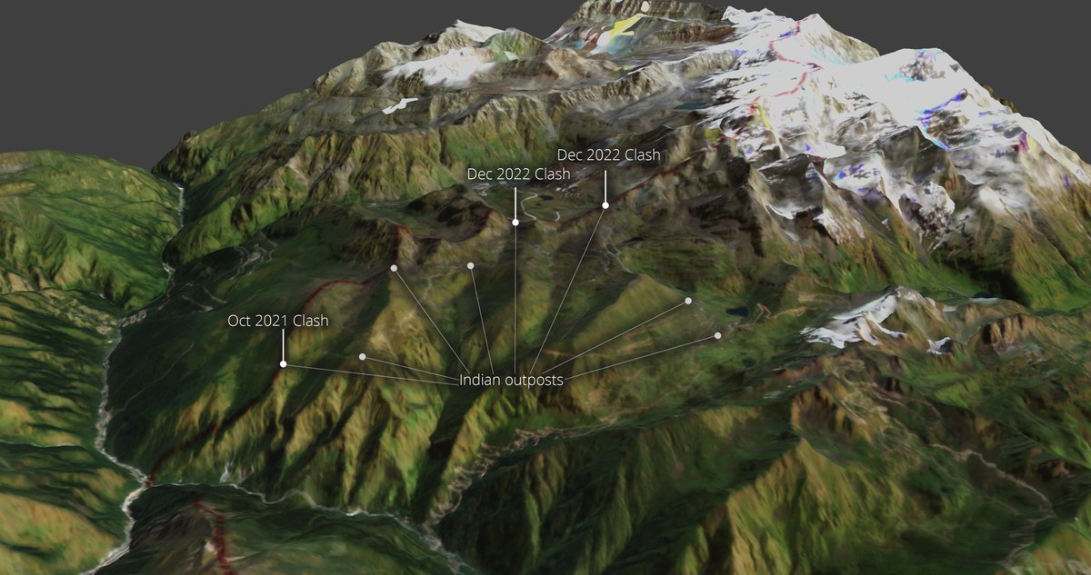
The clashes took place on the Yangtse Plateau, in Tawang district. This is a strategically important high-point on the LAC, from which all traffic in and out of Tawang district can be observed.
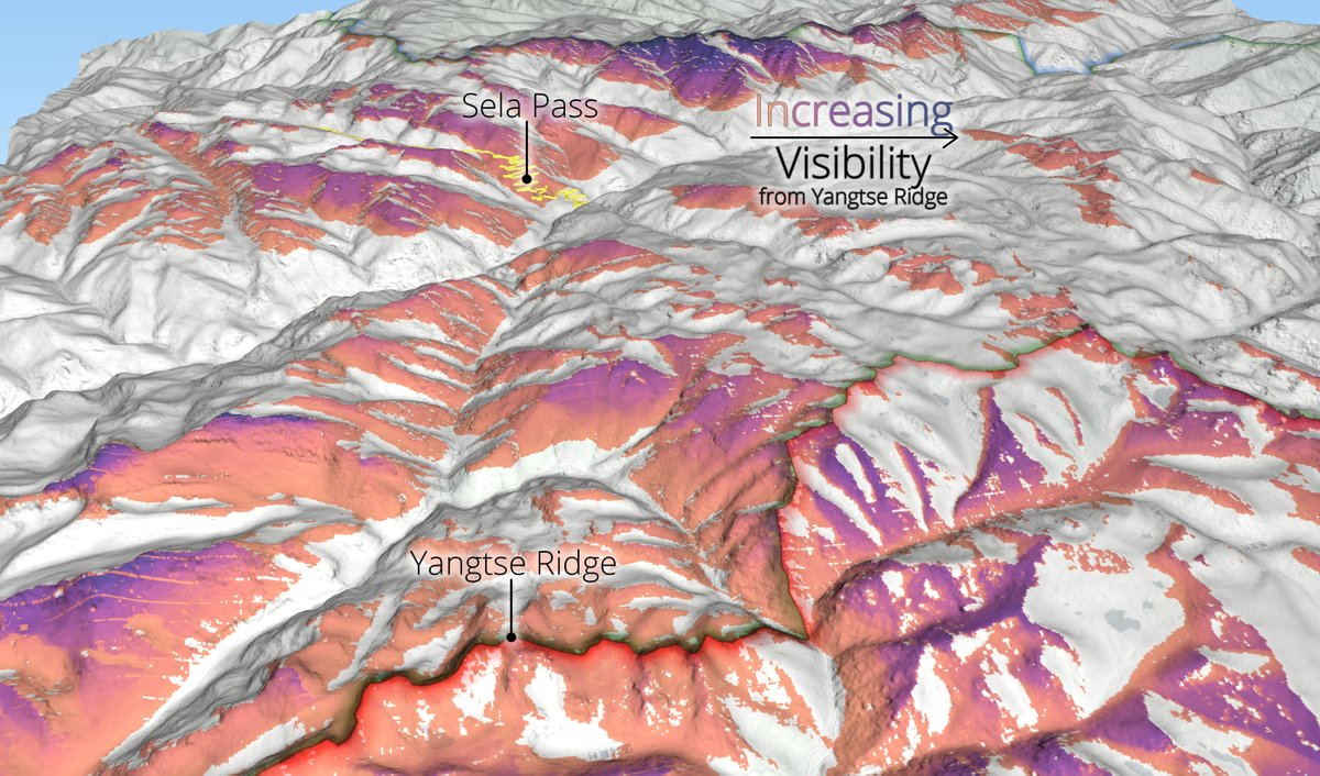
At its heart, this clash was the result of accelerated infrastructure development from the PLA that allows them to surge troops to the LAC - including on Dec 9th. This is most clearly demonstrated by a new major Chinese road that ends just 150m short of the LAC.
While India maintains a network of outposts along the LAC, and thus tactical supremacy on the plateau, this position is dependent on scrappy and, in some cases, crumbling access roads up extremely steep hills, that may not hold up should conflict occur.

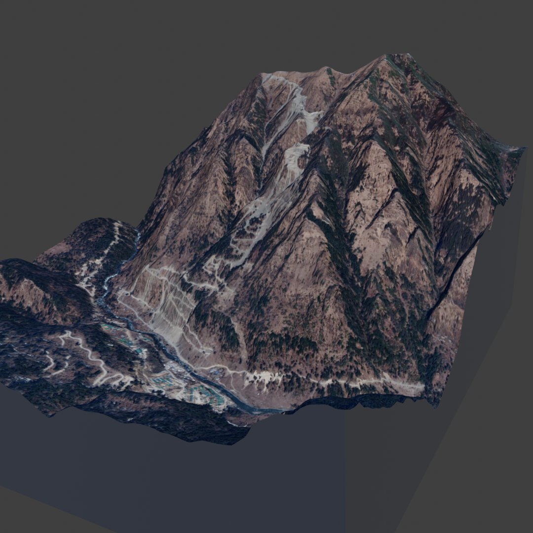
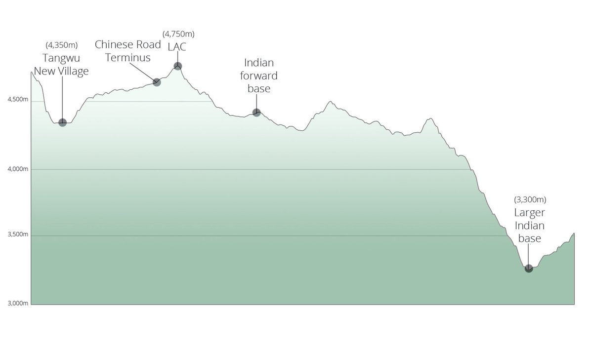
This vulnerability is stark when you compare India's position to the Chinese basing at the Plateau, where reliable access roads now supply major positions at Tangwu New Village just 400m lower than the LAC ridgeline, vs 1,400m lower for major Indian positions.
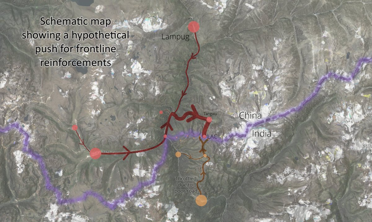
This goes part of the way to explaining why this Plateau is becoming such a flash point. China's investment in infrastructure is paying off to the extent that it can support more adventurous and provocative moves by frontline forces. See this theoretical schematic of resupply.
However, and importantly, we do not assess that this latest provocation was intended to capture the outpost (and consequently Indian territory) despite some reporting. Instead, it was largely to normalise Chinese presence at the LAC and present it as a de-escalation.
Therefore, this clash was a way to alter the status quo, while appearing conciliatory. Ladakh shows that disengagement can work (its durability remains to be seen), but India must be aware of attempts to alter the status quo within disengagement efforts.
India's allies must also see that these aren't just disputes between India and China, but represent concentrated threats to peace and stability in the Asia-Pacific. And provide diplomatic and political support to India (stuck in an escalation trap) to maintain the status quo.
For more details, please check out our finished product which lays the details out more clearly. pageflow.aspi.org.au
And I hope you enjoy the 3D aspect of this product, I think it (literally) adds a new dimension to everyone's understanding of the situation.
And I hope you enjoy the 3D aspect of this product, I think it (literally) adds a new dimension to everyone's understanding of the situation.
Thank you to @GrewalBaani & @DaniellesCave for turning these scattered/scribbled-on 3D renders to a serviceable product! Plus @SushantSin & @arzandc who reviewed it with such a quick turnaround!
And @NatureDesai who helped me a lot with context (watch for their article!)
12/12
And @NatureDesai who helped me a lot with context (watch for their article!)
12/12
Loading suggestions...