

What's the biggest Mississippi city?
Chicago!
Why? Because of an ice age water stream
If you understand this, you can understand why Chicago is so huge today
And more importantly, why some cities thrive while others don't:
Chicago!
Why? Because of an ice age water stream
If you understand this, you can understand why Chicago is so huge today
And more importantly, why some cities thrive while others don't:

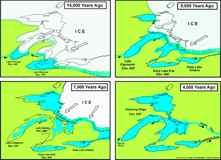
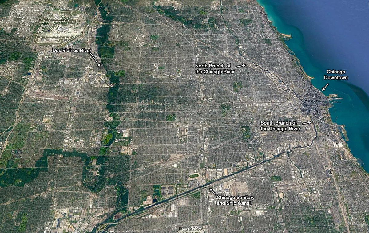
This is the Mississippi Water Basin. There's something weird. Can you see it? It touches the Great Lakes! How is that possible? Does water flow from the Great Lakes down the Mississippi? No! Then?

Look how close it is! The Des Plaines River, a tributary of *the Mississippi*, flows through Chicago, and is about 10 miles away from Lake Michigan!
A slight difference in geology could have made the Great Lakes flow into the Mississippi.
In fact, they used to!
A slight difference in geology could have made the Great Lakes flow into the Mississippi.
In fact, they used to!

During the last Ice Age, when water levels were high & the lakes frozen, water flowed south. But as the ice receded, the ground raised, and water stopped flowing south ~3000 years ago
In other words: when the Great Pyramid of Giza was built, the Great Lakes also flowed south!
In other words: when the Great Pyramid of Giza was built, the Great Lakes also flowed south!
This is all you need to know to understand why Chicago is one of the biggest US metropolitan areas today.
It turns out that this Ice Age water flow carved out a riverbed between the Chicago River (which flows into the Great Lakes) and the Des Plaines River.
It's marshy
It turns out that this Ice Age water flow carved out a riverbed between the Chicago River (which flows into the Great Lakes) and the Des Plaines River.
It's marshy
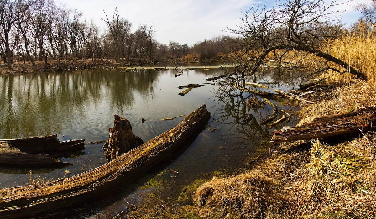
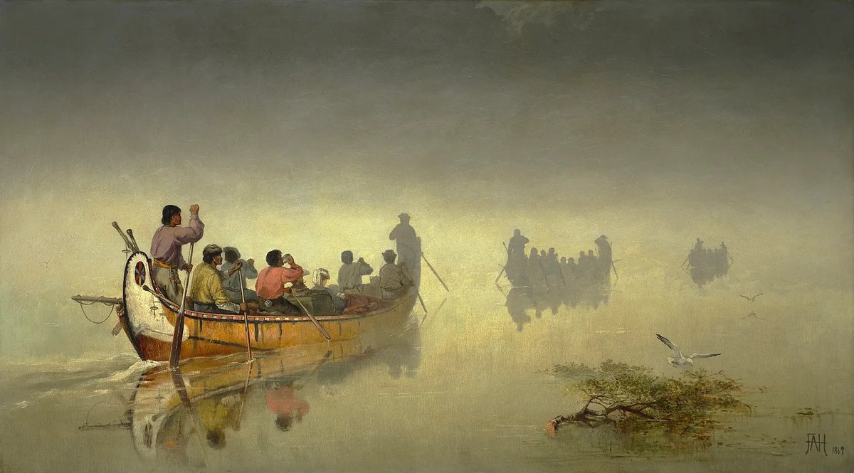
The natives used it as a portage to go from the Mississippi Basin region to the Great Lakes region
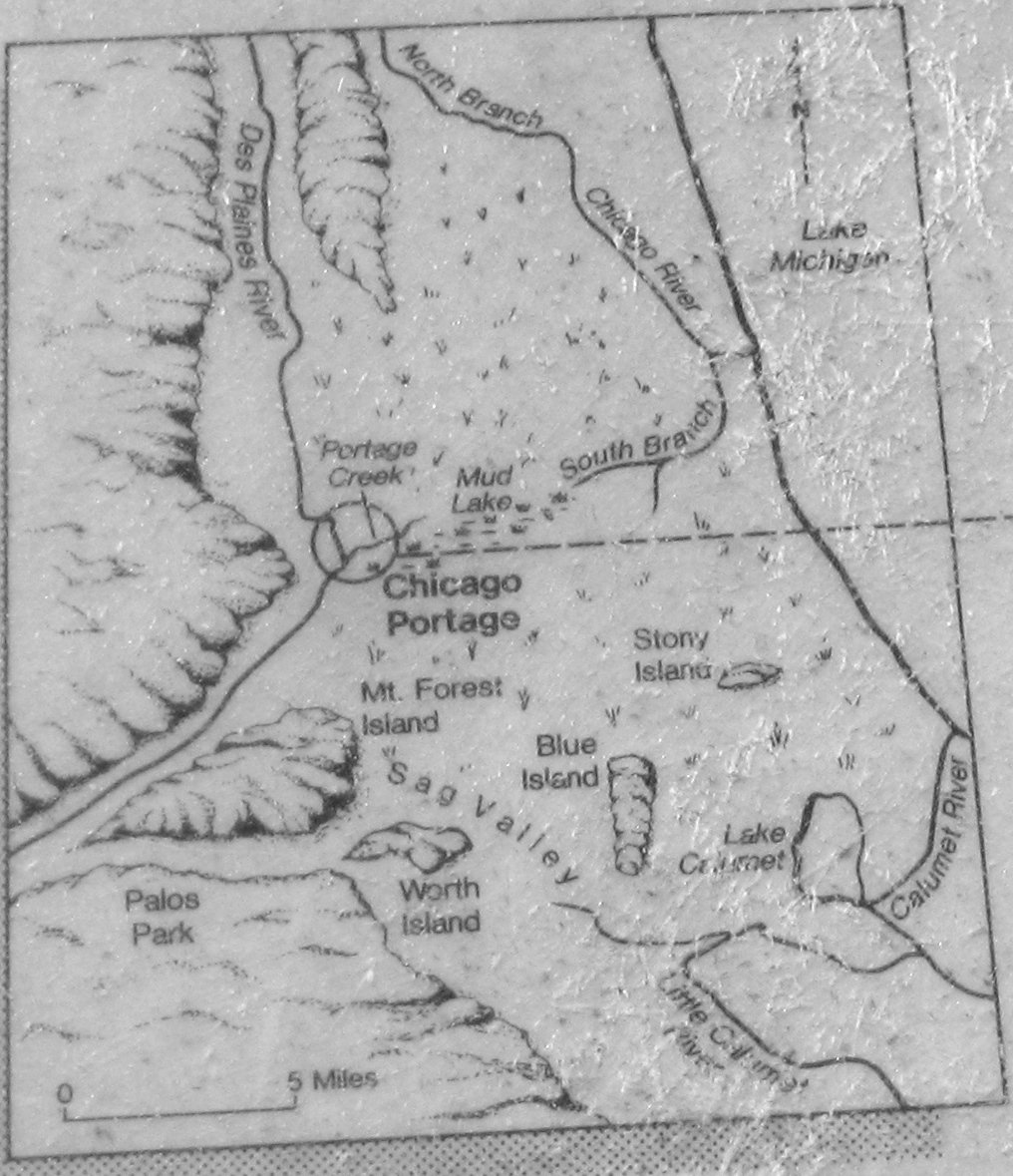
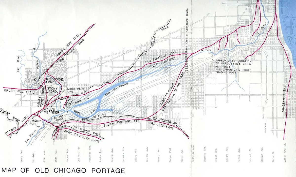
This old map shows how close the Des Plaines River was to the South Branch of the Chicago River, thanks to the creek and marshes that connect them
This made Chicago the fastest way to go from the Mississippi Basin to the Great Lakes.
You can see all of this to this day!
You can see all of this to this day!
The founders of Chicago knew this was the perfect spot for a city—connected not to one, but two of the best waterways in the world.
They 1st organized a trail early on to facilitate the portage
Soon thereafer, they did what it took to build a canal... in 1848!
They 1st organized a trail early on to facilitate the portage
Soon thereafer, they did what it took to build a canal... in 1848!
Between the Great Lakes and the Great Plains, Chicago’s unique position made it the major hub for both. They became the city’s hinterlands.
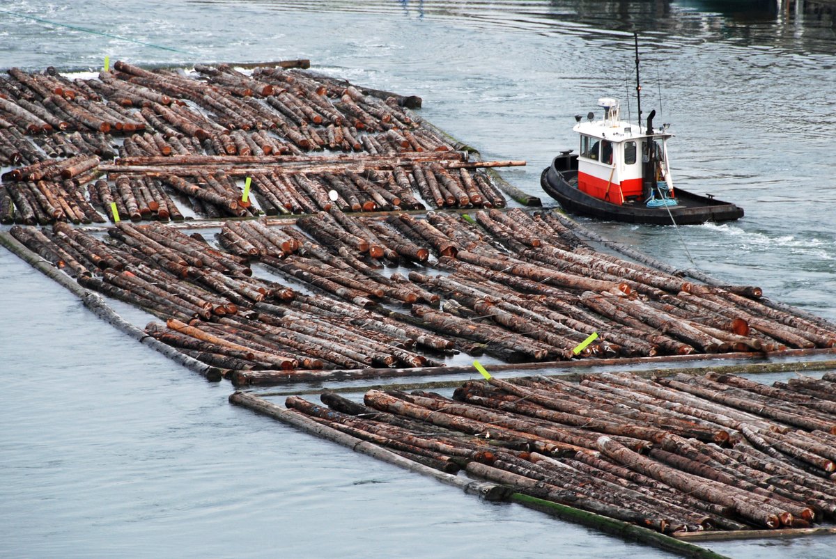
The upper Midwest & Canada floated their logs of trees down the Great Lakes to Chicago's sawmills. Chicago became a trade center for lumber
The upper Midwest & Canada floated their logs of trees down the Great Lakes to Chicago's sawmills. Chicago became a trade center for lumber
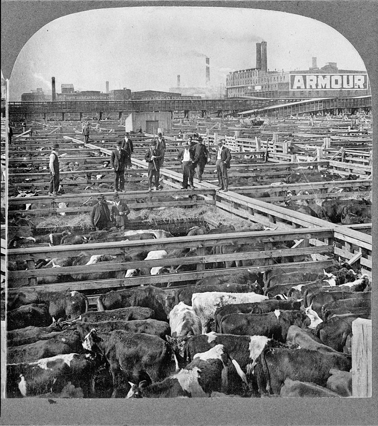
The city also became a center for the meatpacking industry, as cattle from the Great Plains were shipped to Chicago's stockyards for slaughter and processing.
Over time, grain replaced pastures, and Chicago added grain markets.
Over time, grain replaced pastures, and Chicago added grain markets.
It’s good for your economy to connect the two biggest riverine systems, the middle with the east of the country, the north with the south.
But you know what’s even better? Using that to create another level of connections.
But you know what’s even better? Using that to create another level of connections.
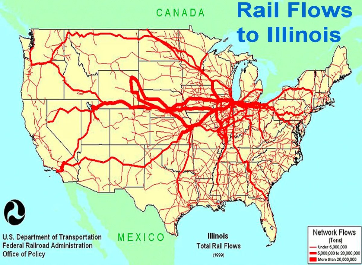
In 1848, Chicago *also* completed its 1st railroad. Within decades, the US had built as many miles of railroad as the rest of the world combined, and Chicago was at the center of that.
Water connections
➡️big markets emerge
➡️more profitable to build railways
➡️bigger markets
Water connections
➡️big markets emerge
➡️more profitable to build railways
➡️bigger markets
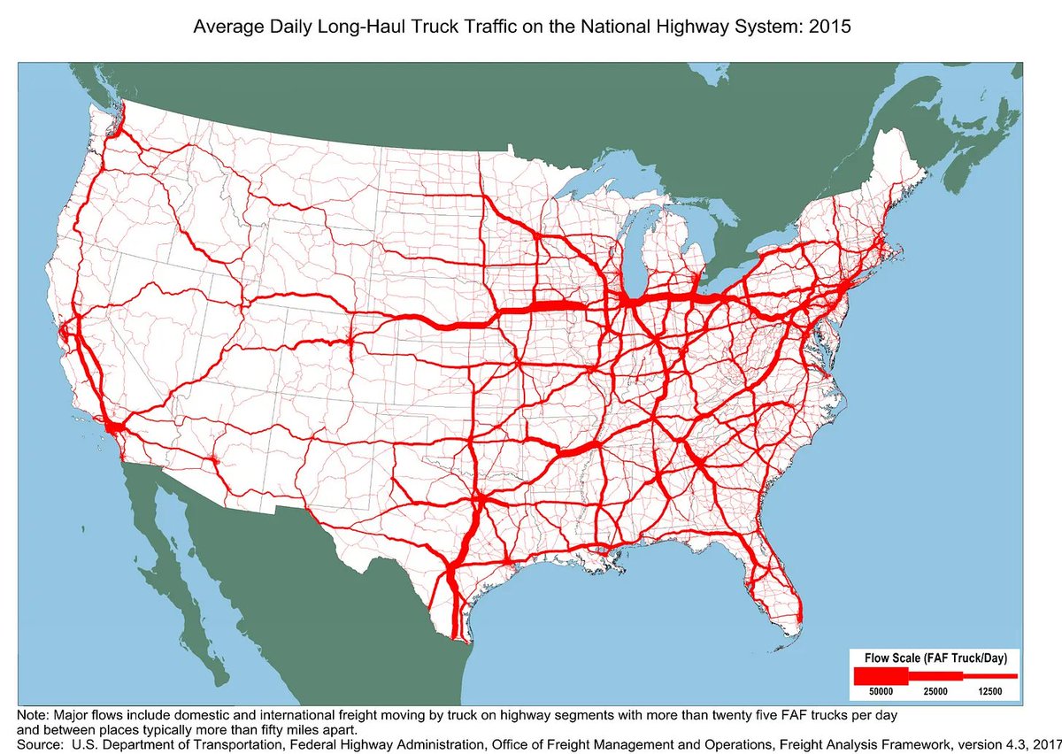
The next layer is then roads of course
➡️Even bigger markets
➡️Even bigger markets
So Chicago had some of the biggest markets in the world
By the 1970s, the Chicago Board Trade and the Chicago Commodities Exchange processed together nearly 80% of all the commodities transactions in the US.
By the 1970s, the Chicago Board Trade and the Chicago Commodities Exchange processed together nearly 80% of all the commodities transactions in the US.
Once you have the biggest markets in the world thanks to your
waterlines
and landlines
You will want...
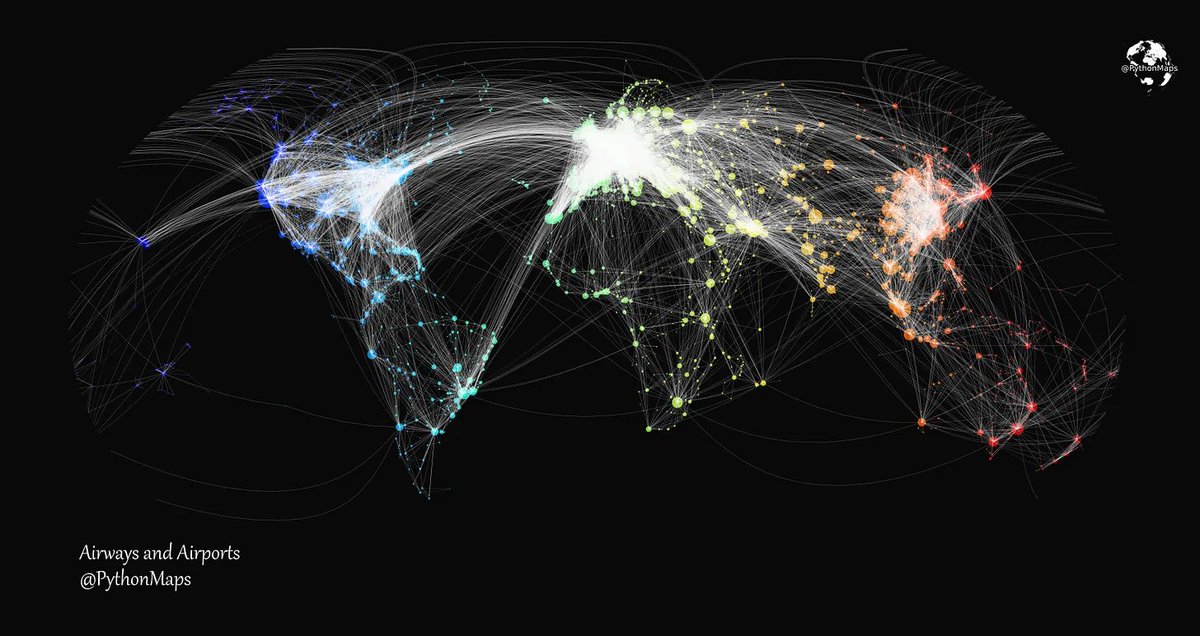
airlines
waterlines
and landlines
You will want...
airlines
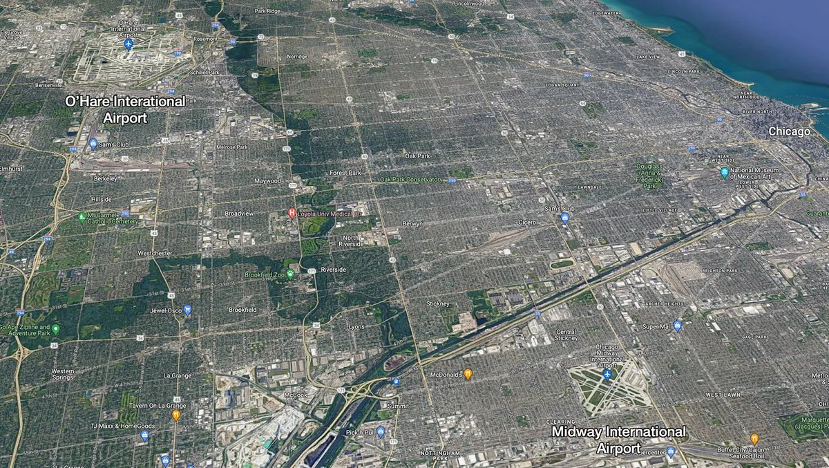
All these markets made Chicago into a hub, so it made sense to build huge airports early on.
This made Chicago into a global trade hub
(Map by @PythonMaps)
So this is how a small river stream caused by an ice age produced one of the biggest cities in the world:
This made Chicago into a global trade hub
(Map by @PythonMaps)
So this is how a small river stream caused by an ice age produced one of the biggest cities in the world:
Chicago:
➡️Shortest path from Mississippi Basin to Great Lakes
➡️Trade between both regions
➡️Markets emerge
➡️Invest in canals
➡️Bigger markets
➡️Invest in railroads
➡️Bigger markets
➡️Invest in roads
➡️Bigger markets
➡️Invest in airports
➡️Bigger markets
➡️Massive global hub
➡️Shortest path from Mississippi Basin to Great Lakes
➡️Trade between both regions
➡️Markets emerge
➡️Invest in canals
➡️Bigger markets
➡️Invest in railroads
➡️Bigger markets
➡️Invest in roads
➡️Bigger markets
➡️Invest in airports
➡️Bigger markets
➡️Massive global hub
So why do some cities thrive and others don't?
Because transportation lines create network effects.
The more transportation lines cross at one point, the more trade, the more investment in more transportation lines, the more trade...
Because transportation lines create network effects.
The more transportation lines cross at one point, the more trade, the more investment in more transportation lines, the more trade...
Chicago is the perfect example, but look at 🇫🇷: the population follows rivers. The bigger the river confluences, the bigger the city. Same concept.
If you liked this thread, follow me. I write one of these threads a week or so.
Or better yet, subscribe to my newsletter to not miss anything. It's free!
unchartedterritories.tomaspueyo.com
Or better yet, subscribe to my newsletter to not miss anything. It's free!
unchartedterritories.tomaspueyo.com
These network effects mean it makes sense to make these lines cross as close to each other as possible, so big cities don't usually appear close to others: they would steal transportation lines from each other
So why do we have cities like Minnesota-St Paul or Dallas-Fort Worth?
So why do we have cities like Minnesota-St Paul or Dallas-Fort Worth?
I'll be writing about this in my newsletter!
What other cities do you know that illustrate the same pattern of growth as Chicago?
What about twin cities?
What other cities do you know that illustrate the same pattern of growth as Chicago?
What about twin cities?
Loading suggestions...