

#Thread: A Problem in the making. Two major problems faced by #Bengaluru are flooding and traiffic. But just like any other Indian city, unbridled urbanization is aggravating these crises and is making sure that these problems would stay for longer
1/n
1/n

In my previous posts, I have explained about the topography and valley system in #Bengaluru. These conveyor belts carry the flood waters of the city. It is across these valleys small dams were built primarily for irrigation purpose (which we now call as lakes)
2/n
2/n

The problem is that a lot of builtup area came across these valleys. Because of the way we construct, the materials we use, and them behaving as blocks, Bengaluru began having flooding problems as the valleys got blocked
3/n
3/n

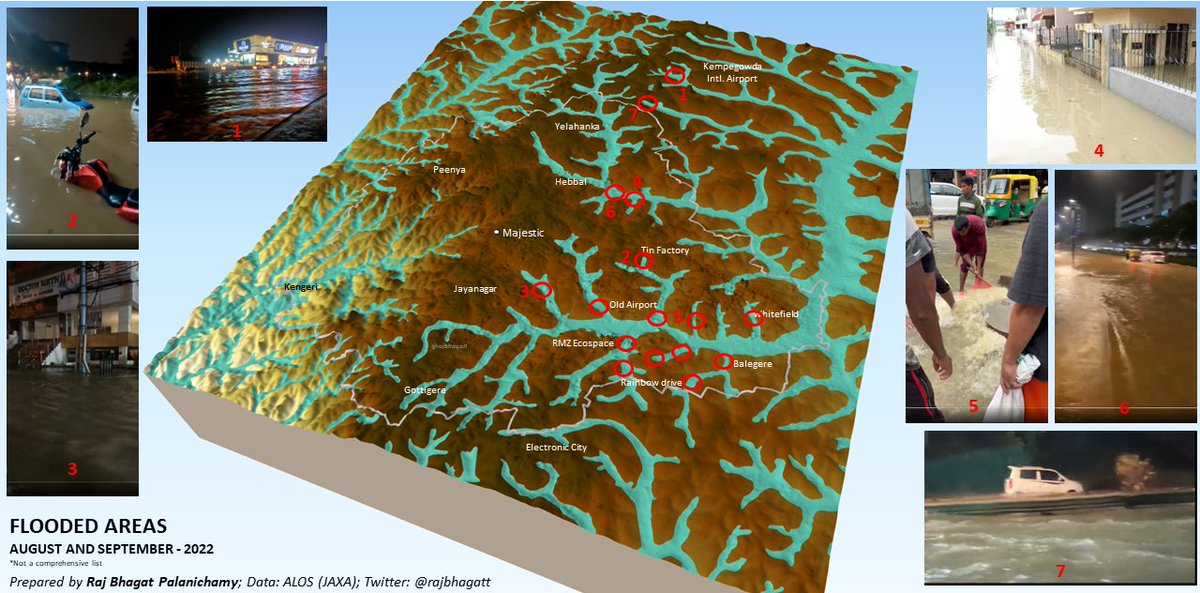
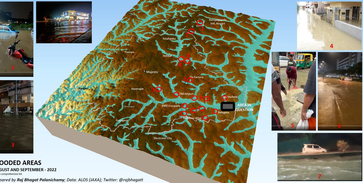
Contrary to what main stream media reports, Bengaluru doesnt flood everywhere and it is only in these valley related spots that the flooding happens. Take a look at the map below for some of the places that got flooded in 2022
Though the importance of the valleys have been established, what happens if we continue building on these valleys further?

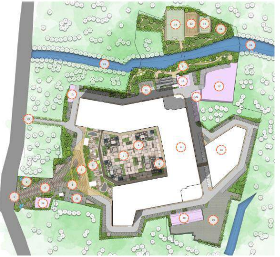
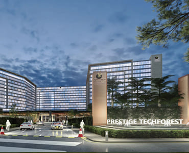
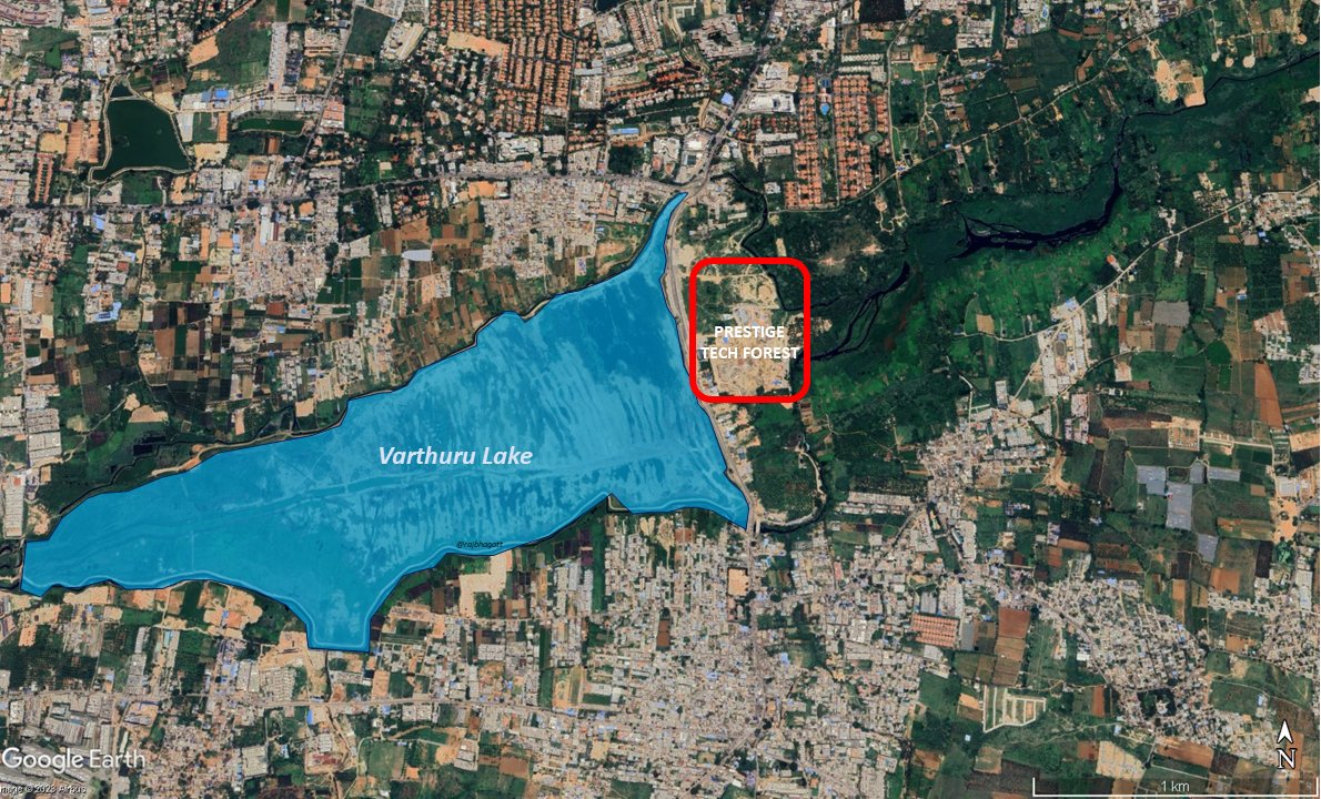
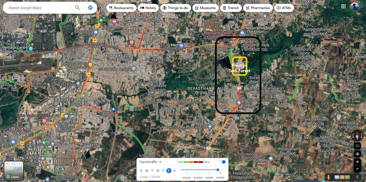
A massive commercial / officce space (Prestige Tech Forest) which is likely to host thousands of people that is being built right in the middle of a valley
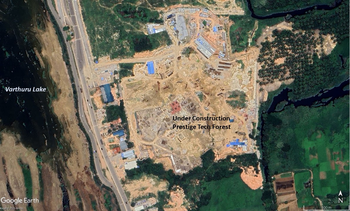
Here's a 3D visual showing the location of the under construction tech forest w.r.t the valley system near Varthuru
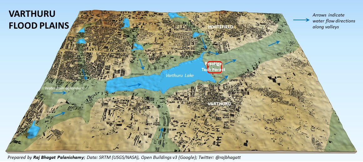
The builtup per se is not on lake however it is in the valley which is more crucial
More than the original project, it is the growth that it would spur that would make it even worser. Such larger projects would caues the entire area to develop with more commercial and residential spaces causing a huge pressure on the valley

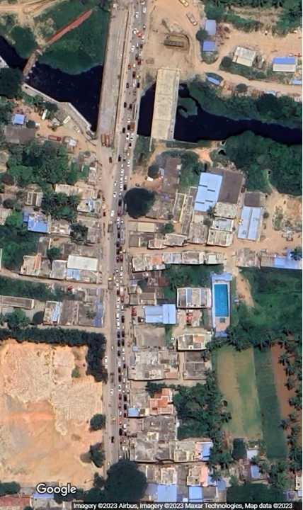
Just like the project, the entire landscape and topography would soon be altered like the snapshot below. This would limit the buffer available for water flow, increase the overall surface flow as infiltration would be reduced resulting in more flooded areas.
It is important to note that the valleys that had been constructed previously in the neighbouring region had already flooded last year
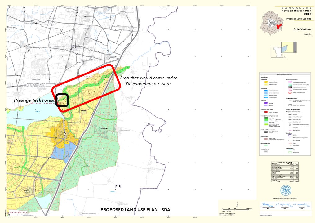
So what does the Master Plan say? Unfortunately Bengaluru is relying still in on the Master Plan for 2015. In the RMP 2015, the area has been identified as "sensitive area" but it has allowed built but has proposed only residential built (outside the small buffer)
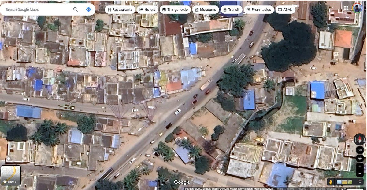
On top of this, the road connectivity is very poor and the project is faraway from Metro!
Though there is a larger road right infront of the plot, on one side they lead to narrow roads in south & on other side they lead to roads that are already reeling in heavy traffic.
Though there is a larger road right infront of the plot, on one side they lead to narrow roads in south & on other side they lead to roads that are already reeling in heavy traffic.
The road to the south (eventually going to Sarjapura) is already choked and it is not having enough space to hold more vehicles. It is important to note that projects like these usually cause more vehicles to flow as people prefer private transportation over public
The roads further south dont have the capacity to handle the high volume traffic that would be created by the project
These kind of problems are faced by every city in India where projects that are merely plot development which no vision beyond the plot fence are allowed and they eventually lead to aggravation of problems that the cities already face
Now there are two challenges:
1. How do we make our master plan preparation process more scientific?
2. How do we make sure that the market follows the provisions in the master plans for our cities?
n/n
1. How do we make our master plan preparation process more scientific?
2. How do we make sure that the market follows the provisions in the master plans for our cities?
n/n
Related case - 1:
x.com
x.com
Related case - 2
x.com
x.com
Related case -3
x.com
x.com
Further Reading:
x.com
x.com
Loading suggestions...