

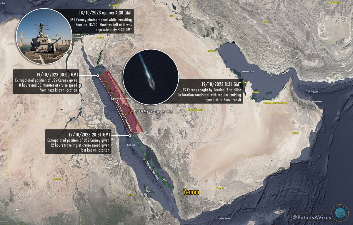
Thanks to this picture taken while USS Carney was transiting Suez on 18/10/2023 and the shadows visible we can extrapolate her path, spot her on Sentinel-2 and have a rough area for the interception. We don't know the time it happened so area is broad. (Short 🧵)
#OSINT
#OSINT

The approximate location altho tells us that it was rather far from Yemen ruling out the possibility that the missiles where intended for the US warship (as Houthis would have no targeting capability at that range save from some very, very, crafty scenario)
This confirming the possibility the missiles / drones were intended for #Israel. Given location and northerly direction reported another juicy target for Houthis up till some time ago would have been the Neom project in #SaudiArabia but given recent relations I would exclude it
NOTE: the possible area for the engagement is calculated based on the assumption that the event happened after sentinel-2 spotting at 08:31 GMT 19/10/23, this given the wording in the reports placing it "close to Yemen", earlier it would have simply been more north.
Since it is possible that the Yemen vicinity reference was very broad and since a similar attack would make sense at dark, here a revised infographic extending the possible engagement area to early morning of 19/10/2023
Another very relevant bit of info brought up by @monty5stars
Report is vague, but assuming cruise missiles are jet engine powered and the drones are propeller powered, the huge difference in speed suggests different engagements at different times
x.com
Report is vague, but assuming cruise missiles are jet engine powered and the drones are propeller powered, the huge difference in speed suggests different engagements at different times
x.com
Not affecting the core of the analysis but better shadow analysis of the warship transiting Suez suggests me that it was taken close to 5:30 GMT than 4:30 GMT.
Loading suggestions...