

High-resolution satellite images can be insanely expensive to buy.
So here's a list of free datasets you can access.
These datasets can be used to build foundation models, super-resolution models, or for segmentation.
So here's a list of free datasets you can access.
These datasets can be used to build foundation models, super-resolution models, or for segmentation.

The most commonly used free multi-spectral satellite images are from:
• Sentinel 2
• Landsat-8
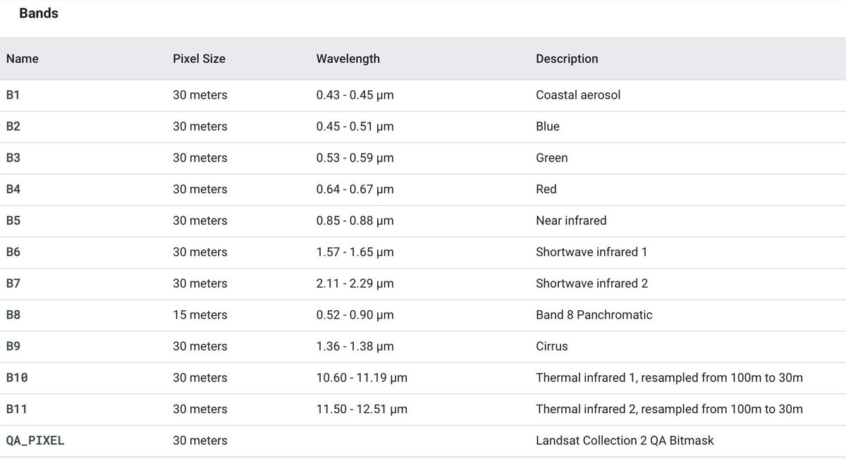
However, Sentinel 2 has ~10m resolution (for RGB), while Landsat-8 is ~30m (for RGB).
But what free high-resolution datasets exist to train foundation models on?
• Sentinel 2
• Landsat-8
However, Sentinel 2 has ~10m resolution (for RGB), while Landsat-8 is ~30m (for RGB).
But what free high-resolution datasets exist to train foundation models on?
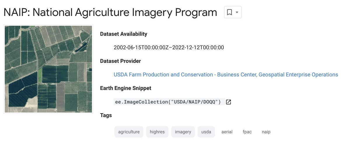
1. National Agriculture Imagery Program (NAIP)
Resolution: 0.6m
Description: It collects aerial footage of agricultural growth in the United States, covering 9 million km² each year.
Link: developers.google.com
Resolution: 0.6m
Description: It collects aerial footage of agricultural growth in the United States, covering 9 million km² each year.
Link: developers.google.com

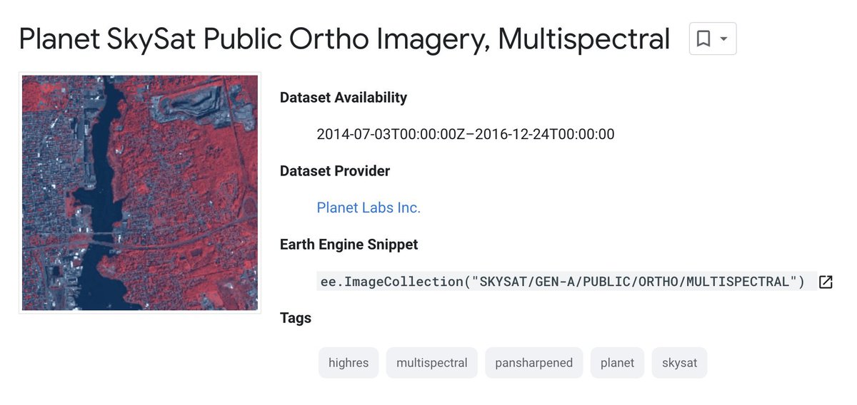
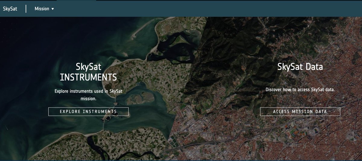
2. SkySat (through Google Earth Engine)
Resolution: 2m
Description: Sample data captured on 4 March 2014
Link: developers.google.com
Resolution: 2m
Description: Sample data captured on 4 March 2014
Link: developers.google.com

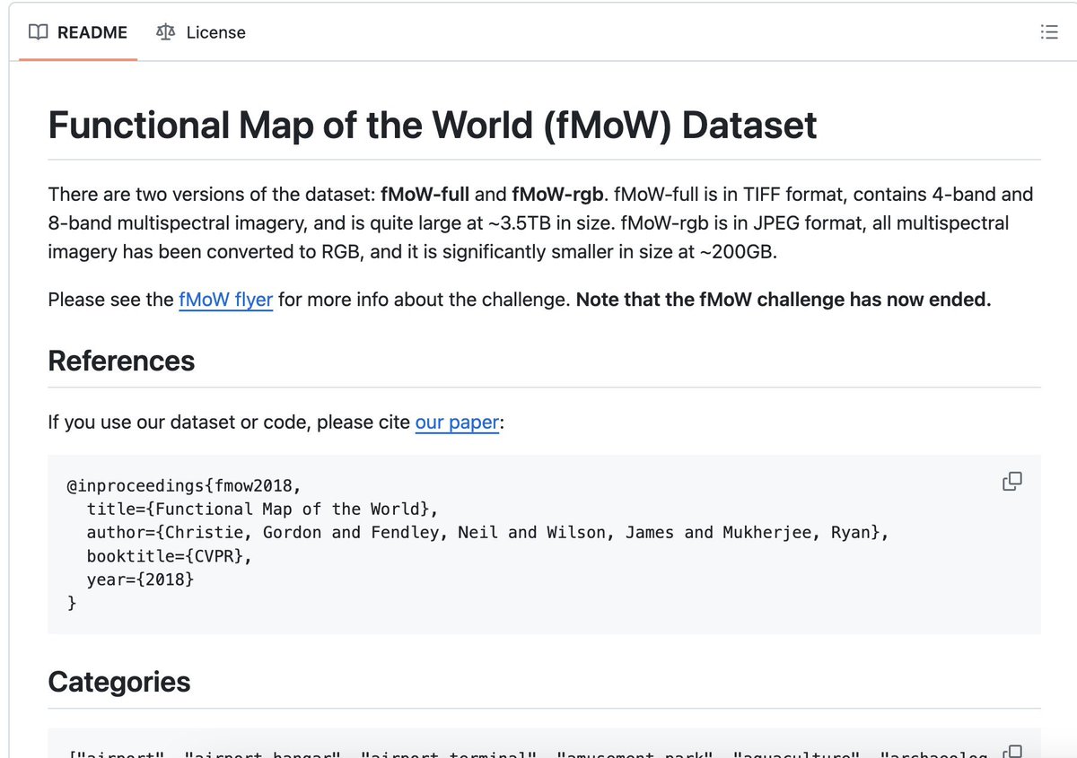
3. Functional Map of the World
Resolution: Various
Description: ~3.5TB of data. Consists of over 1 million images from over 200 countries.
Link: github.com
Resolution: Various
Description: ~3.5TB of data. Consists of over 1 million images from over 200 countries.
Link: github.com

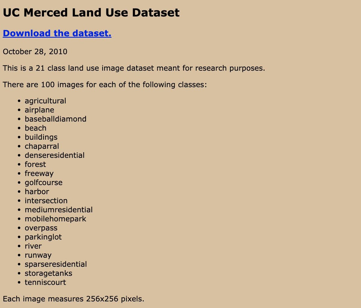
4. UC Merced Land Use Dataset
Resolution: 30cm
Details: 2,100 images from 2010 for several classes (see image below)
Link: weegee.vision.ucmerced.edu
Resolution: 30cm
Details: 2,100 images from 2010 for several classes (see image below)
Link: weegee.vision.ucmerced.edu
6. AID Data
Details: Consists of 10,000 images from Google Earth.
Resolution: Various
Link: captain-whu.github.io
Details: Consists of 10,000 images from Google Earth.
Resolution: Various
Link: captain-whu.github.io


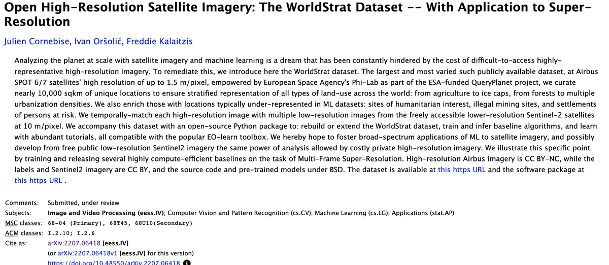
7. WorldStrat
Details: This is a good dataset for training super-resolution models.
It covers 10,000 km² and is temporally-matched high-resolution and low-resolution Sentinel-2 images.
Resolution: 1.5m
Link: arxiv.org
Details: This is a good dataset for training super-resolution models.
It covers 10,000 km² and is temporally-matched high-resolution and low-resolution Sentinel-2 images.
Resolution: 1.5m
Link: arxiv.org

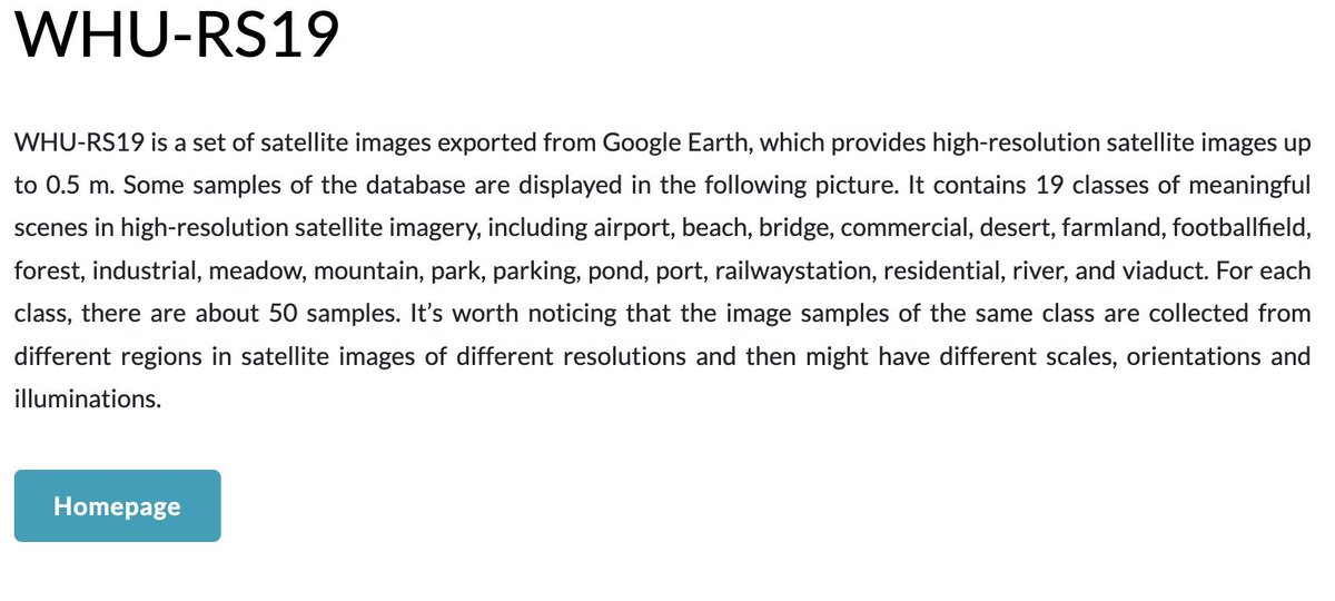
8. WHU-RS19
Details: A collection of high-resolution satellite images up to 0.5 m from Google Earth, covering 19 classes of meaningful scenes with about 50 samples each.
Resolution: Up to 0.5 m
Link: paperswithcode.com
Details: A collection of high-resolution satellite images up to 0.5 m from Google Earth, covering 19 classes of meaningful scenes with about 50 samples each.
Resolution: Up to 0.5 m
Link: paperswithcode.com

9. ESA’s SkySat Archive
Details: @esa collates sample SkySat data from Planet.
Resolution: 0.5m
Link: earth.esa.int
Details: @esa collates sample SkySat data from Planet.
Resolution: 0.5m
Link: earth.esa.int

@esa Please help the community out and reply with any other datasets I may have missed.
And if you liked this, give us a follow
@yohaniddawela for more breakdowns of geospatial topics.
And if you liked this, give us a follow
@yohaniddawela for more breakdowns of geospatial topics.


Loading suggestions...