
Mapping
9 Threads
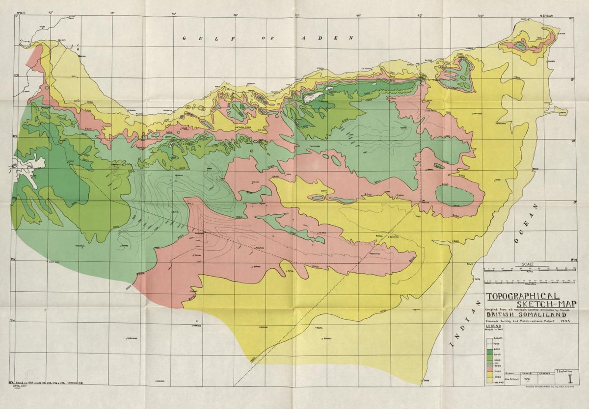
Report on general survey of British Somaliland 1944 (Colonial development & welfare act. Economic survey & reconnaissance), Published under the authority of the Military government...


NEW: I mapped the expansion of buildings & infrastructure in 4 cities between 2000 & 2020 🏙️😍 🇺🇸Austin, TX 🇨🇳Beijing 🇮🇳Delhi 🇪🇸Madrid #city #urban #RStats #DataScience #dataviz #...

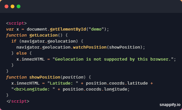
🔷 About HTML Geolocation API - 2 A Thread🧵 👇 https://t.co/ZTK6N6ayp2


I mapped Earth at night using satellite data 🪩 #earth #RStats #DataScience #dataviz #maps #gischat https://t.co/WsXZ8nin4M

Here are all of the rivers and waterways in Europe, coloured according to the major hydrological basins they are part of and scaled by their size. #Matplotlib #Python #DataScience...

Top five Geocoding and Location APIs. A thread:

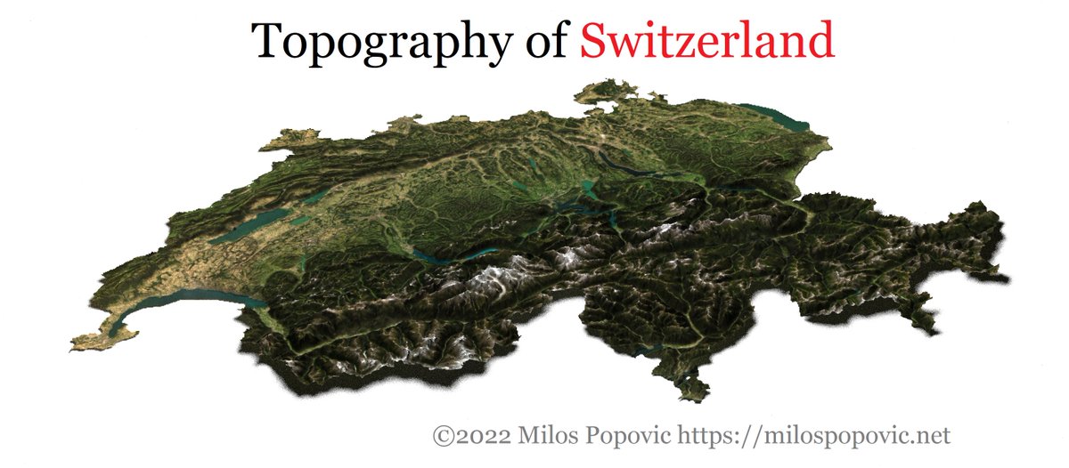
I created topographic maps of several European countries based on my latest tutorial: ✨https://t.co/GMQfnwsvA8 1⃣ Austria🇦🇹 #geography #RStats #DataScience #dataviz #maps #rspat...

From this thread 🧵 you will learn about 12 key #OSINT-services for gathering information about a certain location. I'll show it an example of this place: Bürglenstrasse, 3006 Ber...


#geemap new feature - Creating #Landsat timelapse with a few clicks Try it out: https://t.co/nLH6YFLBrm Notebook: https://t.co/EFGzTGMsXj @USGSLandsat @NASA_Landsat #GIS #remote...
